Here comes the humidity... again 💧
Update #612
No hurricanes (yet), no suffocating haze from wildfires (yet), but humidity? Yeah, we’ve got humidity to end July and start August.
If only there was a meteorological “pause button” where the weather from this weekend could be locked in and played on repeat. On the other hand, that sounds like it would get boring quick — especially for a forecaster like me.
So forecast we will. A southerly flow will drag some moisture and of course, extra humidity, northward into the region this week. This will bring about a daily chance for showers and thunderstorms. That doesn’t mean it will rain all week — but you need to be prepared for the sky to open up with downpours at just about any time! ⚡
The humidity is good for a few things, like keeping your plants happy and skin moisturized. But this isn’t a gardening nor beauty blog. The humidity is also effective at keeping the daytime maximum temperatures slightly suppressed, as a moist environment requires more energy to heat it than a dry one.
Temperatures may eventually reach the 90s later in the week as an air mass reaches the region from the west and a heatwave is possible from Thursday-Saturday. It looks quite humid from Tuesday onward.
Monday: clouds and some sun with scattered showers and a slight chance for isolated PM thunderstorms
Tuesday: partly sunny and more humid with scattered showers and thunderstorms likely, some heavy, especially in the afternoon 💧
Wednesday: some sun and very humid with scattered showers and thunderstorms likely, some heavy 💧
Thursday: the heat turns up a notch; humid with a mix of sun and clouds and a lower chance for rain compared to previous days
Friday: hotter yet; very humid with a slight chance for a PM shower or thunderstorm
Saturday-Sunday: hot and very humid with afternoon shower and thunderstorm chances both days, mainly in the afternoon
Looking ahead to the week of August 5th, a cooler, Canadian air mass to the north will battle with a warmer, tropical air mass to the south. This summer, the tropical air mass has almost always won, but maybe the “underdog” Canadian air mass has a chance this time…
On hurricanes and haze
💨 A light northerly air flow today (Sunday) will send some high-level smoke from the wildfires in Canada across the region. I don’t expect this to significantly impact air quality, but you may notice a milky haze in the sky. This is expected to abate by Tuesday as southerly winds blow the smoke away. There’s a chance that some smoke returns later in the week.
A disturbance in the Atlantic Ocean may pass near or just north of the Caribbean islands later this week, reaching the Bahamas next weekend where it may intensify. The next name on the list is “Debby”. This system bears watching for the weather early next week in the eastern states.
300+ days of sunshine a year ☀️
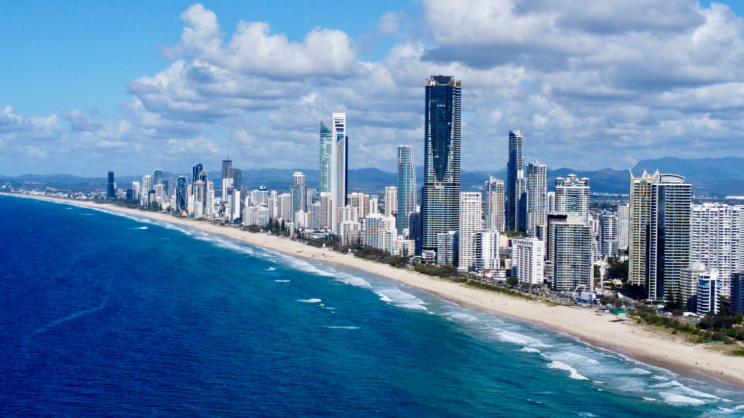
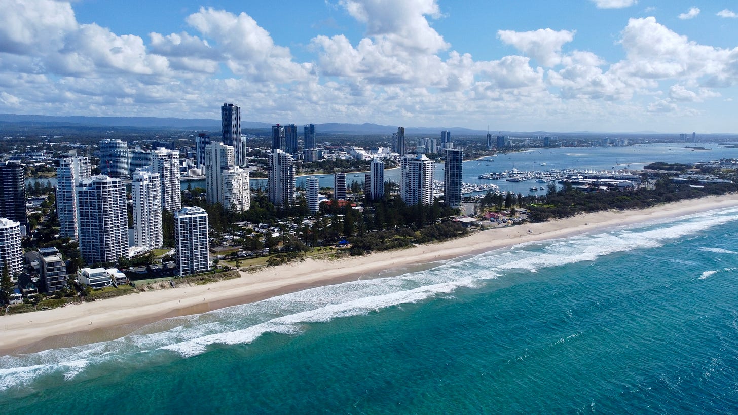
Would you like to live in a place that averages about six sunny days per week? Australia’s Gold Coast might be the place for you. Kate and I called this city, literally on the sea, our home for the weekend. And the weather certainly lived up to expectations.
It’s winter here (you wouldn’t know it looking at the photos) and the sub-tropical climate delivers something akin to Florida during the month of January. The days were in the mid 70s and nights in the upper 50s.
We also drove up to Brisbane, Australia, which about 2.3 million people call home — the capital of Queensland:
It’s a modern-looking city, boasting Australia’s longest road tunnel, called the Clem Jones tunnel. It also has an impressive food scene.
We also got the chance to visit another gem of a coastal town called Byron Bay in far northern New South Wales. I’ll share those photos next week.
Be like a plant and embrace the humidity this week ✌️


