Historic Helene recap; October opens on a tranquil note
Update #621
Hi everyone!
A picture is worth a thousand words — this was the satellite image just before Helene made landfall on Thursday night:
The remnants of Helene, one of the worst hurricanes in modern times, continue to swirl over the Appalachians as of Sunday morning.
While the winds and surge created devastating scenes at the coast, the inland flooding was perhaps the most impactful aspect of the once category 4 storm.
My post-event analysis shows that four to five Septembers’ worth of rain fell in parts of upstate South Carolina and western North Carolina, equating to actual totals of over two feet.
Water, be it from storm surge or inland, freshwater flooding, is the most deadly factor associated with hurricanes. These hazards can unfortunately build and develop very, very quickly, leaving people trapped and cut-off in minutes.
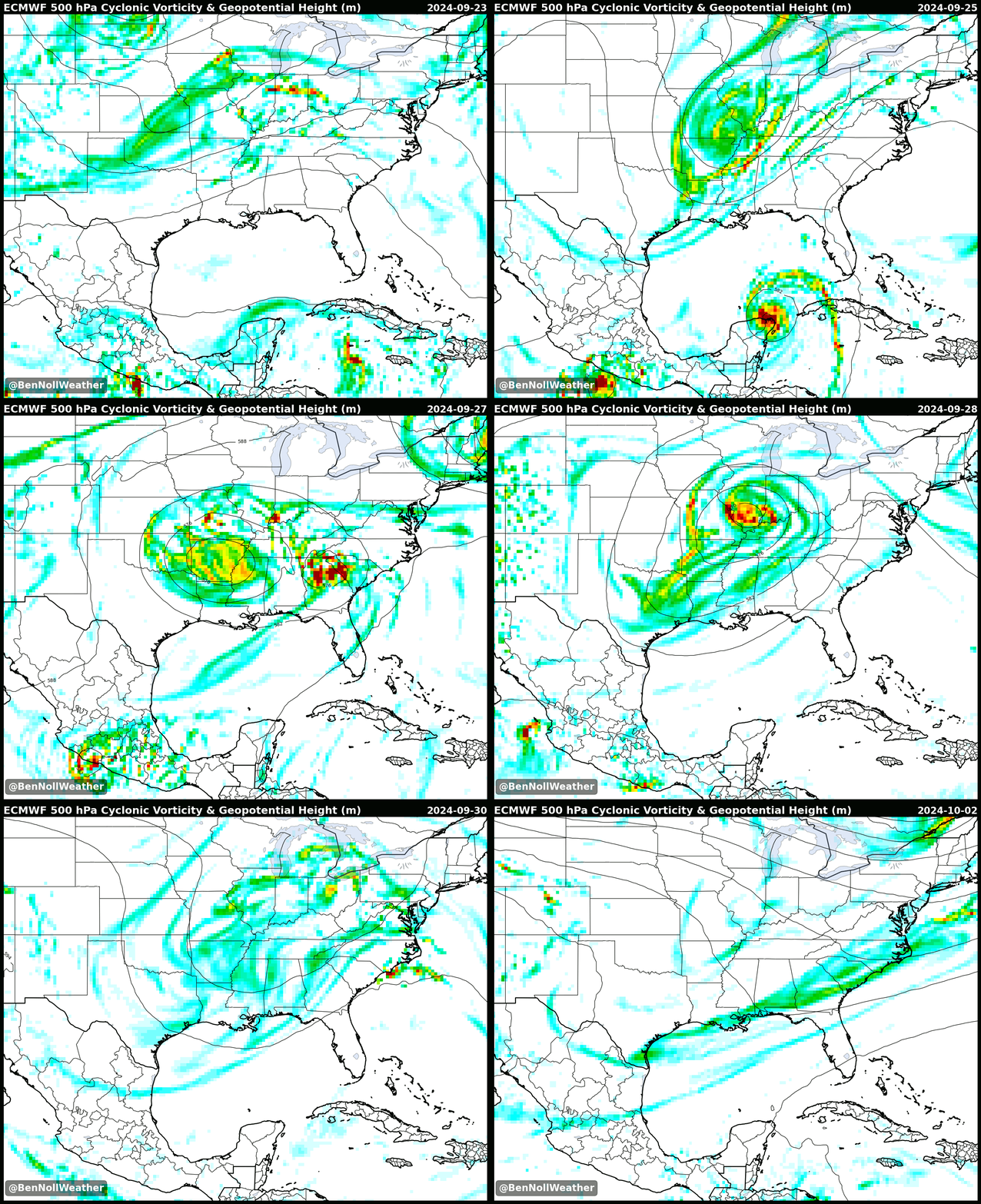
Helene was scooped and swallowed by a separate disturbance in the upper atmosphere, causing it to slam into the Appalachian mountains rather than continuing on a northeast track and back out to sea:
Although no two storms are exactly the same, Helene had some similarities with Hurricane Sandy in the way that a separate disturbance pulled the hurricane from the sea to the land.
Another disturbance in the Caribbean Sea is currently being monitored for development and could emerge into the Gulf of Mexico by next weekend — more on that later in this post.
Four hurricanes have now made landfall in the U.S. this year; since 1850, only eight years have had five or more U.S. landfalls. The record is seven landfalls in a season.
I had the opportunity to speak with NBC about the record-breaking amounts of moisture that Helene contained, which was influenced by record-breaking warmth in the Gulf of Mexico.
The week ahead
The week ahead will see Helene’s remnants skirt south of the Hudson Valley, bringing mostly cloudy conditions today (Sunday) and Monday. By Wednesday, a front will move across the region, bringing scattered showers and finally pushing what’s left of Helene offshore.
Thursday, Friday, and Sunday look pretty good at this point, with a slight question mark for Saturday depending on the speed and timing of a front.
Monday: mostly cloudy, but dry
Tuesday: clouds breaking for some sun
Wednesday: mostly cloudy with scattered showers, mainly later
Thursday: mostly sunny and comfortable
Friday: warmer with sun and clouds
Saturday-Sunday: a front may bring some showers on Saturday, Sunday favored to be dry as of this writing
Looking ahead to the week of October 7th, I’m keeping an eye on the chance for a coastal storm. It’s a long way out and details are definitely fuzzy, but there are some interesting signals, such as a big high pressure system over Greenland that could facilitate a system near the East Coast.
In the tropics, the National Hurricane Center has given a disturbance in the Caribbean Sea a 50% chance of developing over the next week (orange shaded area on the map below). The latest guidance suggests that a feature may emerge into the Gulf of Mexico next weekend, but there is plenty of uncertainty at this point. Obviously, the south doesn’t need more rain, but I suspect more is coming after a relatively dry week ahead.
Elsewhere, Isaac and Joyce are swirling out over the open waters of the Atlantic, with Kirk (red area) expected to form in the days ahead.
❗ One last thing, in case you missed the news earlier this week:
PS — my winter outlook and new merch is just a few weeks away! Click the button below to upgrade your subscription to premium to receive the outlook as well as early info on storms as the weather turns colder.
Hope your week is tranquil like the weather ✌️


