New month, same dry, mild weather
Update #626
The calendar now says November. The days are an hour shorter. But this seems to have little bearing on the weather, with a pattern of dryness and relative warmth set to continue.
It comes after October officially became the driest on month on record in the Hudson Valley with just 0.24 inches of total precipitation (in Poughkeepsie).
However, across the wider U.S, the weather will certainly trend busier in the week ahead: an upper atmospheric ‘bowling ball’ will deliver several Novembers’ worth of rain and severe weather to the central states, the Rockies in Colorado will get truckloads of snow, and another tropical disturbance is forecast to move into the Gulf of Mexico on Wednesday.
However, the Hudson Valley is forecast to remain out-of-reach from most of Mother Nature’s antics. On Wednesday, temperatures may even reach record levels once again.
The week ahead
A warming trend is forecast through mid-week, before a cold front later Wednesday causes temperatures to dip from Thursday into the weekend. Aside from scattered, passing showers, little rain is expected.
Monday: a cold, frosty morning, but a mostly sunny and comfortable afternoon
Tuesday: warming up nicely with a mix of clouds and sun
Wednesday: sunshine and increasing clouds with near-record high temperatures; passing PM showers can’t be ruled out
Thursday: cooler than Wednesday; breezy with plenty of sun
Friday: like Thursday
Saturday-Sunday: dry and sunny on Saturday, probably dry and milder on Sunday, but watching disturbance to the west
Looking ahead to the week of November 11th, more warmer than average weather is in the cards as low pressure continues to favor the western states. The central states also look wet and stormy. Some of that moisture could find its way east — the Hudson Valley could use some hydration! Parts of the region are now experiencing moderate drought according to the U.S. drought monitor.
In the tropics
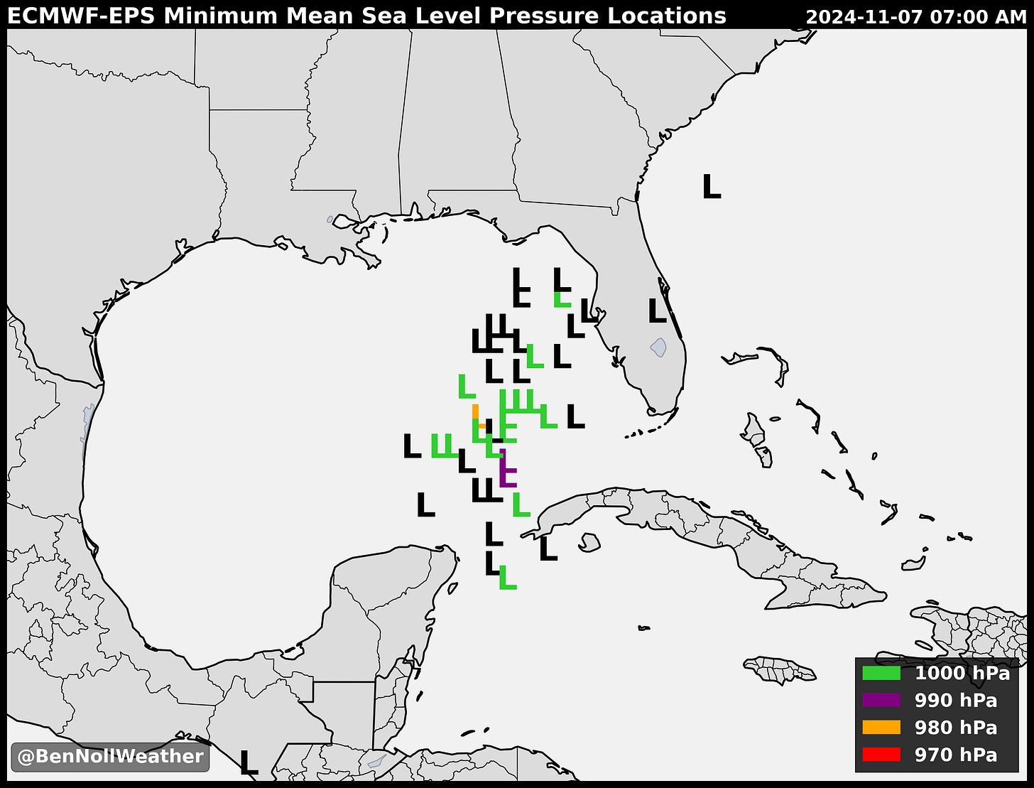
The National Hurricane Center has given a disturbance in the Caribbean Sea a 90% chance of becoming a named storm in the days ahead. By late Wednesday, it’s expected to approach the southern Gulf of Mexico. Moisture streaking out ahead of the storm may cause heavy rain in parts of Florida, Georgia, South Carolina, and North Carolina on Wednesday and Thursday.
One possibility is that system drifts westward in the Gulf of Mexico late in the week, spreading its moisture into Alabama, Mississippi, Louisiana, and Texas. Another possibility is that the storm moves toward western Florida.
The map below shows possible storm locations, denoted by “L”, on Thursday morning. The system isn’t predicted to be particularly intense — but keep watching, especially with how warm the oceans are in the region.
In D.C.
This week, I’m in D.C. for work — the weather is an easy 10/10. I brought it from New Zealand 🌞
Hope your week is also a 10/10 ✌️


Hey Ben: I thought I brought this 10/10 weather from Isla Vista, CA. It's a lot like New Zealand there, except for the Mexican food!
UCSB, Ben. The Eucalyptus trees are gigantic there! So are the Gila monsters. I saw one, once, up in the coastal mountains at a natural spring with the best spring water I ever had.