Cold with a side of snow ❄️
Update #630
Have you finished those Thanksgiving leftovers yet?
As you get ready to head back to work and school, the weather outside… is a little frightful.
20s and 30s will be the rule — not the 50s, 60s, and 70s that were common during November. It is now meteorological winter, after all, and it will feel like it.
I hope you used your free time wisely and unpacked the winter jackets, hats, and gloves, because you’ll need them during the week ahead!
And if you’re in the market for something new, some Ben Noll beanies just dropped!


Follow these links to grab one and try the promo code “snowday” for a discount.
https://bennollstore.com/products/bnw-beanie?source=dashboard
https://bennollstore.com/products/bnw-beanie-2?source=dashboard
Say hello again to my snow day gauge! It’s been dusted off and is now ready for the snow showers that may affect the region on Wednesday night and Thursday. More on that in a moment.
While a snow day is unlikely this week, there’s a slight chance for a delay on Thursday.
Be grateful you won’t be digging out from five feet of lake effect snow like some places are.
The week ahead
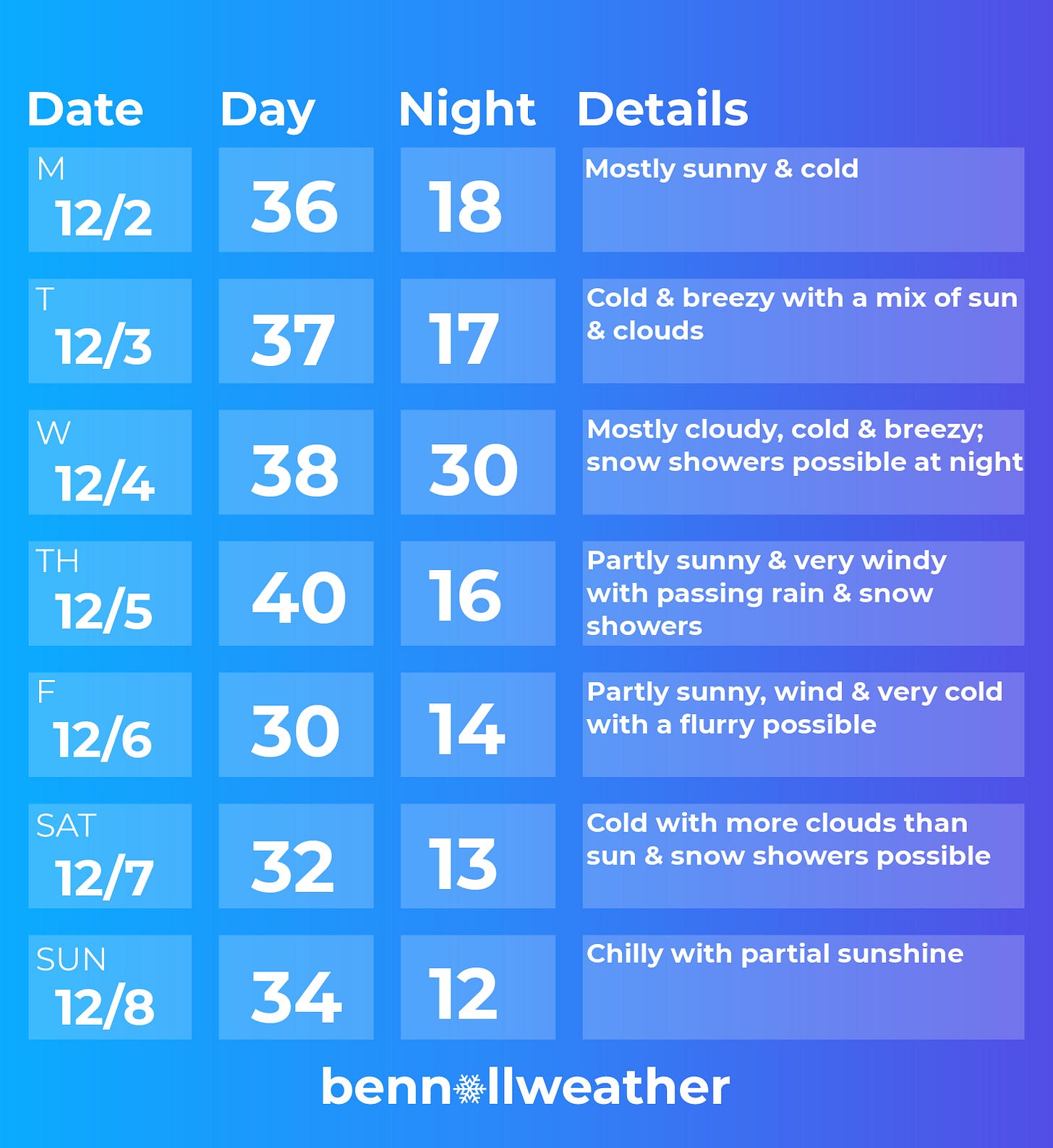
Cold air and gusty winds are the weather story this week — especially on Friday. Occasional sun will do little to warm things up. Flurries will fly at times, though the chance for accumulation looks modest.
I’ll get back in touch if it starts to look like any of the flakes will pose a problem.
Monday: mostly sunny and chilly
Tuesday: cold and breezy with a mix of clouds and sun
Wednesday: mostly cloudy, windy, and cold with snow showers and a light accumulation possible overnight
Thursday: partly sunny, windy, and cold with passing rain and snow showers possible
Friday: very windy and cold with a chance for a flurry
Saturday-Sunday: partly sunny and still cold, chance for snow showers on Saturday
Sending you warm vibes from a land that just welcomed meteorological summer!
Here’s what to expect during the week of December 9th…


