
More cold, windy weather
Update #636

Is it spring yet?
Another surge of Arctic air will spill southward on Monday night, leading to more frigid temperatures and unwelcome visits from someone named wind this week.
Unlike last week, which featured two major winter storms that brought some states their biggest snowfall in years, this polar plunge will come with generally dry conditions, including in the Hudson Valley.
If it’s going to be this cold, a snow day should at least come out of it, right?!
We’ll probably have to wait until at least the week of January 20th for that.

As snow and cold temperatures froze the central and eastern states over the last week, an equally extreme pattern brought Southern California hot winds that fanned the flames of wildfires. Another burst of strong winds is expected from Monday-Wednesday there.
The week ahead
A cold front will sweep through the region late Monday, leading to very cold, windy conditions through Thursday.
A front will probably cross the region on Saturday, potentially bringing a mix of rain and wet snow. There’s a slight chance for more snow on Sunday, though it’s highly uncertain at this point.
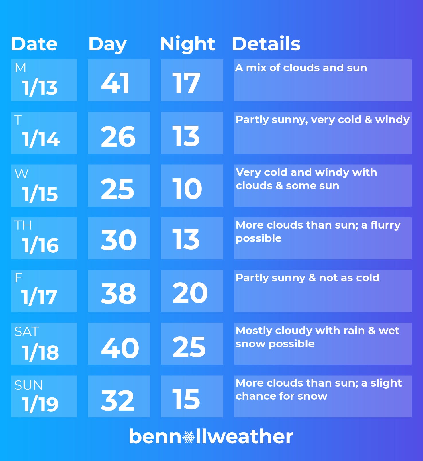
Monday: the mildest day of the week before a strong cold front swings through at night
Tuesday: windy and frigid 🥶
Wednesday: like Tuesday 🥶
Thursday: not as bitterly cold, chance for a flurry
Friday: not as cold with some sun
Saturday-Sunday: a chance for rain or wet snow on Saturday; a slight chance for snow on Sunday (check back later)

Looking ahead to the week of January 20th…
