
Windy, frigid week with polar vortex, watching Thursday
Update #641

Despite it being a short month, February has felt like a marathon as far as the weather is concerned, with storm after storm. It’s icy out there this (Sunday) morning, so be careful!
After Sunday’s freezing rain and rain, the Hudson Valley will be precipitation free until Thursday, but it will be windy and freezing — including on Sunday night.
This comes as the polar vortex returns for the second time this season. You can read my story, polar vortex, the sequel, in the Washington Post.
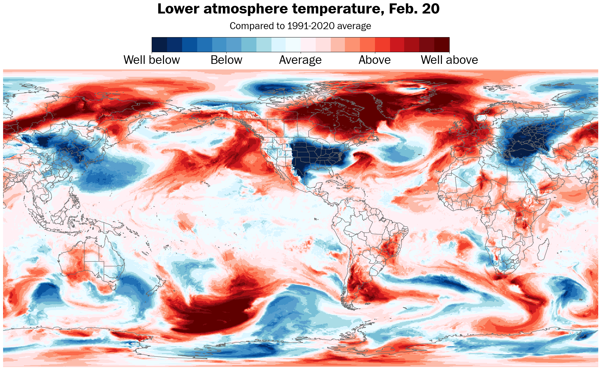
While this week doesn’t look as cold as January’s vortex episode, the wind chill will nosedive to as low as minus-10.
If you think it’s been cold this year so far, well, it has: in the United States. The most unusually cold air on the planet will again be centered over the country this week:
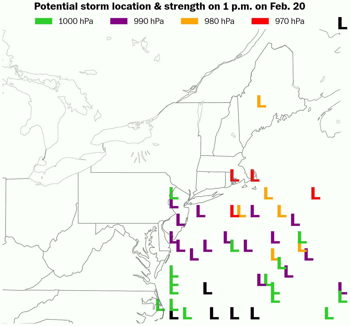
After that, eyes turn to Thursday, which may feature a nor’easter — a strong storm near the East Coast. However, the weather setup is complex and the forecast is hardly locked in.
The latest trends for Thursday suggest more of an offshore track for the storm, meaning that it’s more likely to be a glancing blow rather than a direct hit in the Hudson Valley. The animation below illustrates how the storm location possibilities have generally shifted east between forecasts issued yesterday and today.
The week ahead
The week ahead will definitely be cold and windy and possibly snowy on Thursday.

Monday: very cold and windy 🌬️
Tuesday: remaining frigid and windy 🥶
Wednesday: cold but not as windy with increasing clouds
Thursday: breezy and cold with snow possible ❄️ ❓
Friday: breezy and cold but sunny
Saturday-Sunday: mostly dry and sunny 📈

I’ll be in touch again if snow is in the forecast for Thursday! 🔮
You may also be wondering when the weather will finally settle down. Looking ahead to the week of February 24th…
