
The mildest air of the year so far
Update #642

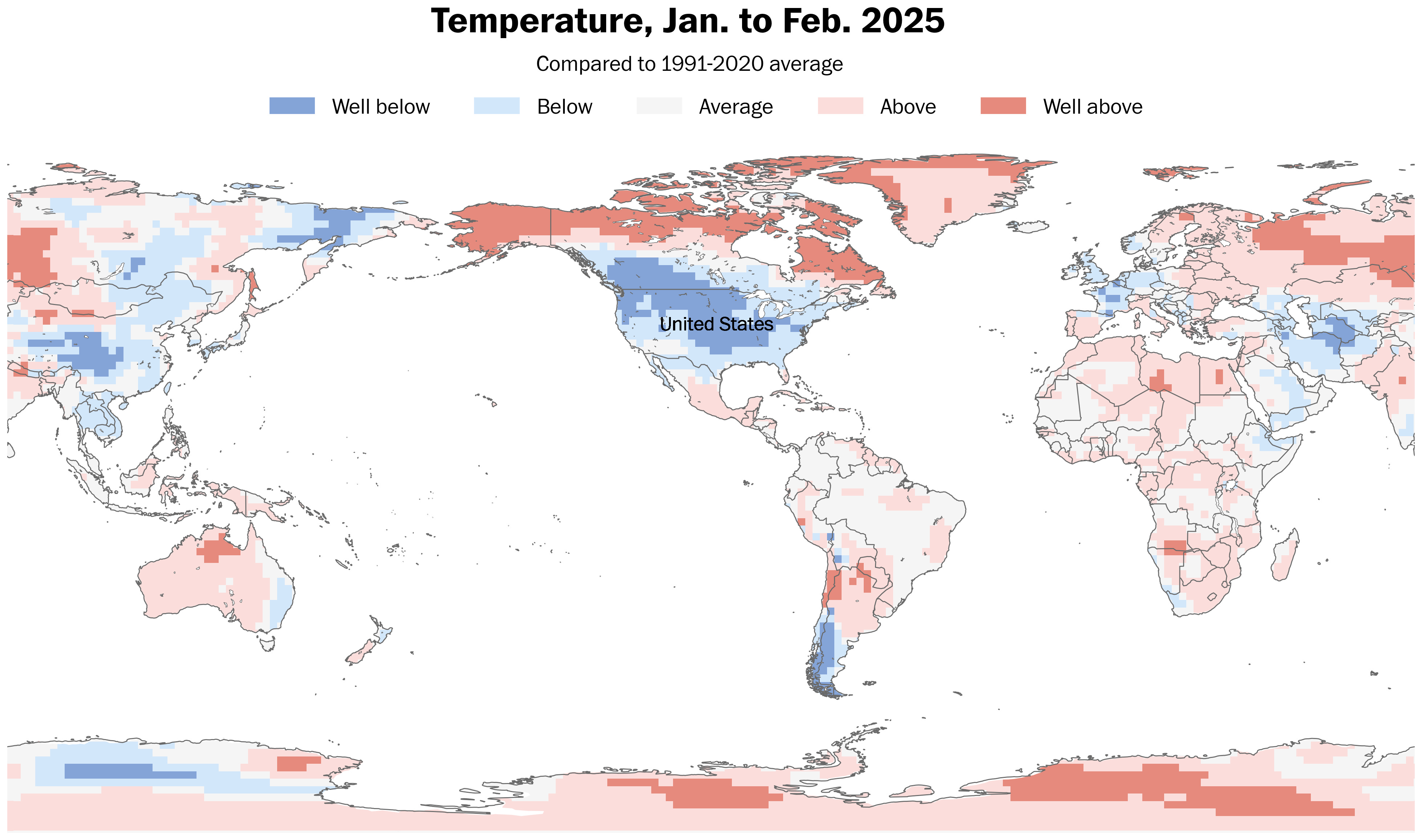
The most unusually cold air on the planet has been anchored over the United States so far this year because of a displaced polar vortex.
You can learn about the reasons why in my latest story for the Washington Post.
The Hudson Valley hasn’t been at the epicenter of the chill — that’s been in South Dakota — but it has been several degrees colder than average so far this year.

As far as snow goes, the region has been running slightly below average.
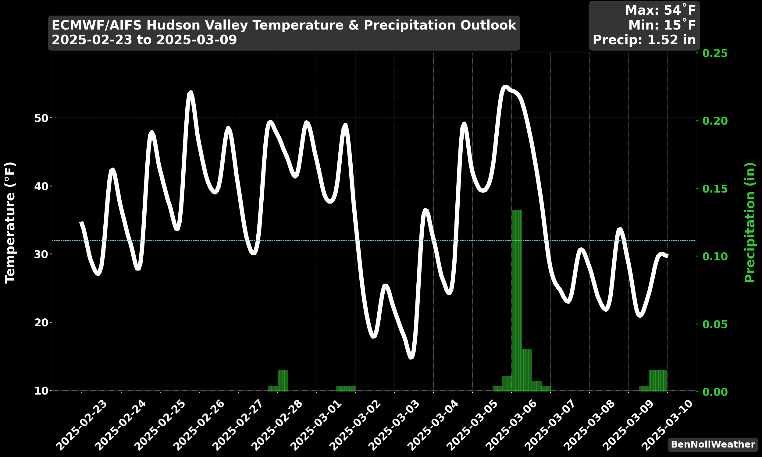
The week ahead
The week ahead will be different.
The area will briefly buck the cold trend and have temperatures in the 40s and 50s — probably the mildest conditions of the year so far.
You might be able to trade your winter coat for a hoodie or t-shirt!
However, chilly air will move back in next weekend, after meteorological spring begins on Saturday, March 1.

Monday: mild with sunshine and increasing clouds
Tuesday: more clouds than sun, but mild; slight chance for some rain
Wednesday: mild with a mix of clouds and sun
Thursday: mostly cloudy and mild again with a few showers possible, mainly later
Friday: breezy and cooler with plenty of sun
Saturday-Sunday: a cold front may blow through the region on Saturday, followed by chilly, windy weather on Sunday
The week after
Looking ahead to the week of March 3, two episodes of chilly air are possible — one at the beginning of the week and another at the end. At this stage, the chance for a winter storm is low.
The second half of March is looking warmer, so winter storm season will probably abruptly come to an end this year — and relatively soon.
The chart below tracks the trends over the next 15 days. 40s and 50s look to become more common with a few cold snaps mixed in.
I’m hoping to publish a spring outlook for premium subscribers in March. Stay tuned!

Enjoy the warmer weather this week! ✌️
Thank you Ben! Looking forward to Spring. Stay safe🥰
Ben, thank you for all your insight. I have been wondering about your thoughts concerning the potential demise of NOAA?