
Warm, cold, warm, cold...
Update #649: inconsistent weather continues!

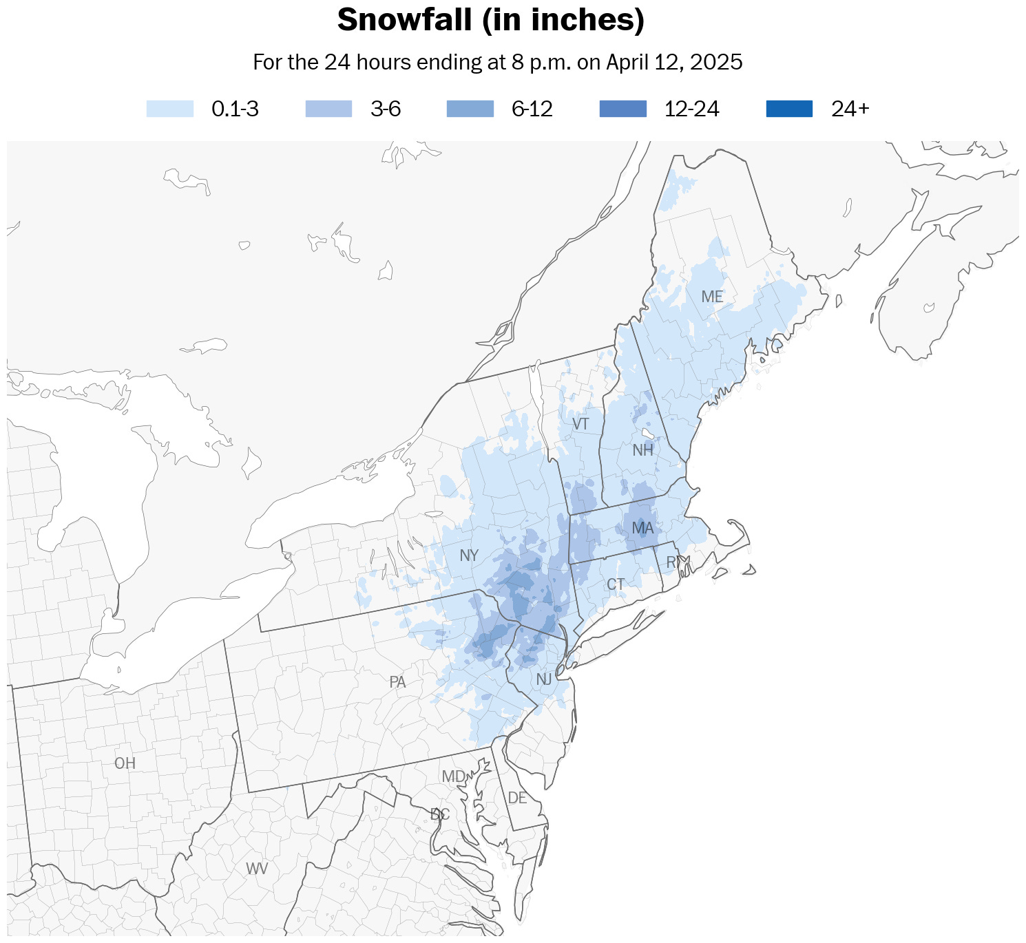
The Hudson Valley just had one of its latest, significant snowfall events on record. As much as 3 to 6 inches of snow were reported in some towns early Saturday.
The average date of the region’s last snowfall has been steadily getting earlier, happening in early March on average, so a plowable snowfall event on April 12 is a real anomaly.
It contributed to beautiful scenes across the area:


The photos are courtesy of the many residents who kindly shared their view on Saturday. You can check out more photos here.
Localized amounts of more than 6 inches were recorded in the Catskills and central Massachusetts, as shown on the accumulation map below.
The week ahead won’t have a plowable snowfall, but it will have inconsistent temperatures, ranging from the mid-20s to around 70.
The week ahead
The week will start with mild conditions on Monday. Then it will get windy and cool off, with a freeze on Thursday morning. Then it will get warmer on Friday and Saturday. Then it will get cool again after that 🎢
Perhaps it won’t come as a surprise, but the United States has had its windiest start to spring in nearly 50 years. I wrote about it in the Washington Post — here’s a gift link.
Guess what? It’s going to be windy most days again this week.
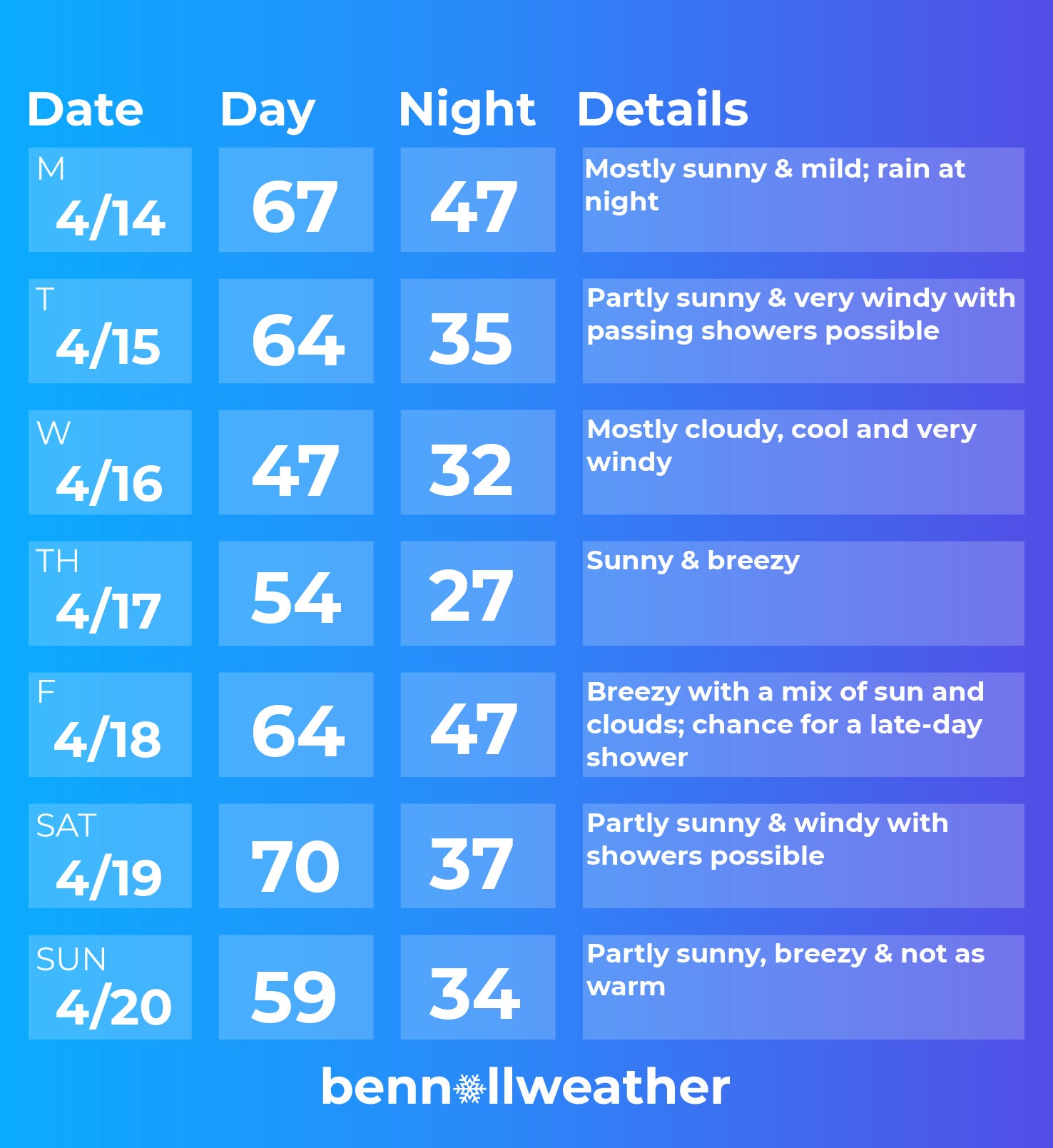
Monday: looks like the pick day of the week! 🥇
Tuesday: strong winds with passing showers possible as a cold front blows through in the afternoon
Wednesday: cool and windy; March-like
Thursday: still breezy, but with plenty of sun
Friday: turning milder, chance for some late-day or overnight showers
Saturday-Sunday: blustery; warm and possibly showery on Saturday, not as warm and probably dry Sunday
Looking ahead to the week of April 21, a significant warming trend is possible as a pattern of severe weather and tornadoes likely returns to the central states.
The animation below shows the swings from above average to below average temperatures over the coming week and the warmup forecast during the following week.
I hope your week is more relaxed than the weather! ✌️
The windy winter caused tons of lake effect snow in CNY: Central NY. Syracuse received 100"+ and people there said it was a winter from the 1980's! Syracuse got even more snow than Buffalo.