
Weather: two steps forward, one step back
Update #655: the weather will get better in the Hudson Valley this week, but it won't be rain-free.

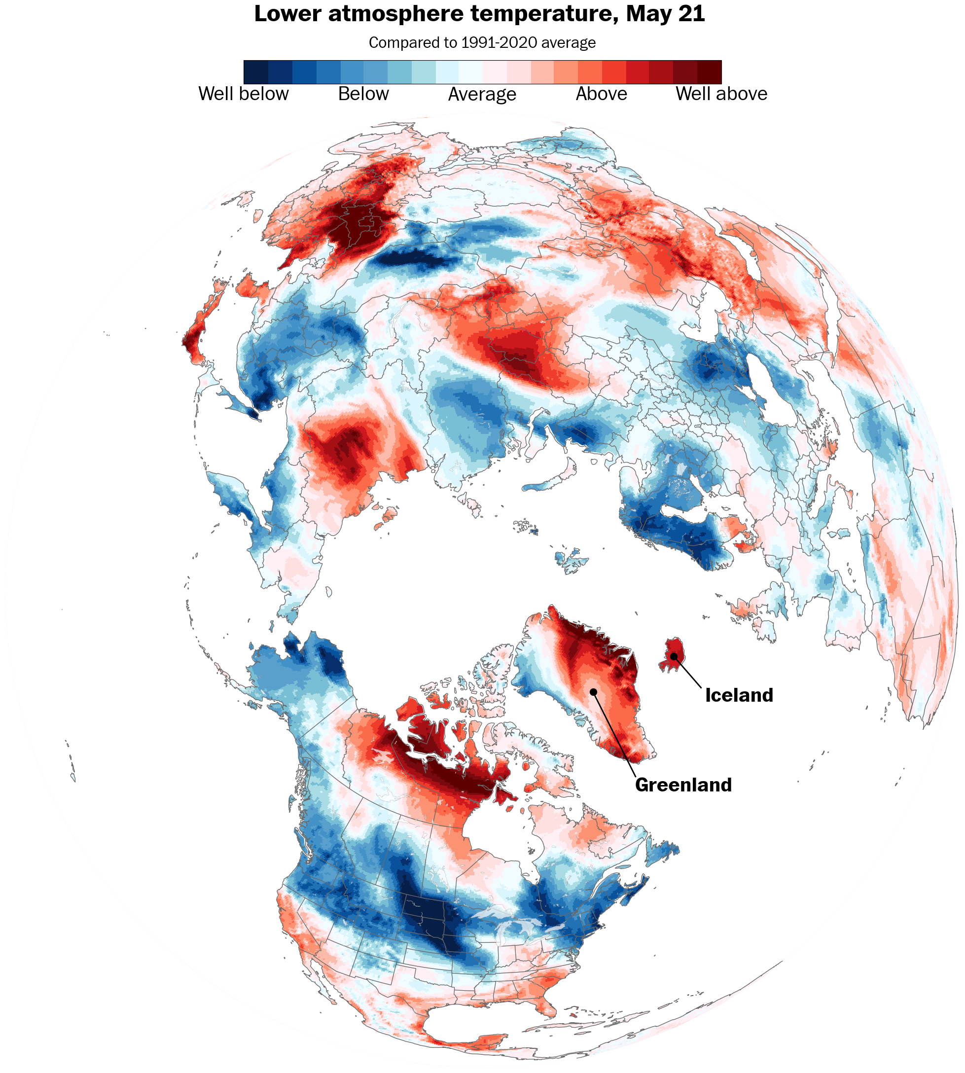
It only reached 49 degrees in Montgomery and 52 degrees in Poughkeepsie last Thursday when an unusually strong May nor’easter struck the Northeast.
It even snowed in northern New England! A weird weather pattern in Iceland sent temperatures soaring to 80 degrees there, dislodging unusually cool air into the United States, with a nor’easter forming when that air clashed with warmer and more humid Atlantic air.
A page will be turned this week as far as the weather goes — but a new chapter won’t begin yet.
It will be warmer, with daytime temperatures generally falling just short of the mid-70s that are typical this time of year. And there will still be some wet weather to contend with as well.
Meteorological summer starts next Sunday, June 1, when another cool, Canadian air mass could come careening into the region.
But there are signs, as premium subscribers will read in my summer outlook next weekend, that hot weather will arrive sooner rather than later.
The week ahead
The week ahead will start pleasant but turn cloudier, more humid, and a bit wet.
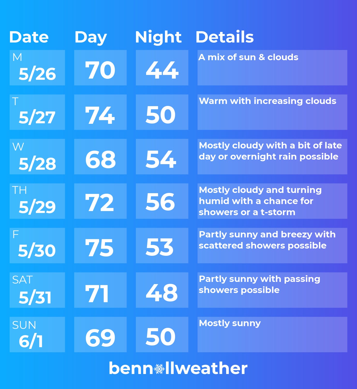
Monday: a mix of sun and clouds
Tuesday: warmer with increasing clouds
Wednesday: mostly cloudy with a chance for a bit of late day or overnight rain
Thursday: mainly cloudy and becoming more humid with a chance for showers and/or a PM t-storm
Friday: warm with sunshine and clouds mixed and passing showers possible
Saturday-Sunday: a front may push through the region on Saturday, delivering a chance for showers with dry conditions currently favored for Sunday
Looking ahead to the week of June 2, a trend toward much warmer weather looks likely. Early signs are that June may be a rather hot month for the country, especially out west, as the below animation shows.

Thank you for giving us the good as well as the bad weather updates .