
Turning up the heat
Update #666: after a cool start to August in the Hudson Valley, it's about to get hot.

The Hudson Valley has had an unusually cool start to August, with low temperatures dipping to 50 degrees — about 10 degrees below average for the time of year.
It’s been a similar story across most central and eastern states: more than 240 million people experienced a cooler than average first week of August.
The increased prevalence of wildfire smoke — blocking incoming sunshine — probably caused high temperatures to be slightly lower than normal this past week in many states, including New York.
But now, the Hudson Valley’s air is generally smoke-free and temperatures will rise under sunny skies, with a possible heat wave from Monday to Wednesday.
The week ahead
Temperatures will reach 90 degrees several times this week, with a possible heat wave from Monday to Wednesday — marked by three consecutive days at or above the 90-degree threshold. Humidity will also be high on Wednesday and Thursday, when there will be a chance for some showers and storms.
Surging heat is likely again next weekend.
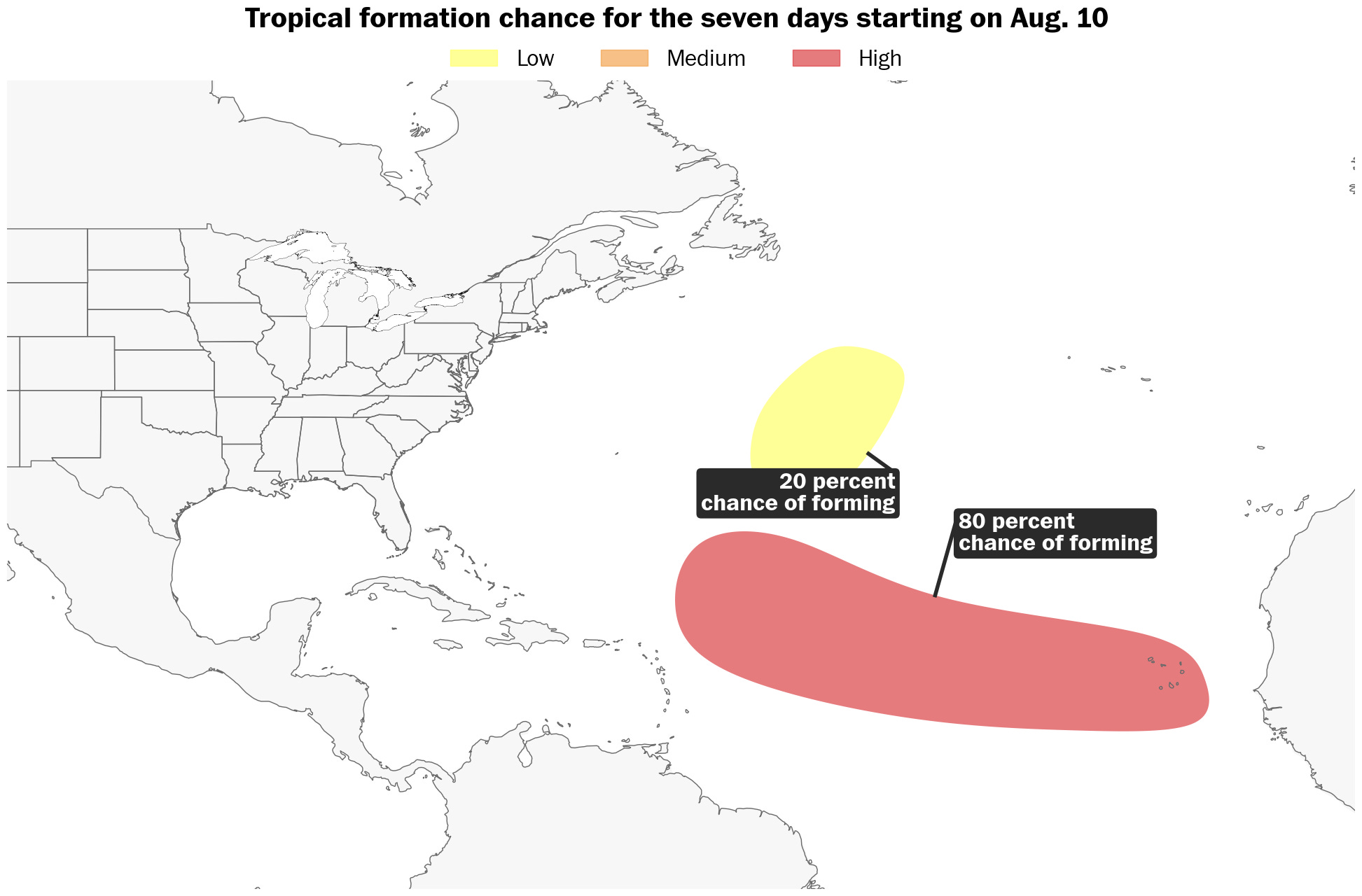
The East Coast will also need to keep a close eye on the track of a hurricane, the first of the season, that’s likely to form in the central Atlantic Ocean later this week.
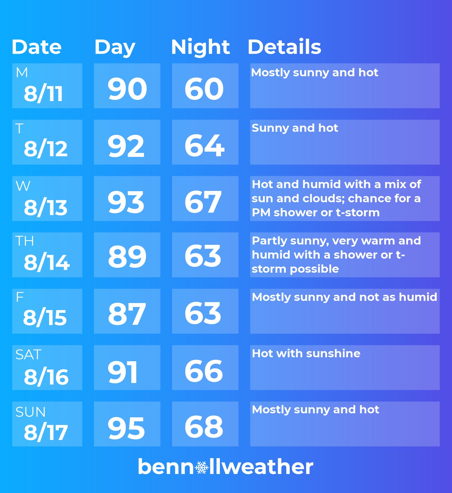
Monday
Sunny and hot
Tuesday
Like Monday, but a few degrees warmer
Wednesday
Very hot and humid with a chance for a late-day or overnight shower or t-storm
Thursday
Remaining very warm and humid with a shower or storm chance
Friday
A slight reduction in humidity possible, plenty of sun
Saturday-Sunday
Turning hot again with sunshine
Looking ahead to the week of Aug. 18, conditions will probably start hot, potentially followed by a cool down.
If you’re wondering how hurricane season is looking, here’s my latest in the Washington Post.

Stay cool this week! ✌️
I’m ready for winter!!!!!