
Warm week ahead
Update #671: highs will reach 80 degrees on several days this week in the Hudson Valley.

The final week of astronomical summer will be a warm one in the Hudson Valley. High temperatures will reach 80 degrees on several days.
Outside of a slight chance for some midweek rain, calm conditions will continue thanks to a parade of high pressure systems.
The midweek rain chance hinges upon a developing low-pressure system in the Mid-Atlantic — it’s currently uncertain how far north some of its moisture will get. It’s possible that the week ends up entirely dry in the Hudson Valley.
And although it’s the heart of hurricane season, there are no active storms, but that may change later this week. A disturbance is forming in the eastern Atlantic and will probably remain at sea.
The week ahead
The week ahead looks warm — especially on Friday — until a cold front next weekend.
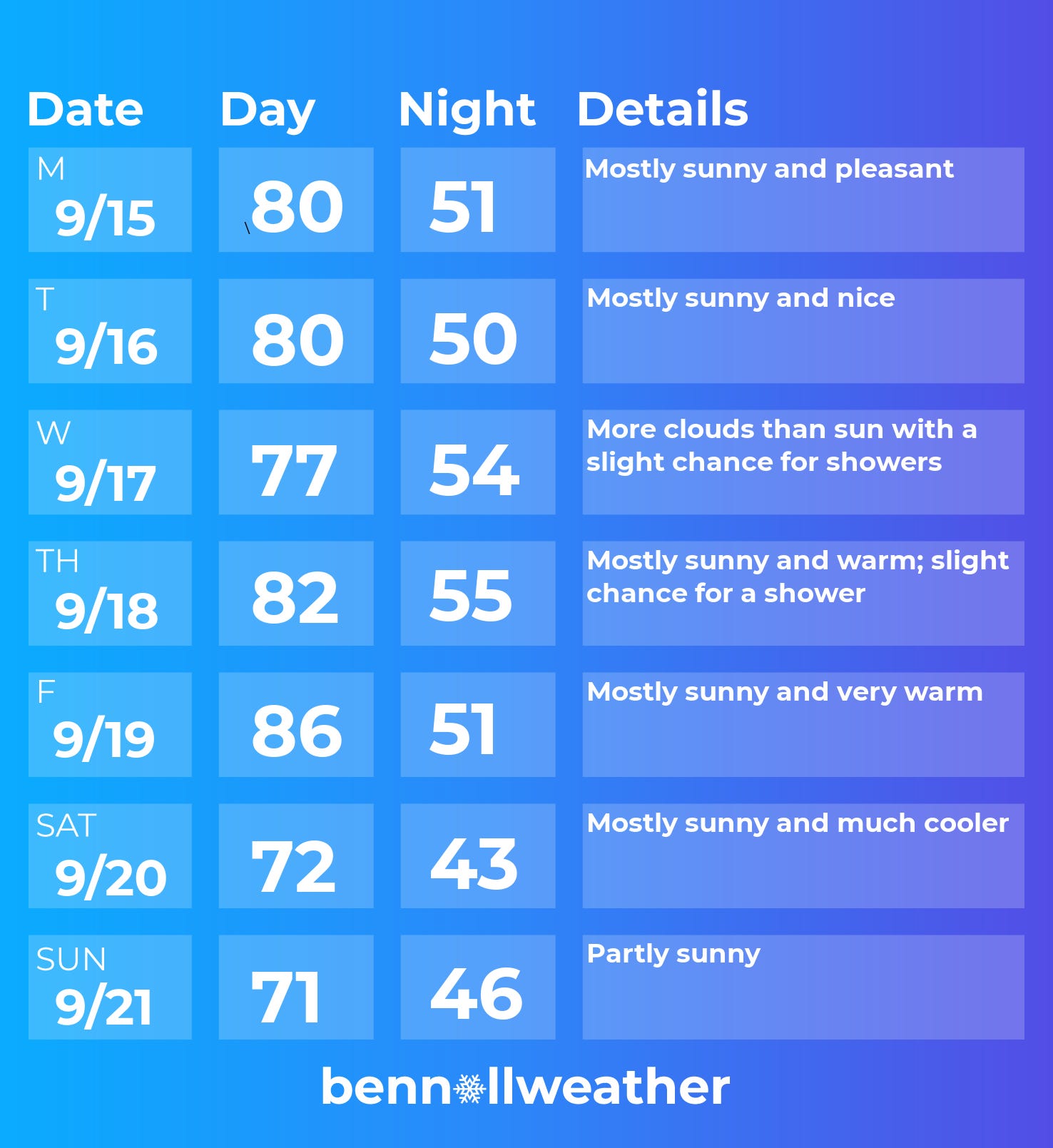
Monday: warm with plenty of sun
Tuesday: like Monday
Wednesday: more clouds than sun and not as warm as Monday and Tuesday; a slight chance for showers
Thursday: warm with increasing sunshine; slight chance for a shower, mainly early
Friday: mostly sunny and very warm
Saturday-Sunday: probably turning pleasantly cooler with a good deal of sun
Conditions look to warm up and maybe even turn more humid during the week of September 22, along with some chances for showers or rain.

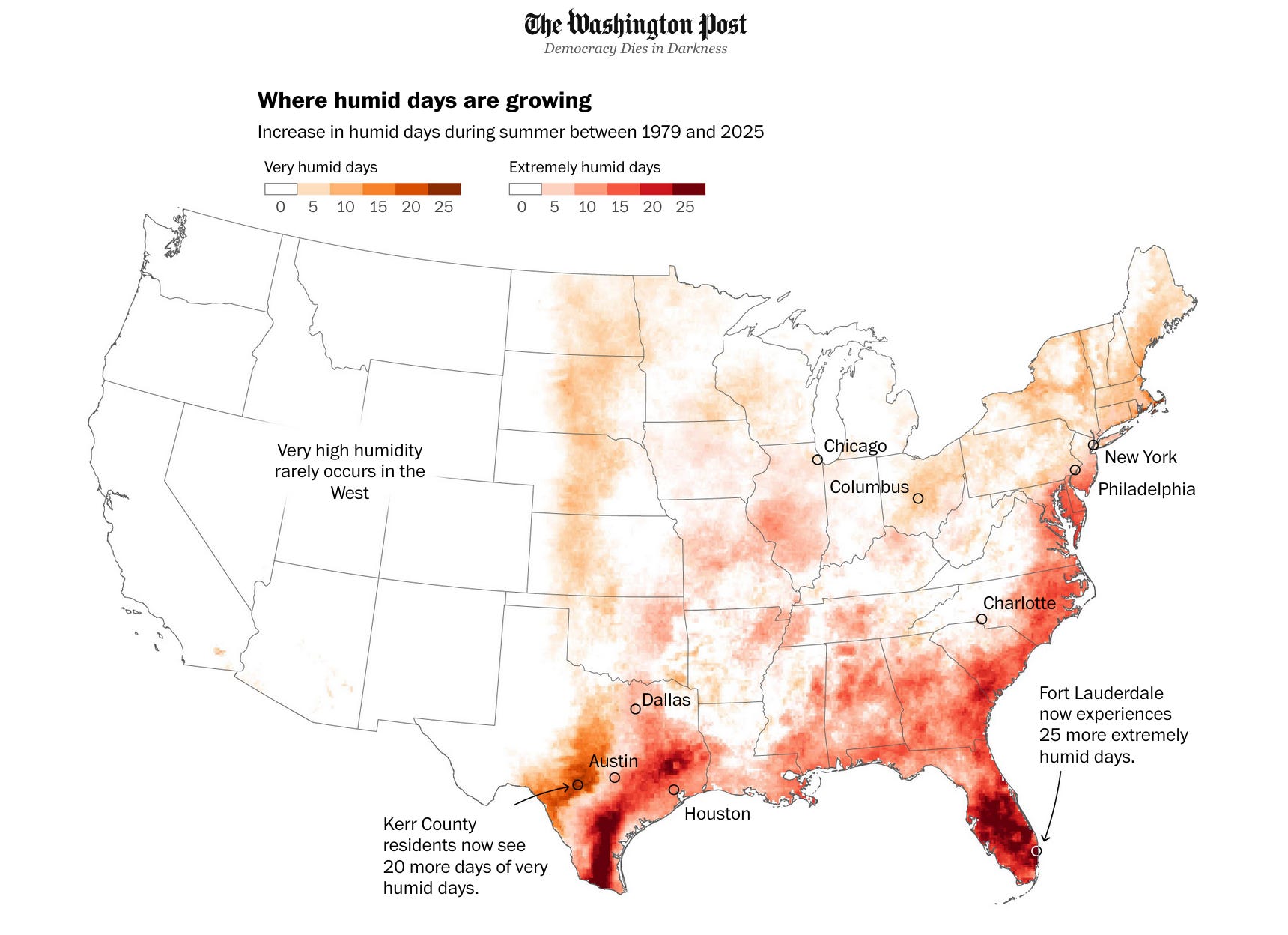
In this week’s Washington Post, I wrote about this summer’s humidity and long-term trends across the United States. Here’s a gift link if you’re up for some additional reading!
Enjoy the last week of astronomical summer ✌️