
Sunny, dry weather on repeat 🔁
Update #674: Outstanding October weather in the Hudson Valley.

It’s high-pressure city in the Hudson Valley and that means sunny and dry weather is on repeat — with some summer-like warmth mixed in early in the week.
A front on Tuesday night will probably bring the week’s only rain, assuming a coastal storm next weekend remains to the south.
Behind all of this fair weather is a weak jet stream. Jet stream winds blow tens of thousands of feet up and are responsible for carrying storms from west-to-east. But recently, the jet has been displaced well north into Canada.
I wrote about the unusual reason why in this week’s Washington Post: a vast expense of unusually warm ocean water in the North Pacific. Here’s a gift link to read the story.
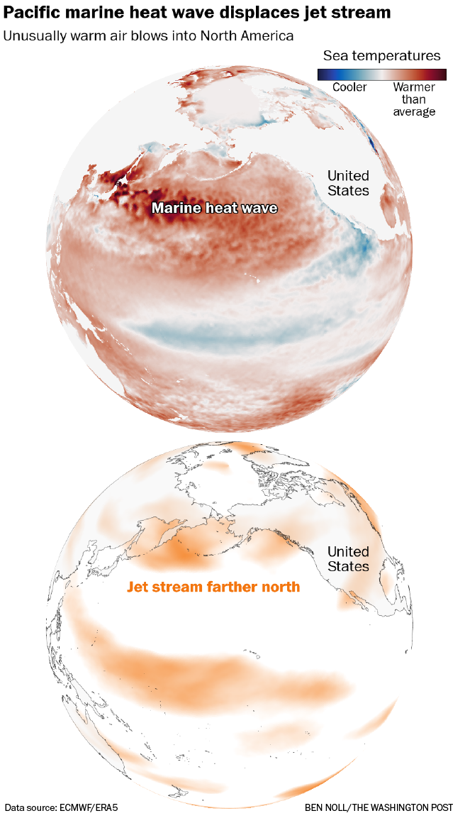
This pattern shows no signs of changing significantly soon.
The week ahead
The week ahead will be very warm to start before a midweek front cools things down — but sunshine will be a constant.
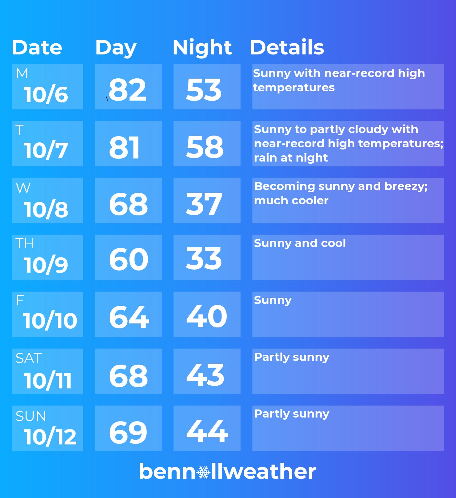
Monday: sunny and very warm with near-record high temperatures
Tuesday: very warm again with sunshine to start, then some increasing clouds; rain at night
Wednesday: much cooler and becoming sunny and breezy
Thursday: cool with sunshine
Friday: chance for patchy morning frost; plentiful sunshine
Saturday-Sunday: some more clouds possible as a storm brews offshore
Looking ahead to the week of October 13, I’m keeping an eye on the potential for a coastal rainstorm. Otherwise, it looks relatively warm.
The animation below shows how above-average temperatures will generally be favored in the East through mid-October.
Also, I’ve started to write my Hudson Valley winter outlook! Premium subscribers will be the first to receive it in a few weeks.


Enjoy the abundance of sunshine this week!