
First a nor'easter, then nicer
Update #675: Stormy weather will give way to sunny and cool conditions this week in the Hudson Valley.

The season’s first nor’easter will soon hit the Hudson Valley. Although this type of coastal storm is synonymous with snow, this one will bring rain and wind, starting Sunday evening and continuing through Monday.
If you’re wondering if it’s a sign of things to come this winter, premium subscribers will receive my Hudson Valley Winter Outlook first, on Saturday, October 25. Click the button below to upgrade and receive it!
Although the weather won’t get an A+ to start the week, it will significantly improve as dry and sunnier conditions arrive — but gusty winds continue.
A midweek cold front will usher temperatures that are more typical of November, helping to push the region closer to peak fall color over the coming weeks. In other words, you probably won’t need the air conditioner again this year!
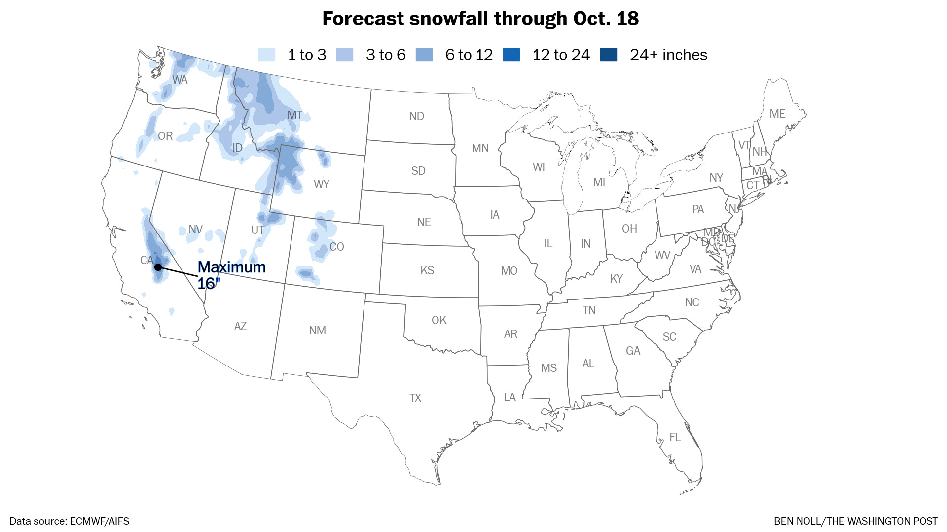
Winter will arrive early in the West, as snow coats the mountains during the week ahead.
The week ahead
The week ahead will bring a mixed bag of fall conditions to the Hudson Valley, with rain, wind, freezes, and some warmth.
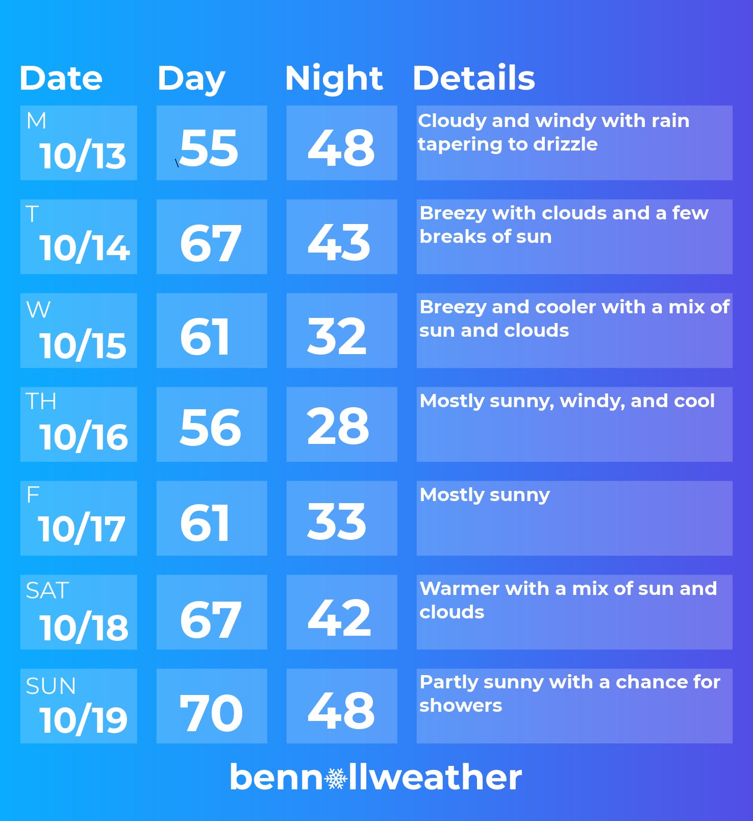
Monday: rain continues, though it should gradually turn lighter; windy
Tuesday: breezy and warmer with a few breaks of sun
Wednesday: a cold front will cause temperatures to drop, breeze blows; cold at night
Thursday: a fall chill in the air, but sunny
Friday: a morning freeze, but a milder afternoon with sun
Saturday-Sunday: probably turning warmer, next storm system may approach late in the weekend
Looking ahead to the week of October 20, conditions may be mild to start followed by a cool down with occasional rain chances. Because of a strong jet stream over the country, winds could be elevated again.
What will winter bring to the Hudson Valley? Be sure to subscribe to gain access to my winter outlook in two weeks! 🔮


Embrace the changeable weather this week ✌️