
Windy with a chill in the air 🌬️
Update #678: A sharp chill arriving later this week in the Hudson Valley suggests snow season is getting closer.

Hold onto your hats! November will be off to a blustery, sometimes cool start in the Hudson Valley.
Each day will bring a slightly different flavor of weather, as windy conditions prevent patterns from getting stuck in place.
Following a potent cold front, Thursday looks like it will be the coolest, gustiest day followed by a frosty night.
There’s no snow on the menu yet — but, if you want to read more about when the first snow may fall, check out my Hudson Valley winter outlook:

Another potent cold front could blow through the region late in the weekend or shortly thereafter.
The week ahead
As temperatures go up and down, wind will be pretty constant in the Hudson Valley. The air will also be pretty dry this week — especially Thursday and Friday — which will add to the chill.
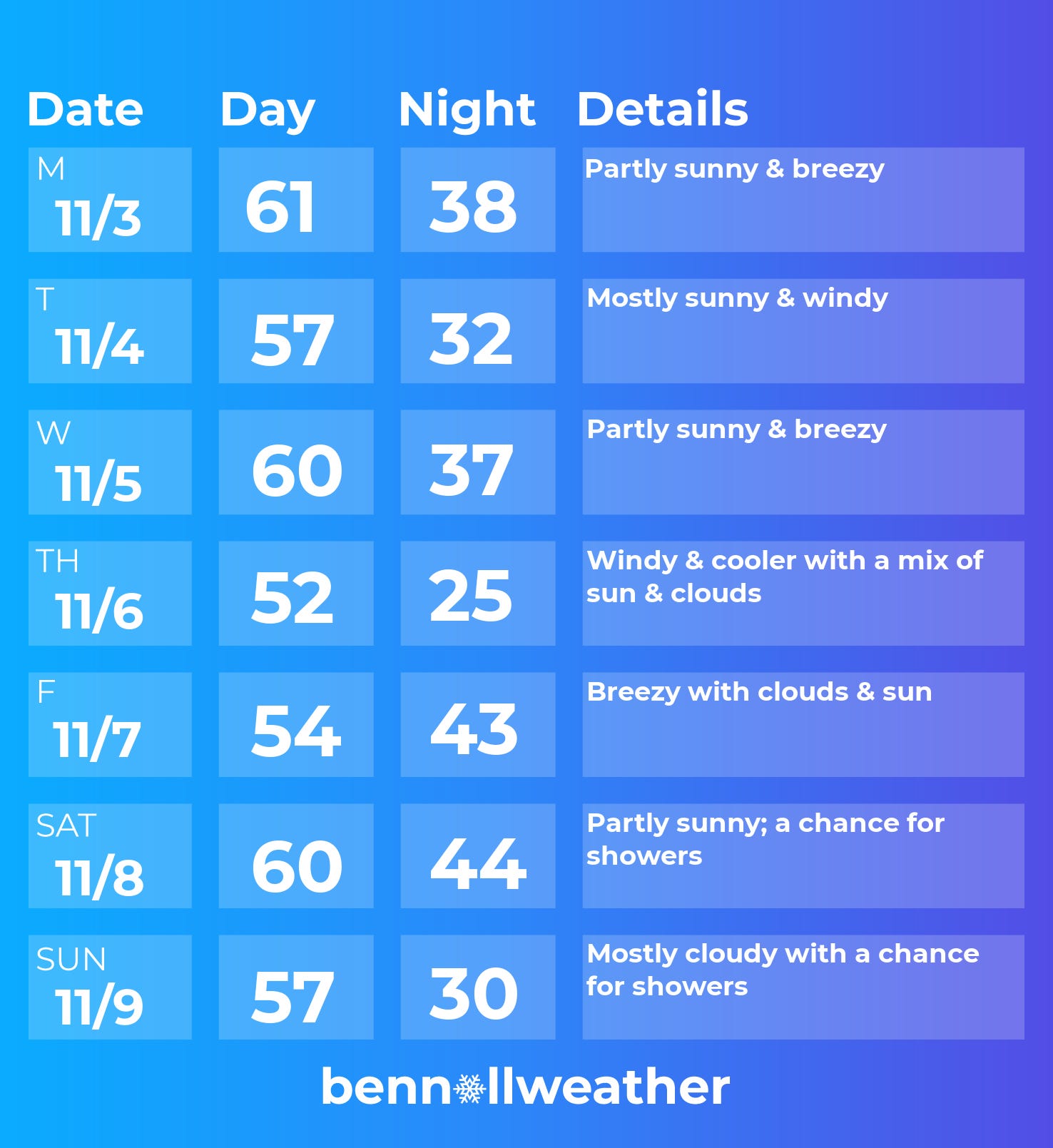
Monday: a mild but breezy start to the week as a front approaches from the west and a storm remains to the south
Tuesday: windy and noticeably cooler than Monday
Wednesday: temperatures rebound thanks to southerly winds ahead of an approaching cold front
Thursday: cold front blows through, temperatures nosedive, especially at night 📉
Friday: on the chilly side, still a breeze
Saturday-Sunday: there’s uncertainty in the weekend forecast, but currently there’s a chance for showers; a strong cold front could swing through Sunday or Monday
The week of November 10 could start on a rather cool note.
Speaking of cool notes, it recently snowed in New Zealand’s South Island and I couldn’t pass up one more trip before warmer weather arrives down under. Enjoy these views of Aoraki/Mt Cook National Park!


Soon, these types of snowy scenes will arrive in the Hudson Valley ✌️
Thank you Ben. Stay well!