
Get ready for a taste of winter!
Update #679: It's going to feel like January in the Hudson Valley on Tuesday.

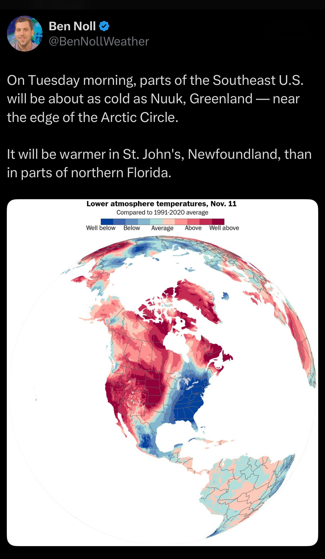
The big weather story this week is the frigid air that’s headed toward the East Coast from the North Pole.
Tuesday will feel like January in the Hudson Valley, with highs struggling to get out of the 30s and wind chills in the 20s. There may even be a passing flurry or two between Tuesday and Friday! ❄️
But no snow days, yet.
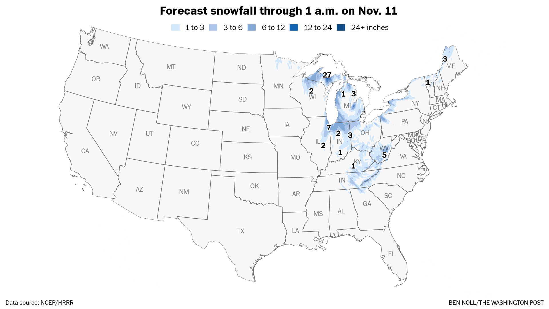
Freezing conditions will stretch all the way down to Florida, where temperature records from the 1800s may be broken. The first flakes of the season will fly in some states, including near Lakes Erie and Ontario in New York. You can read more about that in my recent Washington Post article.
However, the chill will be transient. A fleeting visitor rather than a long-term guest.
And although it will be cool and windy this week, there will be at least some sunshine most of the time.
The week ahead
The week ahead will turn windy and cool in the Hudson Valley and might even feature a flurry or two.
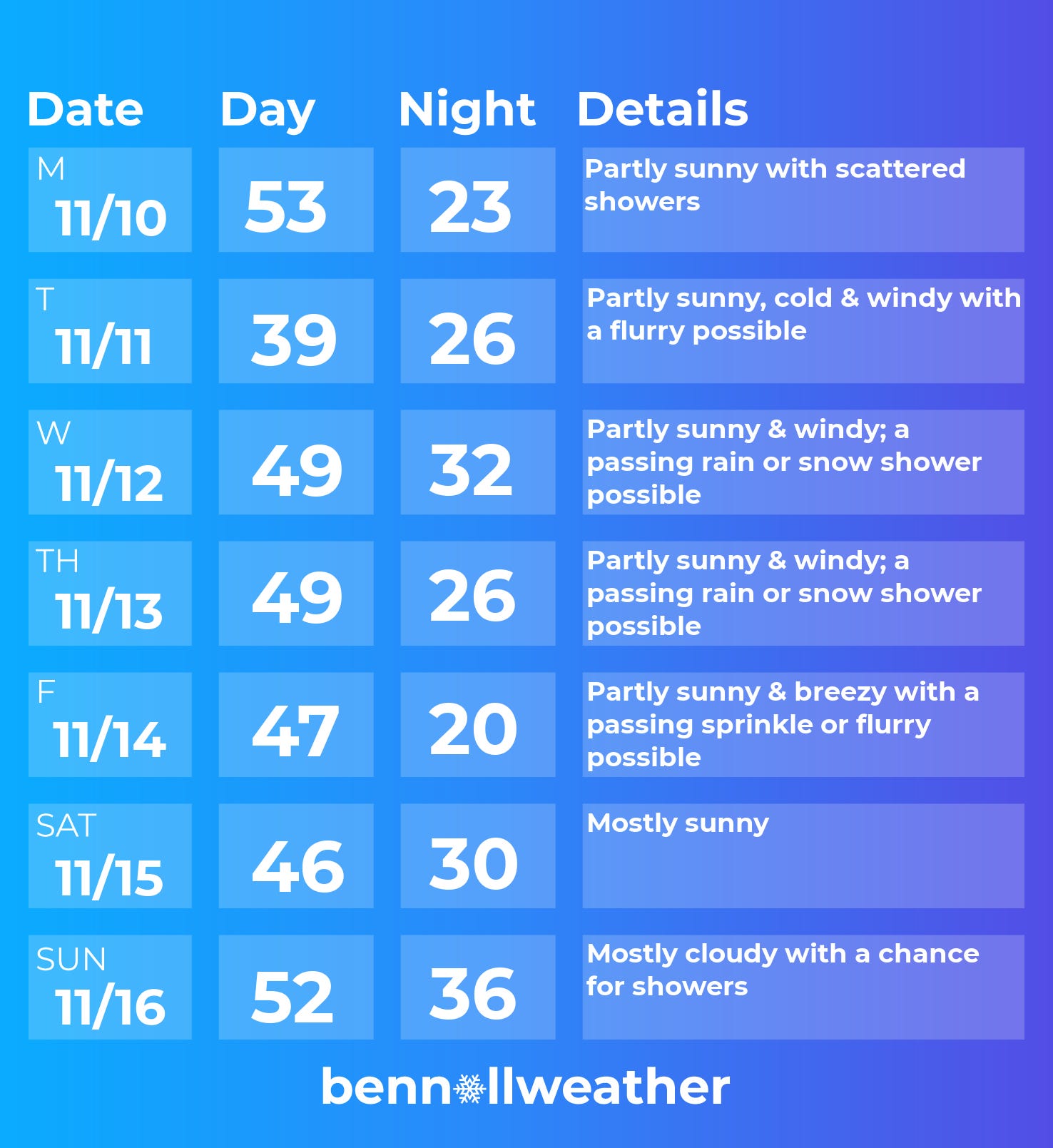
Monday: a day of transition with scattered showers, as mild air departs and colder air arrives
Tuesday: winter-like, the chill made sharper by the wind; stray flurry?
Wednesday: not as cold as Tuesday, but still windy with a passing shower of rain and/or snow possible
Thursday: similar to Wednesday
Friday: like Thursday, winds easing back slightly
Saturday-Sunday: Saturday looks fair at this point, but Sunday is more of a question mark as a storm may approach from the west
Looking ahead to the week of November 17, temperatures look seasonable with ups and downs. If some chilly air lines up perfectly with a storm, there could be wintry precipitation, although I think the odds are fairly low for that.


Have fun flurry-spotting this week! ❄️