
Significant storm late Friday into Saturday
Update #685b: Substantial snow accumulation is looking likely across the Hudson Valley.

Hello again! It may be the thick of the holiday season but downtime is not on Mother Nature’s agenda.
But snow is!
The Hudson Valley is becoming a snow ‘hot spot’ this season and I wouldn’t be surprised if the next system, arriving on Friday evening, also delivers in a big way.
Timing
The storm will start late Friday afternoon or early in the evening and continue into Saturday morning. The worst of the storm will be on Friday night.
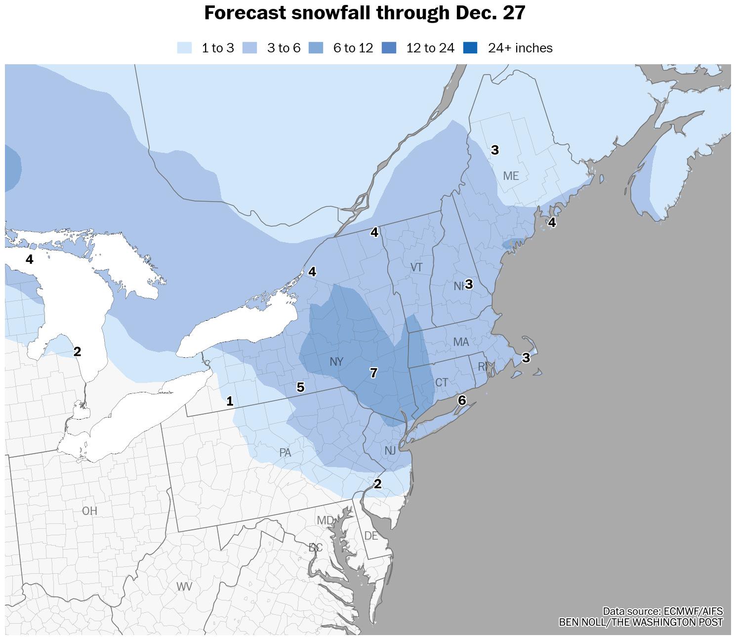
Amounts
The potential for a significant snow accumulation is increasing. An early bid of 5 to 10 inches regionwide seems reasonable based on current forecasts. Recent storms have tended to produce snow amounts near the top of the forecast range or even slightly higher. Given this, and the fact that this storm’s snow will be fluffy and pile up easily, I’m buying into heavier amounts.
Impacts
Road conditions will become dangerous on Friday evening as snow quickly intensifies, potentially reaching an inch per hour at times through the night as temperatures fall into the teens. Winds generally look light. Conditions will gradually improve on Saturday, though temperatures won’t rise above freezing, allowing icy spots to linger.
Confidence
At this time, there is strong weather model agreement that the Hudson Valley will experience heavy snow from this storm, leading to higher confidence levels. Strong Arctic high pressure to the north of the region over Canada will funnel cold air southward, likely leading to an all-snow event. However, a shift in the track of the storm or the position of the high pressure zone could lead to some changes in the forecast.
Another system will bring a period of freezing rain and/or rain to the area late Sunday into Monday.
🎅 It’s going to be a bumpy ride back to the North Pole!
Finally we are getting snow this season and cold weather I love it!!!!! Merry Christmas!!