
Heavy snow Friday night
Update #685c: If Saturday was a school day in the Hudson Valley, you probably wouldn’t have school.

Merry Christmas! Whoever asked for a big snow storm will soon get their wish 🎅
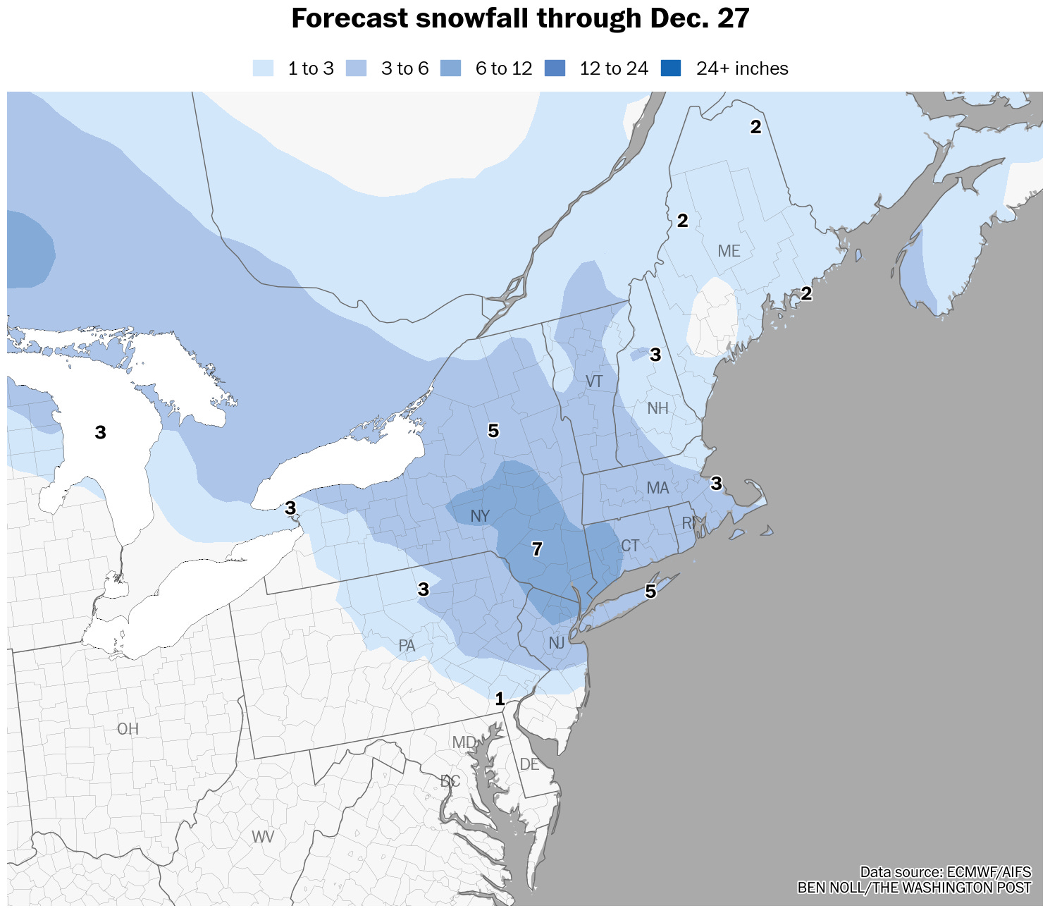
A significant winter storm is headed for the Hudson Valley. As of early Thursday, winter storm watches covered most of the region.
Let’s just say, if Saturday was a school day, you probably wouldn’t have school, as the region will be digging out from the storm.
Timing
Snow is expected to begin between 3 p.m. and 6 p.m. on Friday from west to east, tapering to flurries by 7 a.m. on Saturday. The worst of the storm will be on Friday night.
Amounts
Widespread snowfall of 5 to 10 inches is expected, with localized totals potentially reaching a foot. Snow will be fluffy and pile up easily. A heavy band of snow during the first half of Friday night may produce snow rates in excess of an inch per hour as well as large snowflakes that are conducive to substantial accumulation.
Impacts
Road conditions will become dangerous on Friday evening as snow quickly intensifies. The heaviest snow rates look to occur during the first half of Friday night, when it may be challenging for road crews to keep up with the storm. Conditions will gradually improve on Saturday, though temperatures won’t rise above freezing, allowing icy spots to linger.
Confidence
There is strong weather model agreement that the Hudson Valley will experience heavy snow from this storm, leading to high confidence levels. The areas that receive the heaviest snow will be determined by the exact placement of snow bands, which is challenging to predict.
Another system will bring a period of freezing rain and/or rain to the area late Sunday into Monday.