
Icy spots possible early Wednesday
Update #687a: A little freezing rain could affect the Hudson Valley and Catskills from Tuesday night into early Wednesday.

Winter weather advisories are in effect for the mid-Hudson Valley and Catskills, including Orange, Ulster, Sullivan, Dutchess and Putnam Counties, starting Tuesday evening and ending Wednesday morning.
There’s a chance for some light, patchy freezing rain overnight, especially in hilly, elevated areas as well as near the Catskills.
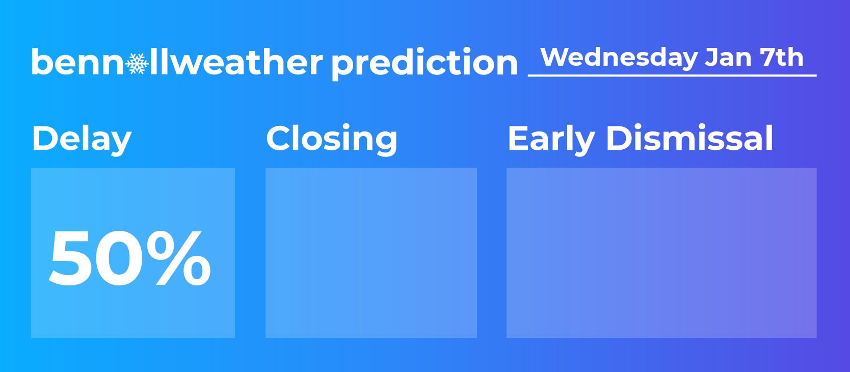
Because of this, there’s a chance for delays on Wednesday morning, although the situation looks borderline.
It’s uncertain just how low temperatures will go from Tuesday night into Wednesday. Advancing cloud cover may help to keep temperatures above freezing, reducing the icing risk.
But if it falls to freezing or below, which is most likely in Sullivan and Ulster Counties, a light glaze of ice may develop.
Although temperatures rose above freezing on Tuesday, ground temperatures will be colder since it’s been very cold for a while, still allowing rain to freeze on contact with untreated surfaces.
I think it will be a wait-and-see type situation, with schools assessing their local situation early Wednesday morning — looking at area temperatures and road conditions. Tools that I use to monitor local conditions include the New York State Mesonet and 511NY.
As a reminder, freezing rain is simply rain that turns to ice when it makes contact with a surface that’s below freezing.
Ice can be tricky and even minor amounts can cause problems, so it’s worth taking it a little slower on Wednesday morning. Temperatures after sunrise Wednesday will rise above freezing — if they aren’t already — ending the icing risk.
In a best-case scenario, there’s little or no ice. But just a degree or two — and a hill or mountain — can mean the difference between wet roads and slippery ones.
Stay safe!
Thank you Ben