
The scoop on Saturday's snow
Update #688b: Accumulating snow is headed for the Hudson Valley this weekend.

Hi there! This is an update about snow that will hit the Hudson Valley this weekend.
One storm will arrive on Saturday in two waves. A second storm on Sunday should pass mostly offshore, but the region could end up on its western fringe.
Timing
Saturday’s snow looks to come in two waves: one during the early hours of the morning before sunrise and another, steadier wave from the late morning through the afternoon.
Considering these two periods of activity, snow will fall between 1 a.m. and 5 p.m. Saturday.
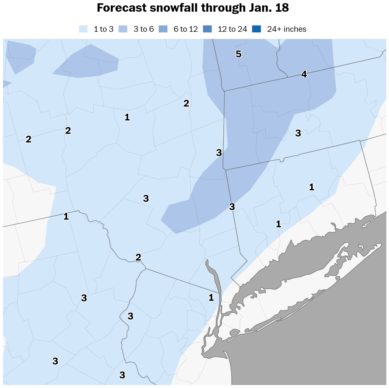
Amounts
Total snowfall of 1 to 3 inches looks likely by Saturday evening, highest in hilly and elevated areas as well as north of I-84 where temperatures will be colder.
The second wave of snow will bring more than the first.
If a narrow corridor of moderate snow forms squarely over the Hudson Valley around midday on Saturday as some models suggest, snow amounts could end up on the higher end of the forecast range — as the region has already experienced several times this winter.
Impacts
Roads and sidewalks will be snow-dusted first thing Saturday morning and then will become covered and slippery when the second round of snow arrives.
With temperatures hovering near freezing, snow will be wet and slick.
If a steady band of snow develops in the middle part of the day, travel may become treacherous for a time.
If Sunday’s forecast also trends snowier, I’ll send another update!
Have a good weekend and stay safe.