
Polar vortex pattern arrives
Update #689: Hudson Valley to face brutal cold this week.

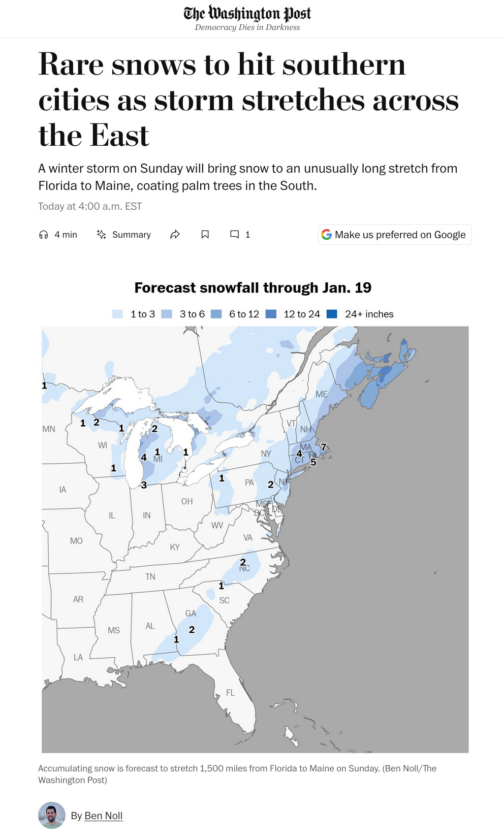
Old Man Winter will certainly make his presence felt in the Hudson Valley this week.
Snow through Sunday evening is forecast to accumulate 3 to 5 inches. An Arctic cold front will blow through the region late Monday. Low temperatures will be in the single digits many nights. But it doesn’t look like there will be snow days at this point! 🤷♂️
This polar vortex pattern is expected to continue through the end of the month and there will be more chances for snow.
It’s even snowing in Florida!
The week ahead
The week ahead will bring frigid conditions but few chances for snow.
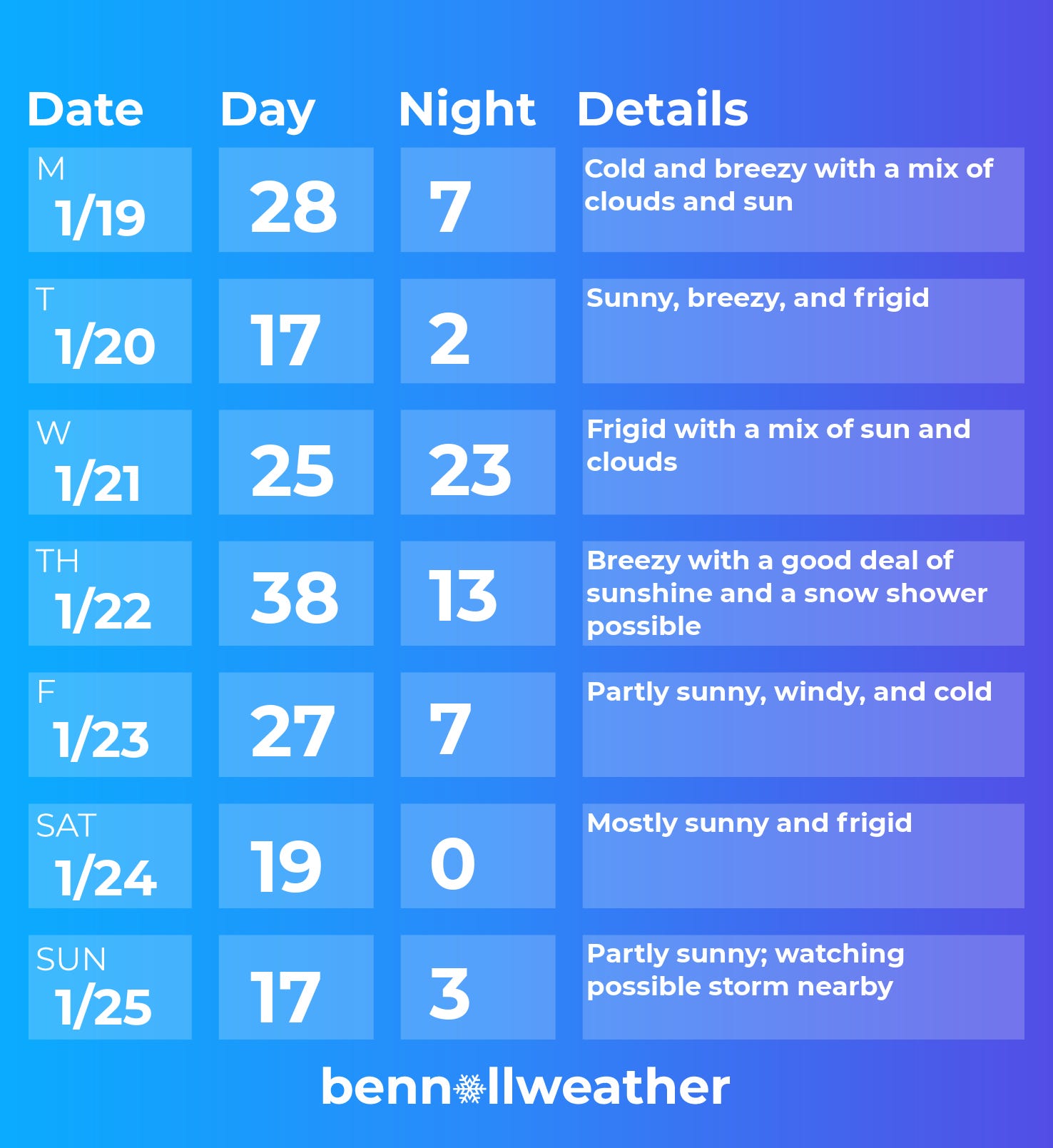
Monday: a cold, breezy start to the week; Arctic cold front arrives at night
Tuesday: plenty of sun, but frigid with gusty winds
Wednesday: a very cold start to the day; not as blustery as Tuesday
Thursday: temperatures could rise above freezing for once (!) with a snow shower possible
Friday: a reinforcing shot of cold air arrives
Saturday-Sunday: it’s looking cold as a storm may brew nearby late in the weekend…
Looking ahead to the week of January 26, there’s a heightened risk for a coastal storm as frigid conditions continue.
There are signs that the cold will become less intense in early February.
On another note, meteorological spring starts in 42 days ⏳

Beulah (North of Hwy 90) Pensacola Fl. 12mm accumulation .06 inches total liquid precipitation plus melt in gauge.