
Big snow Sunday into Monday
Update #689b: A major storm will bring a lot of snow to the Hudson Valley.

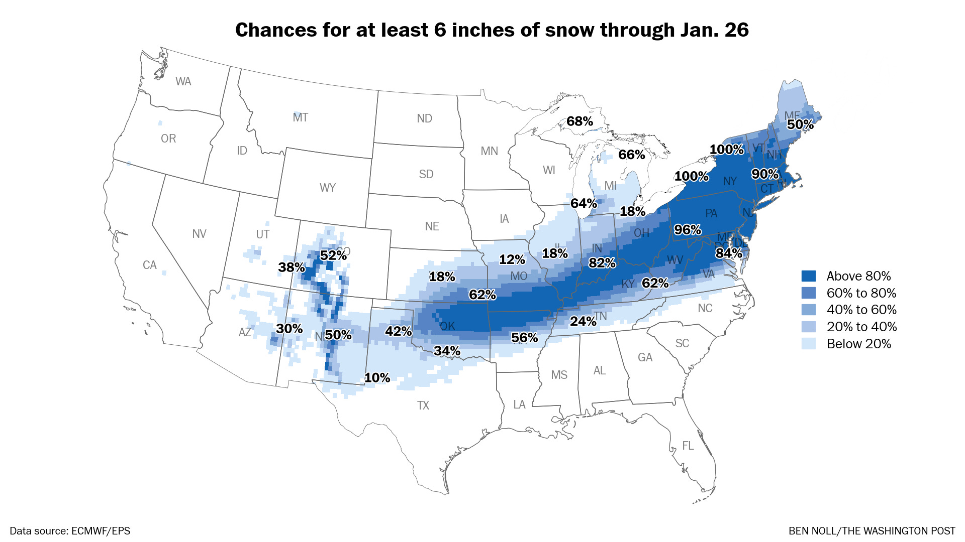
This one’s for all the snow lovers out there 💙
The weekend storm has continued to trend north, putting the Hudson Valley in the thick of the forecast heaviest snow.
Here’s what to expect:
Timing
Snow will start before dawn on Sunday and continue into Monday. The worst of the storm will occur on Sunday and Sunday night.
Amounts
Because of frigid temperatures in the single digits and teens, the snow will be super fluffy and accumulate efficiently. It will have no trouble piling up.
My early forecast is for 10 to 20 inches of snow across the region. That’s subject to change, but I think this has the makings of a big storm.
One thing I’m watching is the potential for snow to change to a wintry mix closer to New York City, including Rockland and Westchester Counties, which could suppress accumulation there somewhat. If that mix line creeps farther north, it could affect forecast snow amounts.
Impacts
On Sunday and Sunday night, deep snow cover may make roads impassable and lead to closures. Blowing and drifting snow may also create disorienting conditions.
At this point, school closings look likely on Monday as snow gradually ends and the cleanup begins.
For people flying into and out of hubs in the Northeast on Sunday and Monday, expect numerous cancellations. Consider changing your plans.
If you’re interested in reading more about this massive storm — which will stretch 2,000 miles across the country — here’s a gift link to my latest weather briefing in today’s Washington Post.
Buckle up!

Ben Noll Weather is the Real Deal! Thank you ❤️
Can always count off you for a real forecast! Thanks