
How much snow will fall? A lot.
Update #689c: The Hudson Valley will probably have a three-day weekend!

It’s going to be a big one.
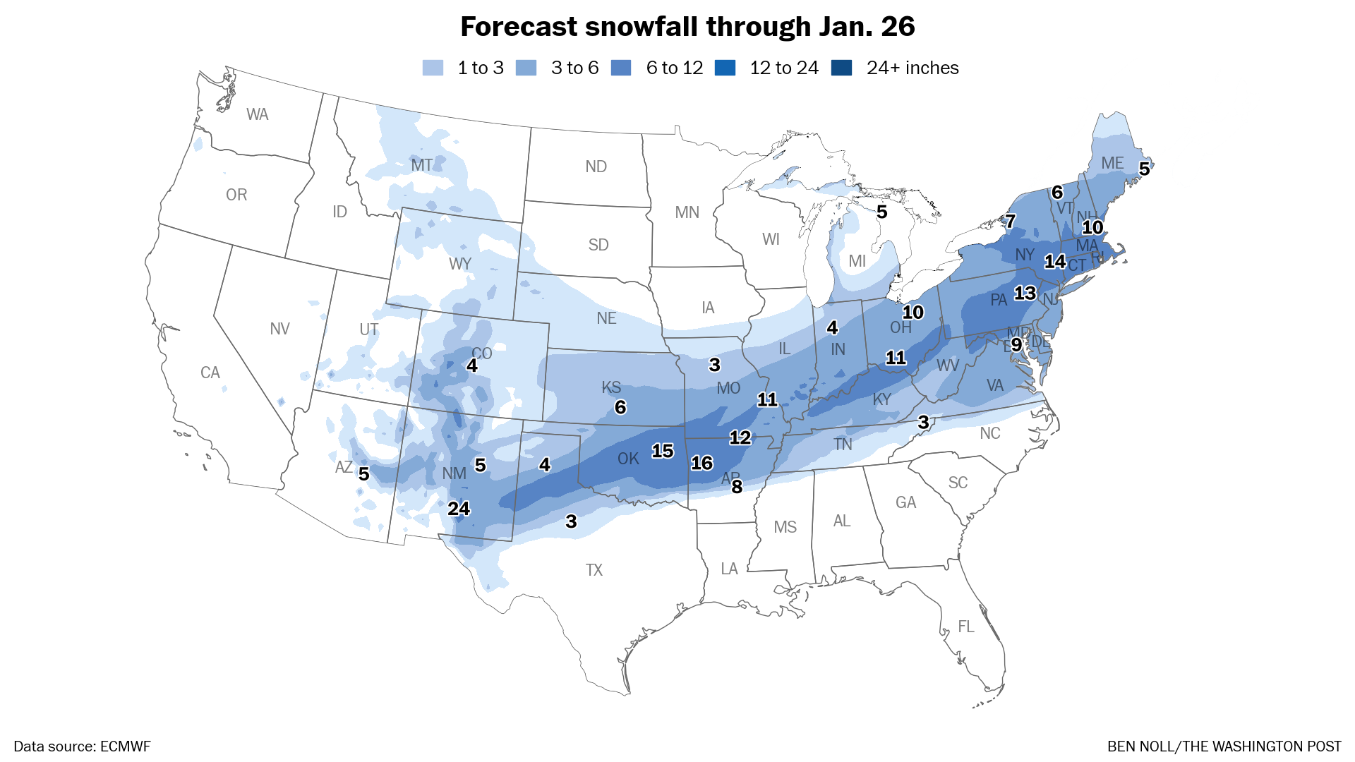
I’m expecting 10 to 20 inches of snow from the storm arriving on Sunday in the Hudson Valley — with localized totals possibly reaching two feet.
Because the cleanup will be so large and snow won’t end until Monday afternoon, you’ll probably have a three-day weekend!
Timing
Snow is expected to start between 5 a.m. and 8 a.m. Sunday from south to north. The bulk of the accumulation will occur from Sunday into Sunday night, but light snow will probably continue through Monday morning.
The worst of the storm is expected on Sunday afternoon and evening when snow rates may reach two inches per hour. During that time, travel may become impossible as deep snow covers roads.
Amounts
Because of frigid temperatures in the lower portion of the atmosphere and lots of rising air, this storm is primed to produce big, fluffy snow flakes that pile up with ease.
For most of the region, this will be an all-snow event. That means 10 to 20 inches of snow will easily accumulate, with localized totals possibly reaching two feet — especially in hilly, mountains areas.
On Sunday evening, snow may change to sleet closer to New York City, including Rockland and Westchester Counties, which could keep snow totals toward the lower end of the forecast range. But even in these places, there will be a lot of snow. A crusty layer of ice on top of the snow will make it harder to shovel.
Impacts
On Sunday, especially after noon, deep snow cover may make roads impassable and lead to closures. Blowing and drifting snow — with wind gusts of 15 to 25 mph — may create disorienting conditions late in the day.
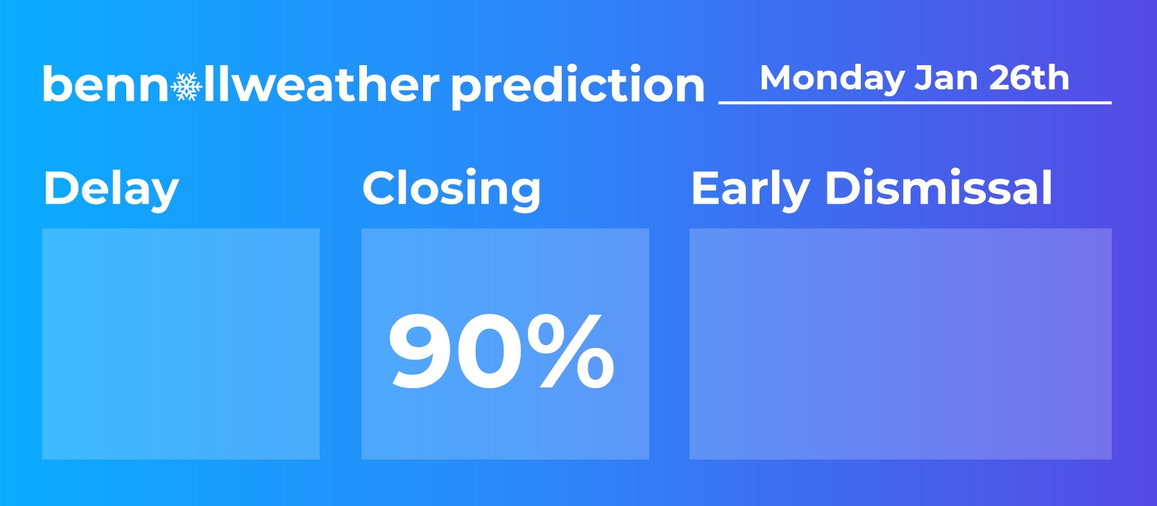
School closings are very likely on Monday as snow gradually ends and the cleanup begins.
For people flying into and out of hubs in the Northeast on Sunday and Monday, expect numerous cancellations. Consider changing your plans.
If you’re interested in reading more about this massive storm which will affect more than 200 million people across the country, here’s a gift link to my latest weather briefing in today’s Washington Post.
Thanks Ben!
Can’t wait