
One to two feet of snow
Update #689d: Do not attempt to travel on Sunday afternoon and evening in the Hudson Valley, as you may become stranded.

Hello again!
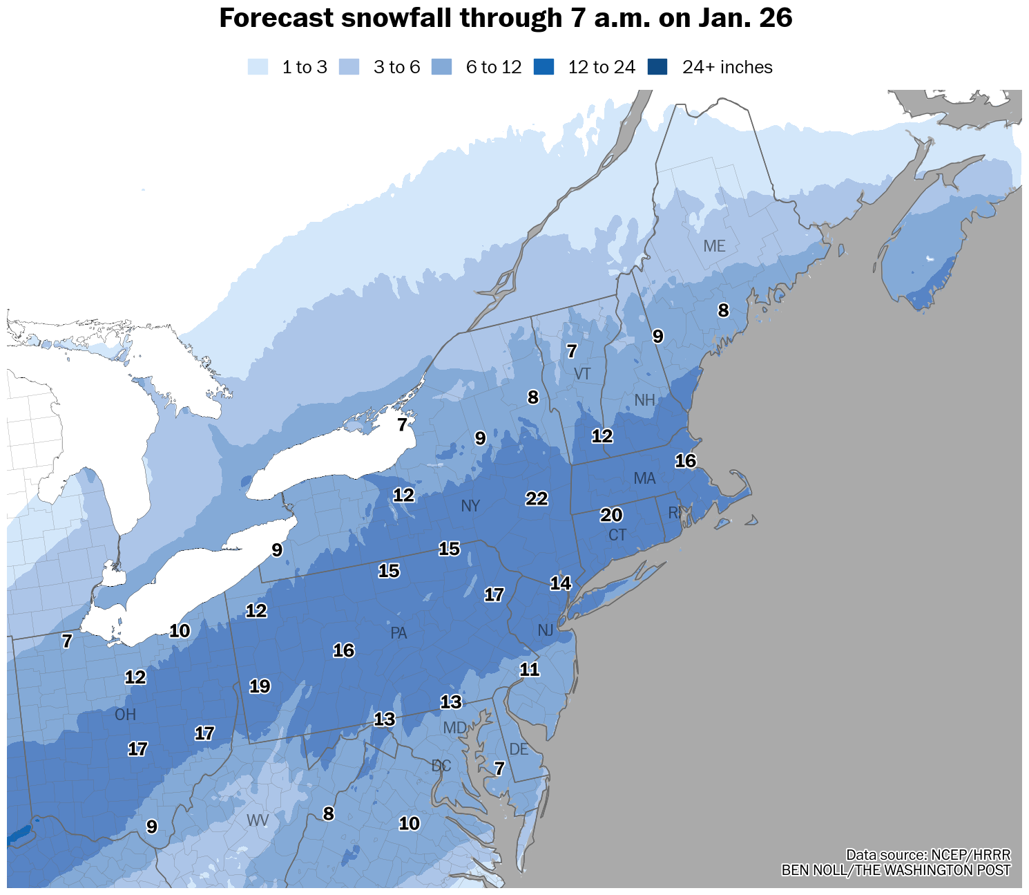
I am increasing forecast snowfall amounts for the Hudson Valley to one to two feet.
This is based on an expectation for heavy snow bands on Sunday, especially in the afternoon and evening, that could reach 2 to 4 inches per hour for a time. Such extreme snow rates are very unusual and will make travel impossible for a time.
Timing
Snow is expected to start between 5 a.m. and 8 a.m. Sunday from south to north. Snow won’t end until Monday afternoon, although the bulk of the accumulation will occur from Sunday through the first half of Sunday night.
The worst of the storm is expected on Sunday afternoon and evening when snow rates may exceed two inches per hour.
Do not attempt to travel on Sunday afternoon and evening, as you may become stranded.
Amounts
Because of frigid temperatures in the lower portion of the atmosphere and lots of rising air, this storm is primed to produce big, fluffy snow flakes that pile up with ease.
I’m expecting one to two feet across the region. There will be a ton of snow, but it will be light and relatively easy to move around — but it won’t be possible to make a snowman!
An interesting facet of this storm will be an advancing sleet line, which could reach portions of the lower Hudson Valley, including Rockland and Westchester Counties, on Sunday evening. Some forecast models even show this line moving into the southern reaches of Orange County, though I’m more skeptical about that. Any sleet would keep snow totals toward the lower end of the forecast range and make snow harder to shovel, but I don’t expect it to be widespread.
Impacts
Deep snow cover from Sunday afternoon through the night may make roads impassable and lead to closures. Blowing and drifting snow — with wind gusts of 15 to 25 mph — will create disorienting conditions late Sunday and overnight.
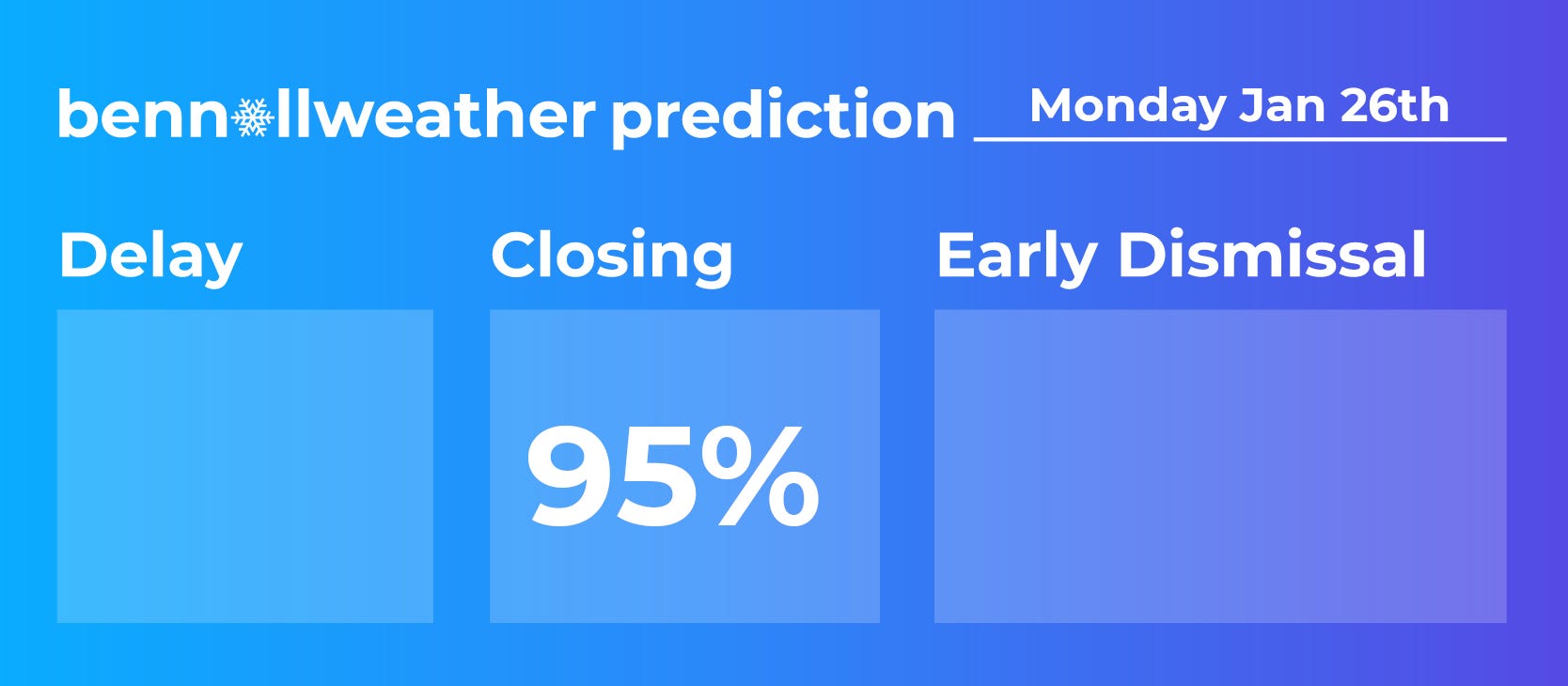
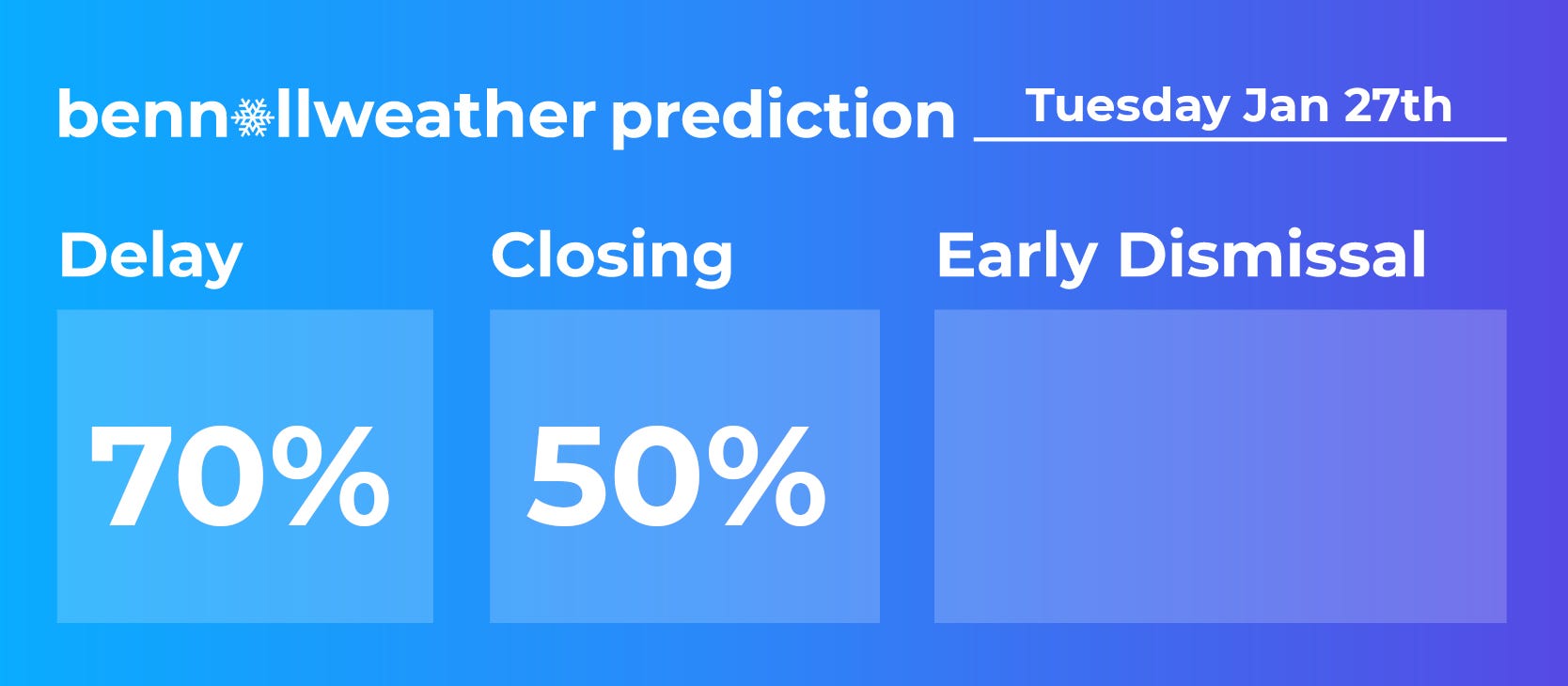
School closings are very likely on Monday as snow gradually ends and the cleanup begins. Because of the extensive nature of the cleanup process and the likelihood for subzero temperatures on Tuesday morning, I think there are chances for delays and potentially more closings in the hardest hit areas.
Stay safe! You’ve got this!
Wooooohoooooooo
Thank you Ben!