
Frigid after big storm
Update #690: Massive snows will be followed by a deep freeze in the Hudson Valley.

Here we go. One the biggest storms in recent memory is about to clobber the Hudson Valley with 1 to 2 feet of snow. Days like this don’t come around too often, so enjoy it (if you like snow)!
A majority of the region may end up in the 18-to-24-inch range when all is said and done on Monday. Across the the wider Northeast, isolated 30-inch amounts are possible.
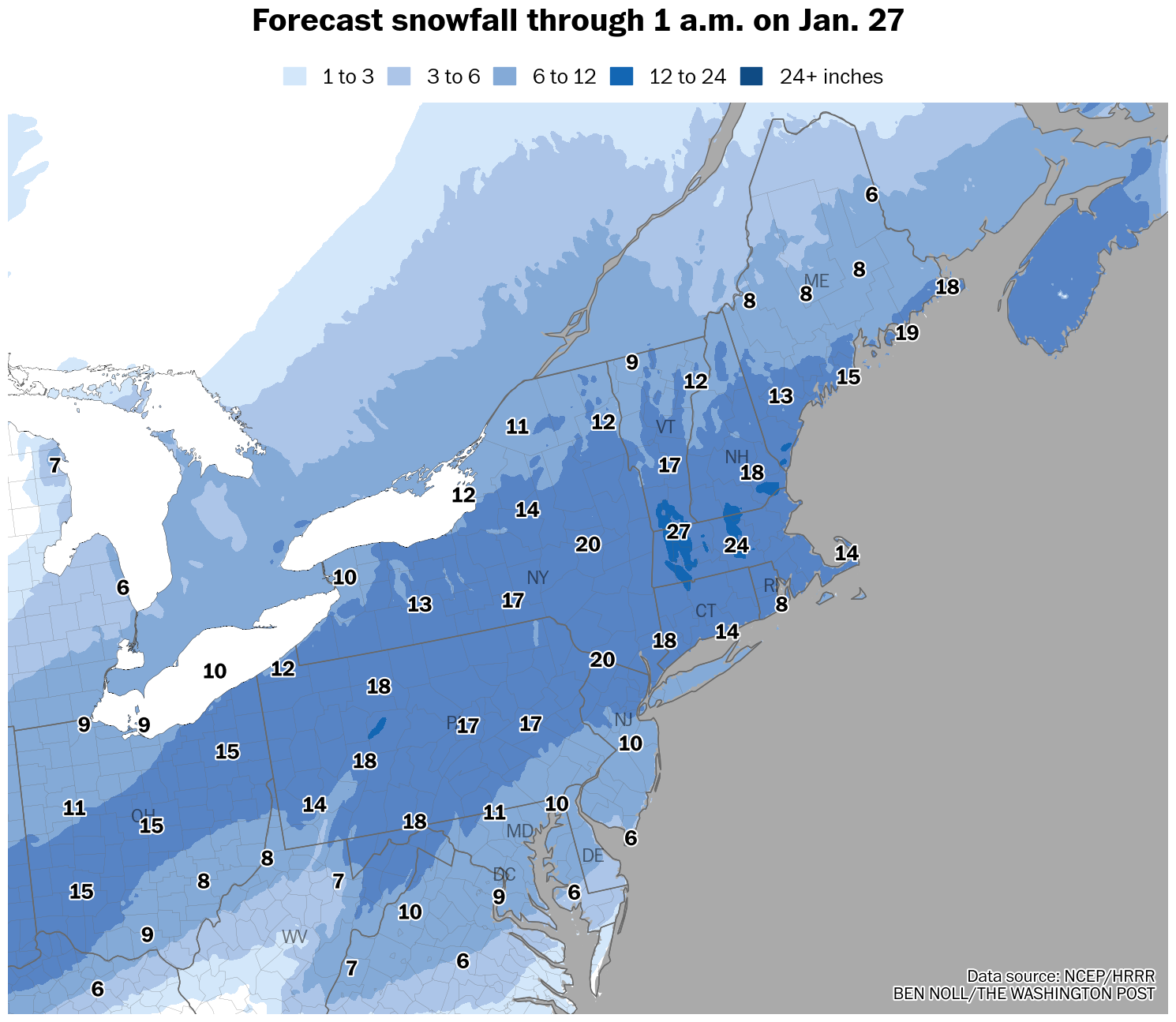
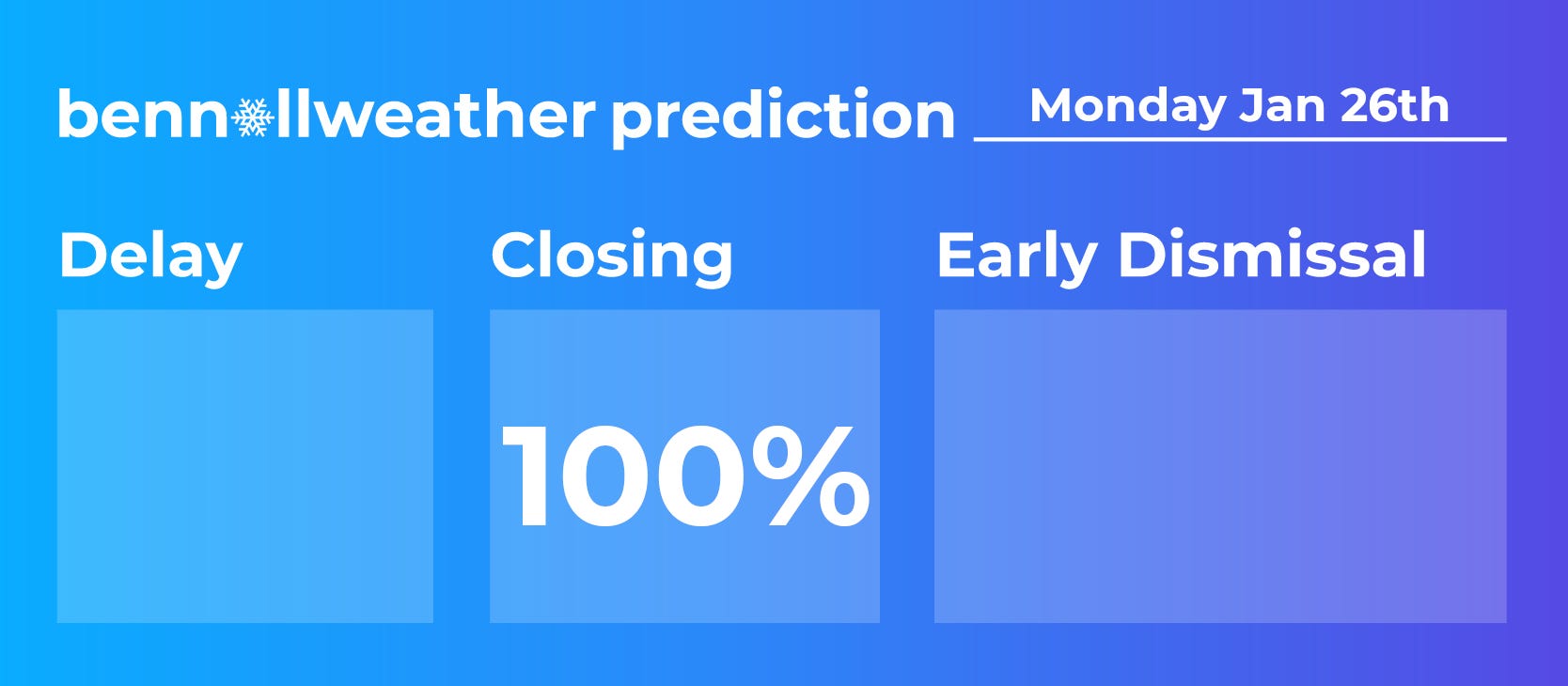
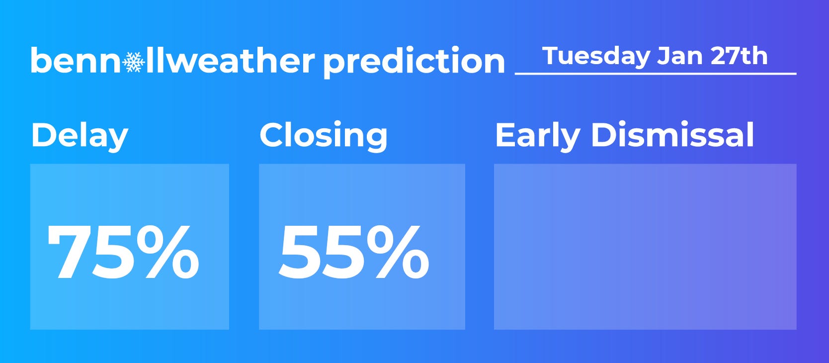
Schools have understandably started closing for Monday. Areas that approach two feet of snow will also likely be closed on Tuesday. We’ll know more about Tuesday when the the snow ends and the cleanup begins.
If you have found the storm coverage useful and enjoyable this week, please consider upgrading your subscription to premium. It supports unrelenting local weather analysis and custom visuals underpinned by years of meteorological experience. To those that are already in the premium tier, thank you.
The week ahead
The week ahead will be brutal. There are few words.
A deep, fresh snow cover will act like a freezer, enabling overnight temperatures to plummet and reflecting incoming sunlight. During the week after a big storm, I always take the ‘under’ when it comes to forecast temperatures. Dress warmly.
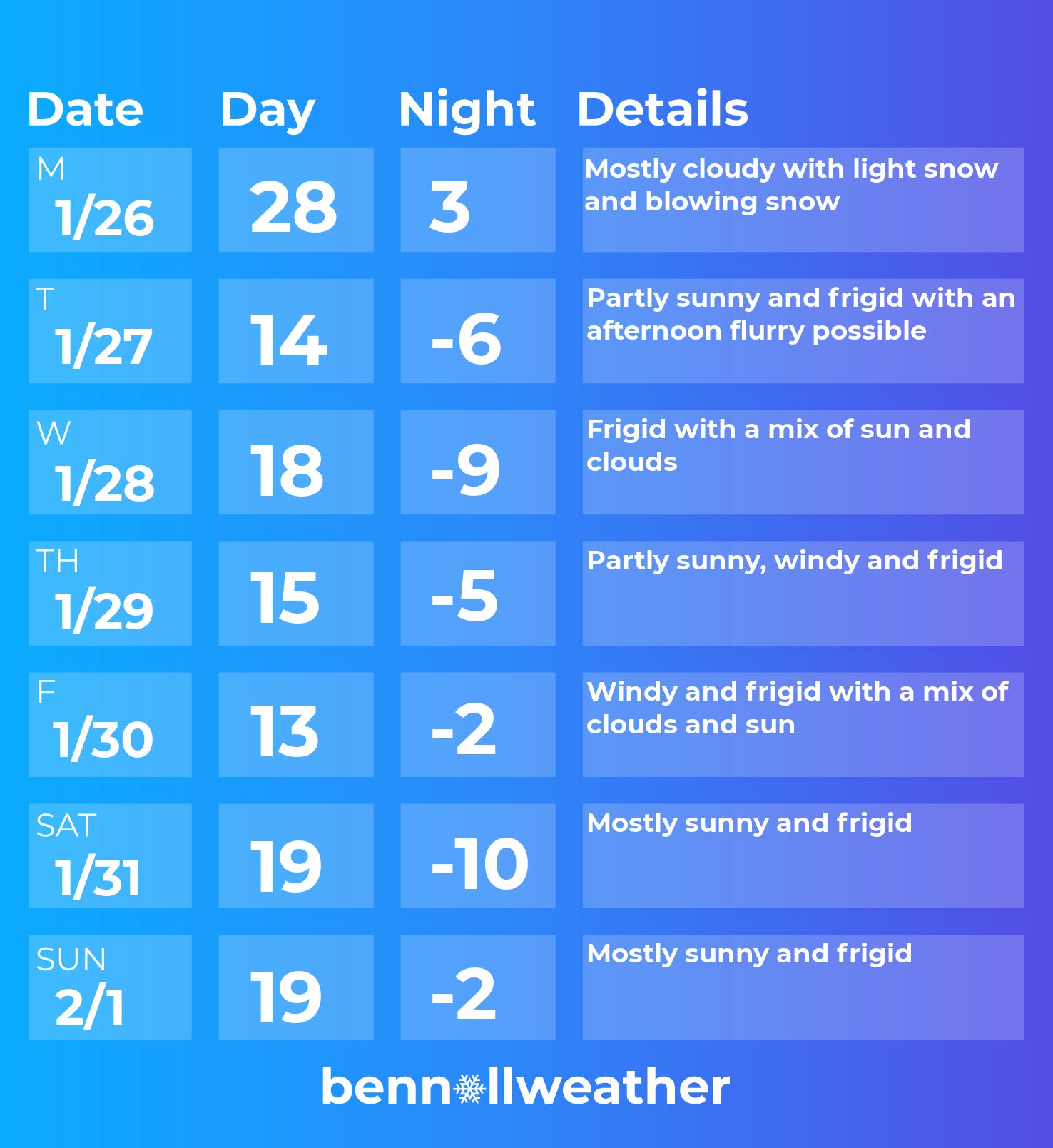
Monday: cold with light snow and blowing snow
Tuesday: frigid
Wednesday: frigid
Thursday: frigid
Friday: frigid
Saturday-Sunday: frigid
Looking ahead to the week of February 2, I’ll be keeping an eye on a potential storm near the East Coast to start the week, but it currently looks most likely to stay offshore. Otherwise, it looks cold, but probably a little less intense than this week.
Stay warm and safe 🔥
Did you know? Meteorological summer starts in 127 days ✌️

Warwick now @3” & coming down fast. Thanks Ben. It’s pretty.
10 inches in Greenville as of 3 PM