
Glancing blow or near miss?
Update #690c: A potent nor'easter will be within arm's reach of the Hudson Valley this weekend.

Ok, so I don’t think a direct hit from the storm is particularly likely in the Hudson Valley this weekend.
(famous last words)
But a glancing blow or a near miss still seem about equally likely to me.
This two-horse (or two-scenario) race is a result of a complex merger between two disturbances riding along the jet stream. Think of it like two cars merging into a single lane. Will they merge like a zip? Or will it be less seamless?
If a zip merge happens, we’ll probably get scenario 2. If not, then scenario 1 will probably win out.
Scenario 1 (45% chance): A miss to the east.
It’s possible that the storm remains far enough offshore that the Hudson Valley is spared of snow on Sunday.
Scenario 2 (45% chance): A glancing blow.
It’s equally possible that the storm’s western edge grazes the Hudson Valley, bringing a few, fluffy inches on Sunday.
Scenario 3 (10% chance): A direct hit.
All the storm-forming puzzle pieces would need to come together just right for this scenario. It’s quite unlikely — but it can’t entirely be ruled out yet.
If you favor a particular scenario, feel free to drop it in the comments 🙂
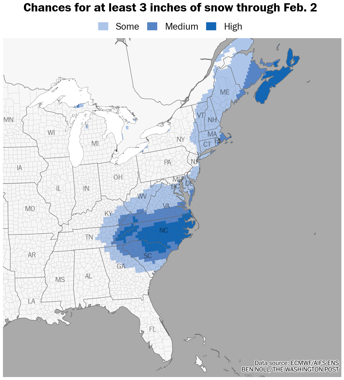
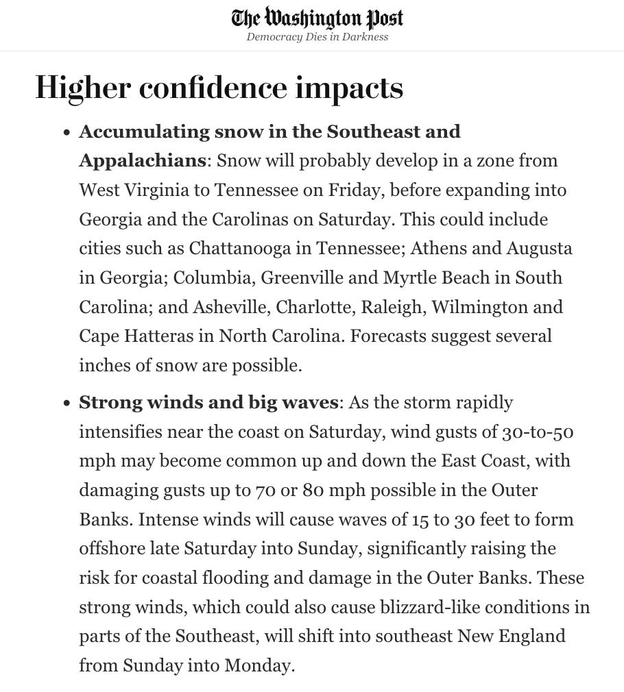
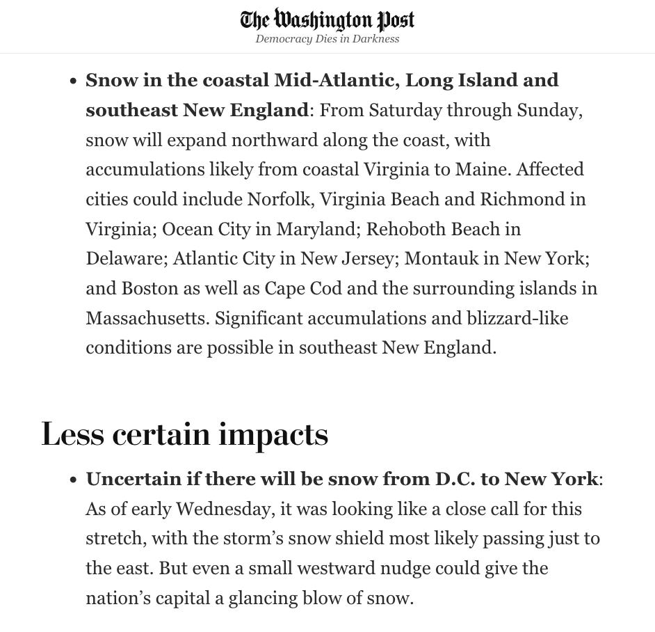
Where this storm will bring big snow
The big snow winner will be… the Carolinas! And southeast New England, including Cape Cod and the surrounding islands in Massachusetts — and perhaps Montauk on Long Island.
Cape Hatteras isn’t exactly synonymous with blizzard-like conditions, but this weekend will bring some wild weather there.
Here are a few words from my Washington Post article this morning:
The lanes are ending and we’ll soon know the outcome of this merge! Thanks for reading and stay tuned.
I like the scenario that brings another 24” to the Catskills……. So, you’re saying there’s a chance…..