
Wintry mix Friday
Update #693b: It won’t be the biggest storm, but it may be enough to cause school disruptions in the Hudson Valley.

Hi again!
A wintry mix of snow, sleet, and freezing rain will affect the Hudson Valley and Catskills on Friday, causing slippery conditions.
It won’t be the biggest storm, but it may be enough to cause school disruptions.
Timing
Starting between 6 a.m. and 10 a.m. on Friday morning from south to north.
Amounts
A coating to an inch or two of snow followed by a glaze of ice, with the highest amounts near the Catskills.
Impacts
Because of recent milder temperatures, the impact of this event is a bit uncertain. Temperatures will be hovering near freezing as wintry precipitation begins around the morning commute on Friday — which isn’t a great recipe.
That should cause roads and sidewalks to slicken up.
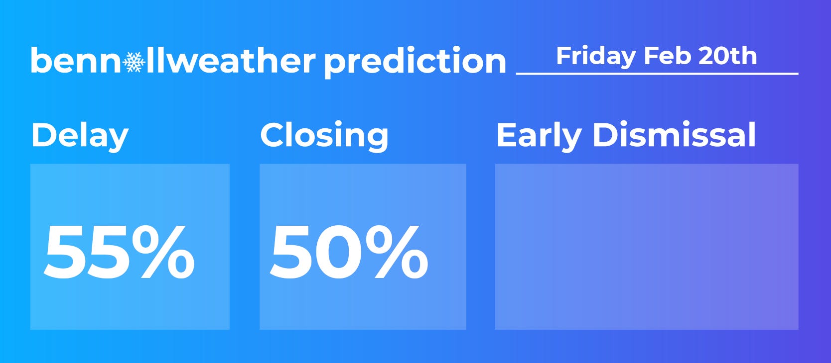
Based on current information and the borderline nature of this event, I tend to lean toward initial school delays on Friday, giving districts a little more time to decide on whether or not to call a snow/ice day.
Other storms
Be mindful of the chance for freezing drizzle on Wednesday night across the Hudson Valley. After plain rain Wednesday, temperatures will drop into the 20s overnight, with the potential for locally icy conditions. Because of this, there is a low-end chance for delays on Thursday.
Forecasts for another, more powerful storm from Sunday into Monday are still coming into focus, though outlooks are generally favoring a storm that tracks south and east of the Hudson Valley. This means that a direct hit is looking less likely, but the region could still be grazed by snow.
More to come!