
Here we go again!
Update #693d: Yet another winter storm is headed for the Hudson Valley.

I’m running out of clever headlines for winter storms. Is it spring yet?
Let’s just cut to the chase: there’s going to be a whole bunch of snow and you’re not going to have school on Monday. Cool? 🙃
Cool.
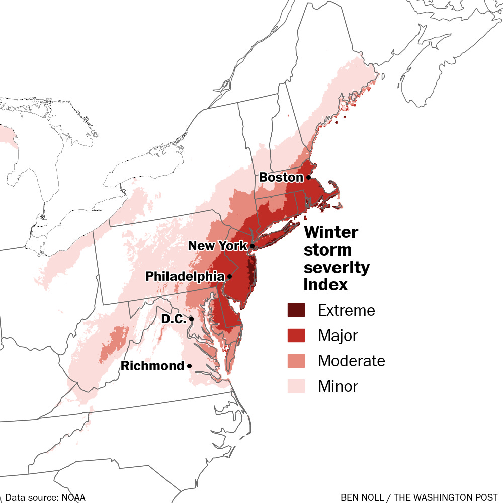
For the first time in four years, blizzard warnings line the coasts of the Northeast — that even includes southern Westchester County.
This storm has been tricky. It’s going to be well offshore, no it’s getting closer; oh wait, now it’s a stone’s throw away.
I don’t think the tricks are done quite yet. Because of that, the forecast snowfall range below may be a little wider than you are used to seeing.
Timing
It shouldn’t be that bad on Sunday. Light snow will probably bring an inch or so of accumulation during the day.
But by evening, conditions will start to deteriorate. That’s when snow will turn steadier and heavier, continuing through at least Monday morning.
The storm should pull away on Monday afternoon.
Amounts
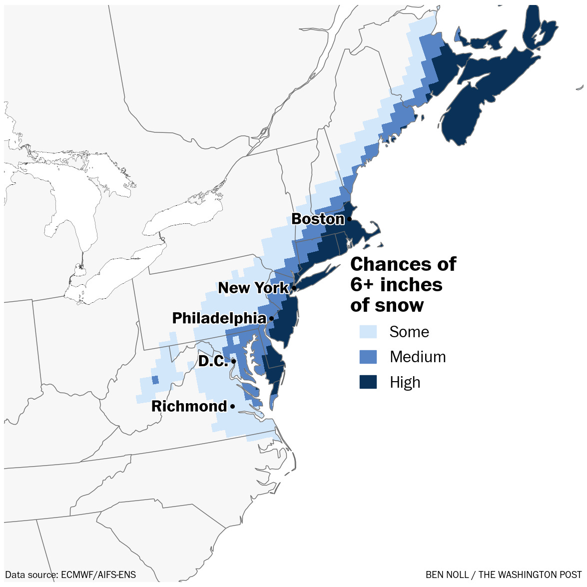
Because a relatively small 50- to 100-mile shift in storm track could make a big difference in snowfall, I think a wide forecast snowfall range is reasonable and prudent for this storm.
I’m going with 7 to 14 inches of windswept snow by Monday afternoon.
The snow should be of a wetter consistency, making it good for snowmen and snowballs.
Impacts
You know the deal: widespread travel disruptions, school closings, massive snow piles, and more potholes.
The worst of the storm looks to be Sunday night and Monday morning, including the commute — avoid driving if you can.
Things should start getting back to normal by Tuesday.
Whew. I’ll have another update tomorrow! Maybe it will trend back offshore.
(probably not!)
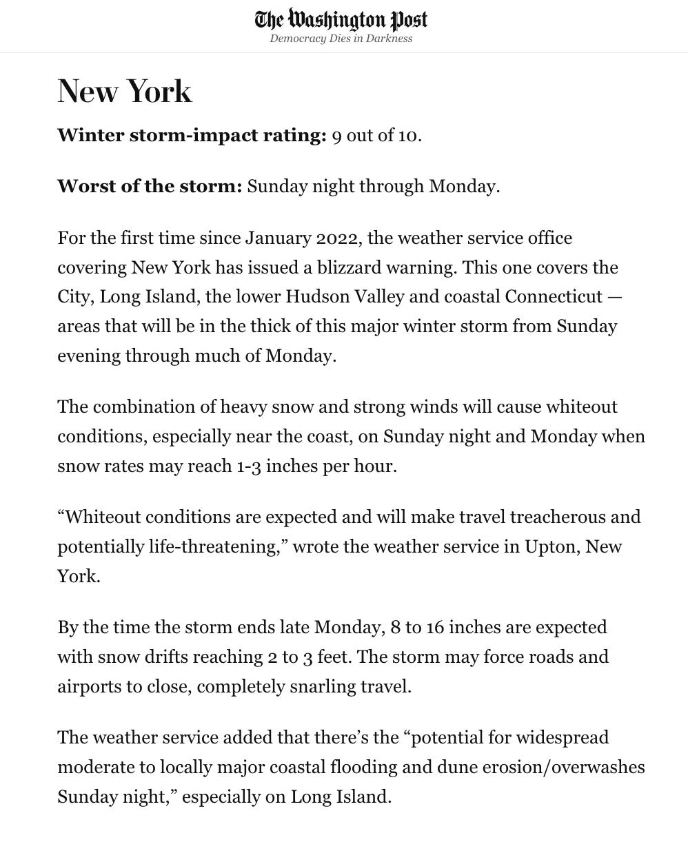
If you want to read about the full fury of this storm and all the places it will hit, here’s a gift link to my article in today’s Washington Post.
Thanks Ben!