
Icy mix on Tuesday
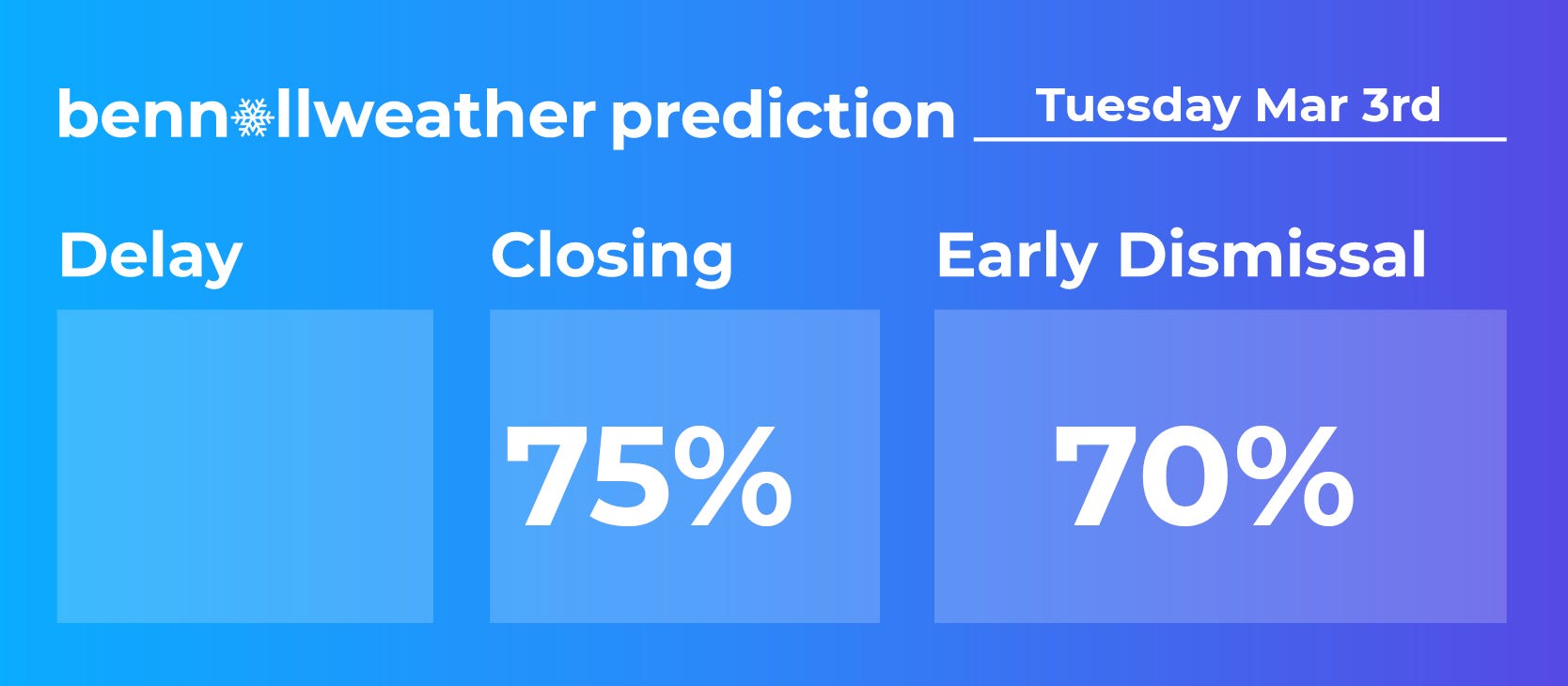
Update #695a: School closings and early dismissals are likely in the Hudson Valley on Tuesday.

Well, at least it should be the last winter weather event for a while!
This won’t be a big storm, but even a little ice can cause issues out there.
It’s looking like a close call between closings and early dismissals, but given an expected storm arrival time of late morning for most of the Hudson Valley, I lean in the direction of closings.
With a cold air mass from Canada overhead, freezing temperatures on Monday, and temperatures in the upper 20s to around 30 on Tuesday morning when precipitation arrives, snow and ice should have no trouble sticking, creating slippery roads.
Timing
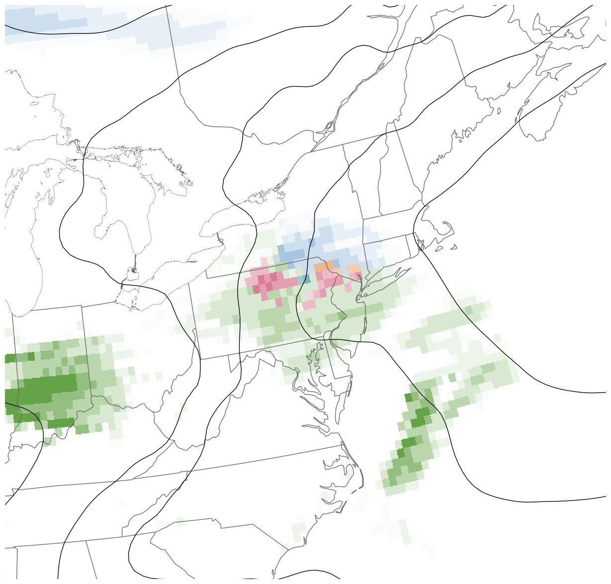
Snow will start between 9 a.m. and noon on Tuesday from south to north, before transitioning to sleet and freezing rain in the afternoon.
Amounts
Up to an inch or two of snow followed by a glaze of ice, with the highest amounts along and north of I-84.
Impacts
Roads will become snow-coated and slippery by midday Tuesday with slippery conditions lingering into the evening commute.
School closings are more likely than early dismissals because the latter risks a dismissal into the developing storm.
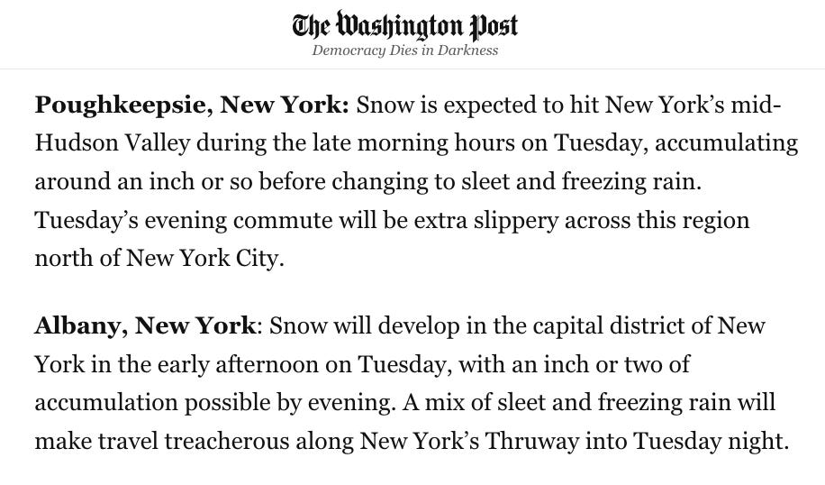
Here’s an excerpt from my story in Monday’s Washington Post.
Stay safe!
Fallsburg CSD is closed 🙂