70 degrees! Then... snow?
Update #696: It will be warmest since October in the Hudson Valley, then it's back to reality.

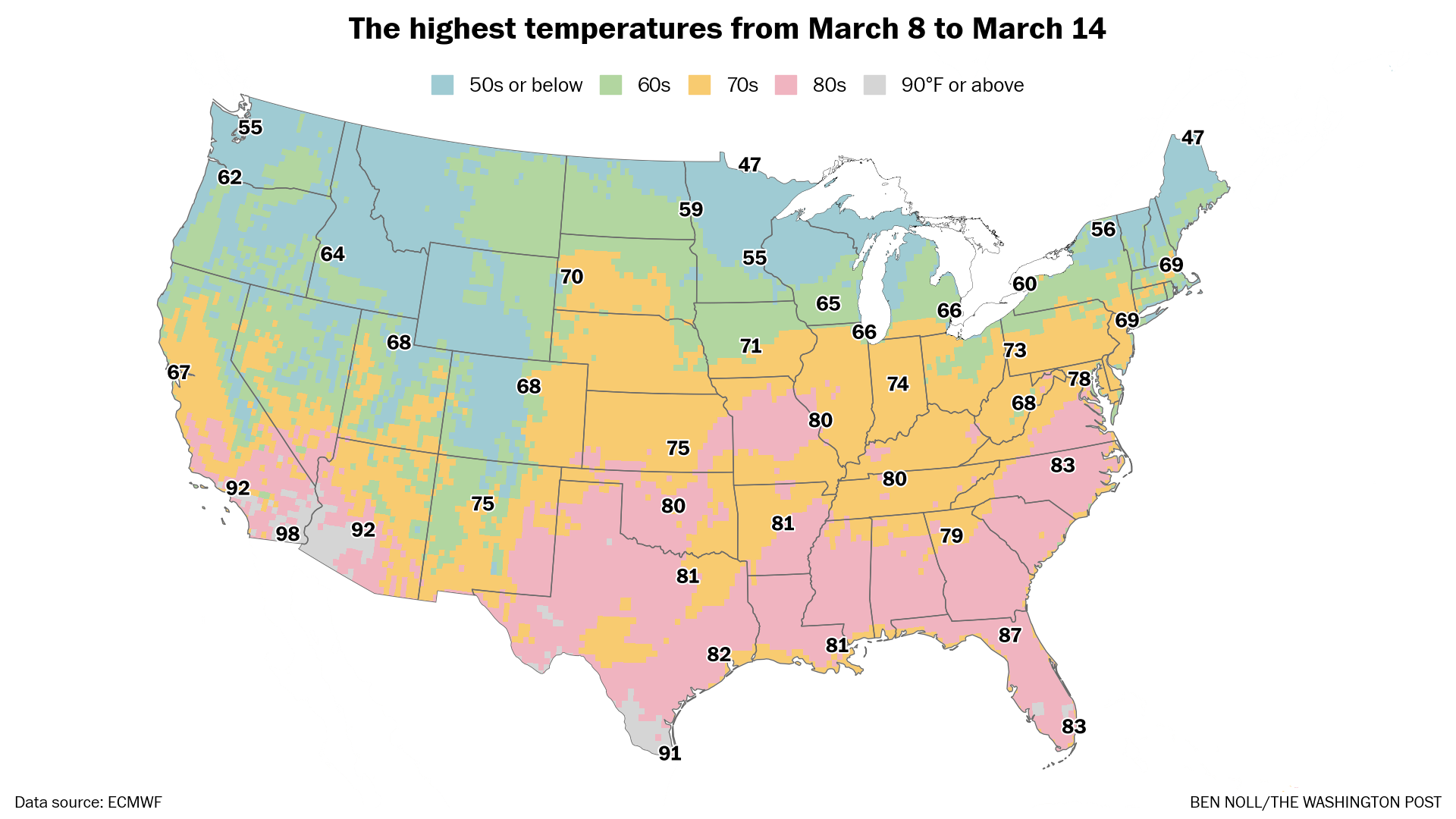
After a long, hard winter, how does three straight days in the 70s sound?
The Hudson Valley might just get that early this week. With plentiful sunshine on Monday and Tuesday and gusty-but-warm southwesterly winds, I’m taking the ‘over’ on temperatures. Wednesday looks warm too, but there will be more clouds.
Don’t get used to it.
By Thursday, it’s back to reality and the bumpy road that is March. I’m talking about the weather, not the potholes!
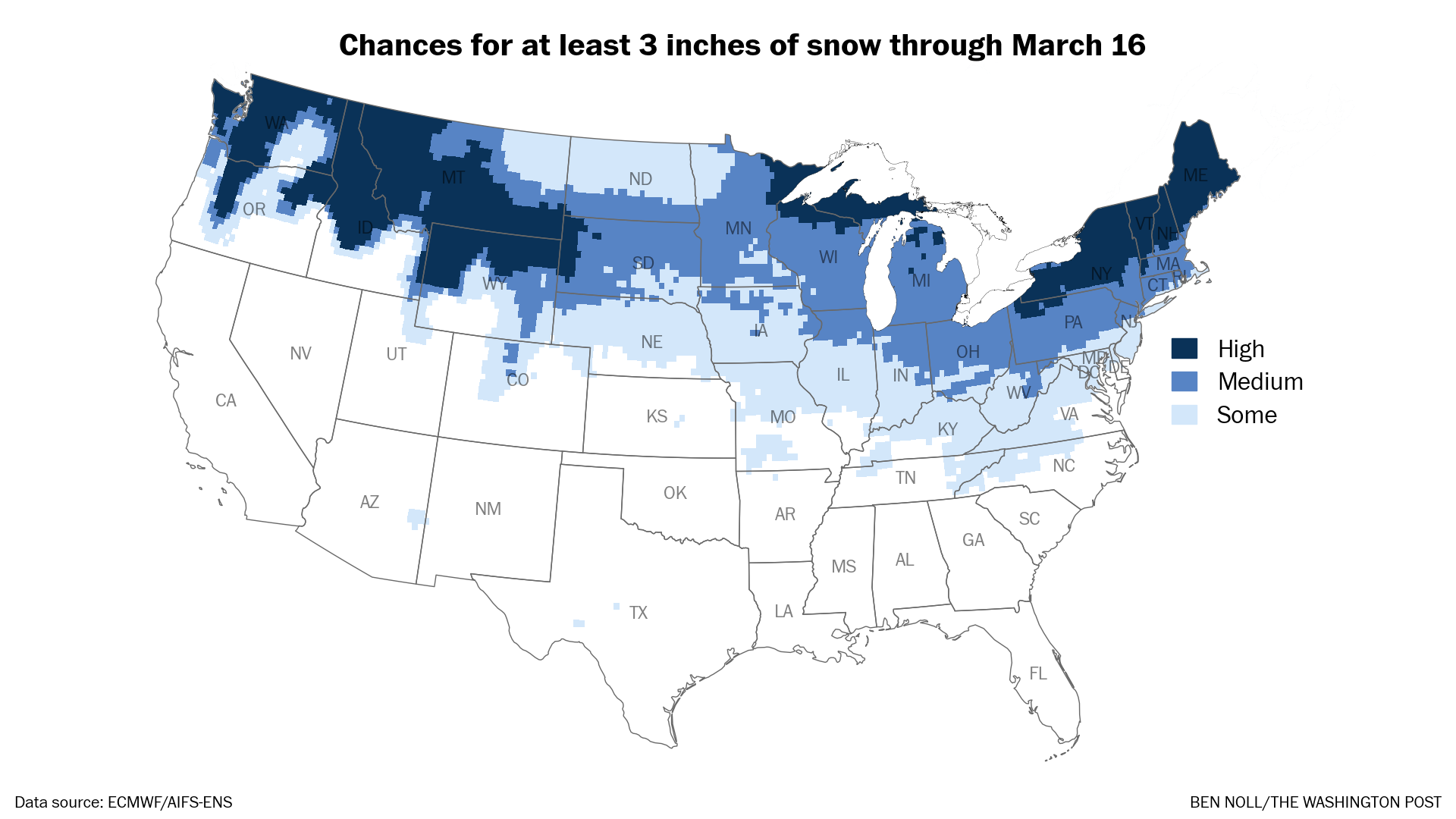
There’s even a chance that rain changes to wet snow when a strong cold front crosses the region on Thursday. And we’ll have to watch Sunday too.
The week ahead
The week ahead typifies March, with temperatures swinging around 50 degrees from the 70s to the 20s and blustery conditions.

Monday: sunny and warm; could be the region’s first 70-degree day since October 19
Tuesday: even warmer than Monday; a high in the mid-70s would be record-breaking and is more typical of late May or early June
Wednesday: warm again, but turning cloudier as a front approaches; chance for some afternoon or evening showers
Thursday: a strong cold front will cause temperatures to nosedive; expect some rain, possibly changing to wet snow❓
Friday: probably a dry, windy, and cool day
Saturday-Sunday: the weekend outlook is somewhat uncertain, although Saturday seems more likely to be dry than Sunday when another storm could approach
The week of March 16 looks to turn considerably colder, a reminder that winter isn’t technically over.
Don’t put away that shovel just yet!
I’ll get back in touch in case of any escalating wintry weather this week. If not, soak up the sun! 😎