
From extreme heat to severe storms
Update #712: It will be a wet start to the week, with flood watches in effect for the Hudson Valley.

Wow, what a week it has been. There’s a lot to talk about!
After an extraordinary period of heat, especially on Thursday and Friday, Mother Nature set off some fireworks of her own on July 4, leaving thousands without power, especially in Ulster and Dutchess Counties.
Starting with the heat, an official high of 103 degrees at Dutchess County Airport on Thursday tied for the second-hottest day on record and the hottest day in 25 years (since August 2001). It was only the sixth time the temperature reached at least 103 degrees there since weather data collection started in 1931. The temperature then reached 101 degrees on Friday, with back-to-back 100-degree days for the first time since July 2010.
At 12 a.m. on Friday, it was 94 degrees at LaGuardia Airport in New York City — the highest midnight temperature ever recorded in the city. But that remarkable heat wasn’t confined to the concrete jungle. It was 86 degrees at midnight in Montgomery — a record — and 81 in Monticello.
Elsewhere, it reached an exceptional 106 degrees in Atlantic City on Saturday. In D.C., it was 103 degrees while Baltimore sizzled at 104 degrees.
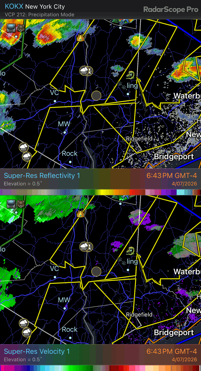
A cold front clashed with all that hot air, leading to severe thunderstorms that downed trees and power lines. That included a squall line of storms that passed through Ulster and Dutchess Counties, where 10 and 22 percent of customers were without power, respectively, early Sunday. Also, radar imagery showed a tornado-like signature passing near Pawling, New York just before 8 p.m. on Saturday.
As some area residents clean up and hopefully regain power on Sunday, what’s next?
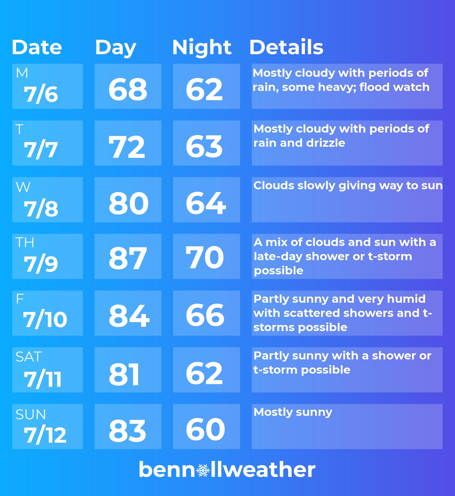
Well, it’s not going to be 100 degrees this week, but there is a flood watch that starts at noon on Sunday and continues through Monday.
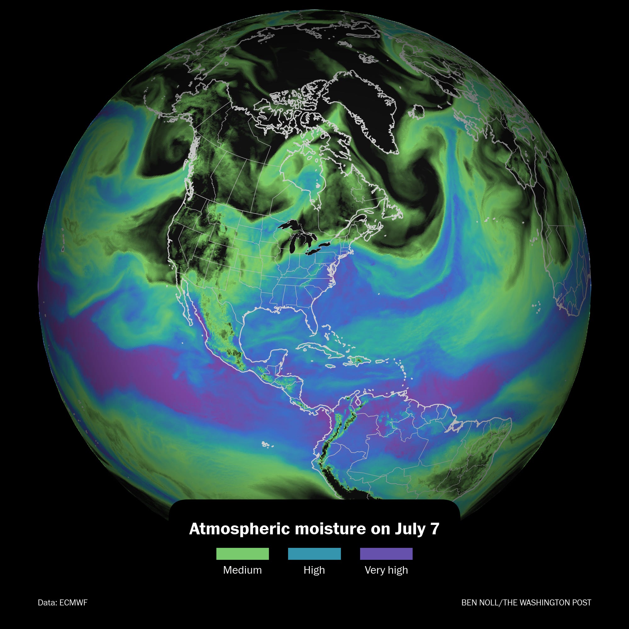
From Sunday afternoon through Monday, tropical moisture gliding northward will meet a front that’s stalled over the region. The interaction of these two features will lead to the formation of heavy and slow-moving blobs of rain. This will culminate in a flood risk, especially on Monday. While it’s uncertain exactly where the heaviest rain will fall, there’s a chance for flash flooding across the region.
The week ahead
It’s looking a little turbulent this week. There aren’t many great weather days. Maybe next Sunday? But that’s a long way out to make promises.
Monday: periods of rain, some heavy, with a flood risk
Tuesday: rain continues
Wednesday: rain fades, but clouds remain for a long while, eventually clearing to sun later in the day
Thursday: probably the warmest day of the week with a shower or storm risk toward the end of the day
Friday: very muggy and warm with an atmosphere that looks primed for more showers and storms
Saturday-Sunday: at this point, Sunday has higher chances of being dry while a slight rain chance lingers for Saturday
Looking ahead to the week of July 13, signs are that extreme heat will sizzle the West.
In the Hudson Valley, the week will probably start dry, but typical afternoon shower and storm chances could return later in the week.
For now, I’m not seeing any strong signals for more 100-degree heat!
Mammatus clouds visit Hudson Valley
These uncommon cloud formations were captured in Montgomery on Friday evening.
They often develop near thunderstorms and appear to hang from the base of a cloud. Their distinctive pouch-like shape forms when cooler, sinking air descends from the cloud, creating downward bulges.
People all across the Hudson Valley shared their cool cloud photos here.

Mother Nature is busy. Stay weather-aware out there! ✌️