

I’m ready for a sunny day. Or a snow day. Or a stunning day. Not a smoky day.
Alas, New York City had the 10th worst air quality of any major city in the world early Thursday. Topping the list were Detroit, Toronto, Minneapolis and Chicago. Air quality levels there were grim — in hazardous territory.
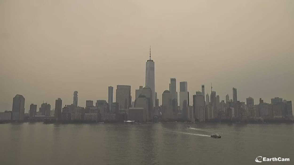
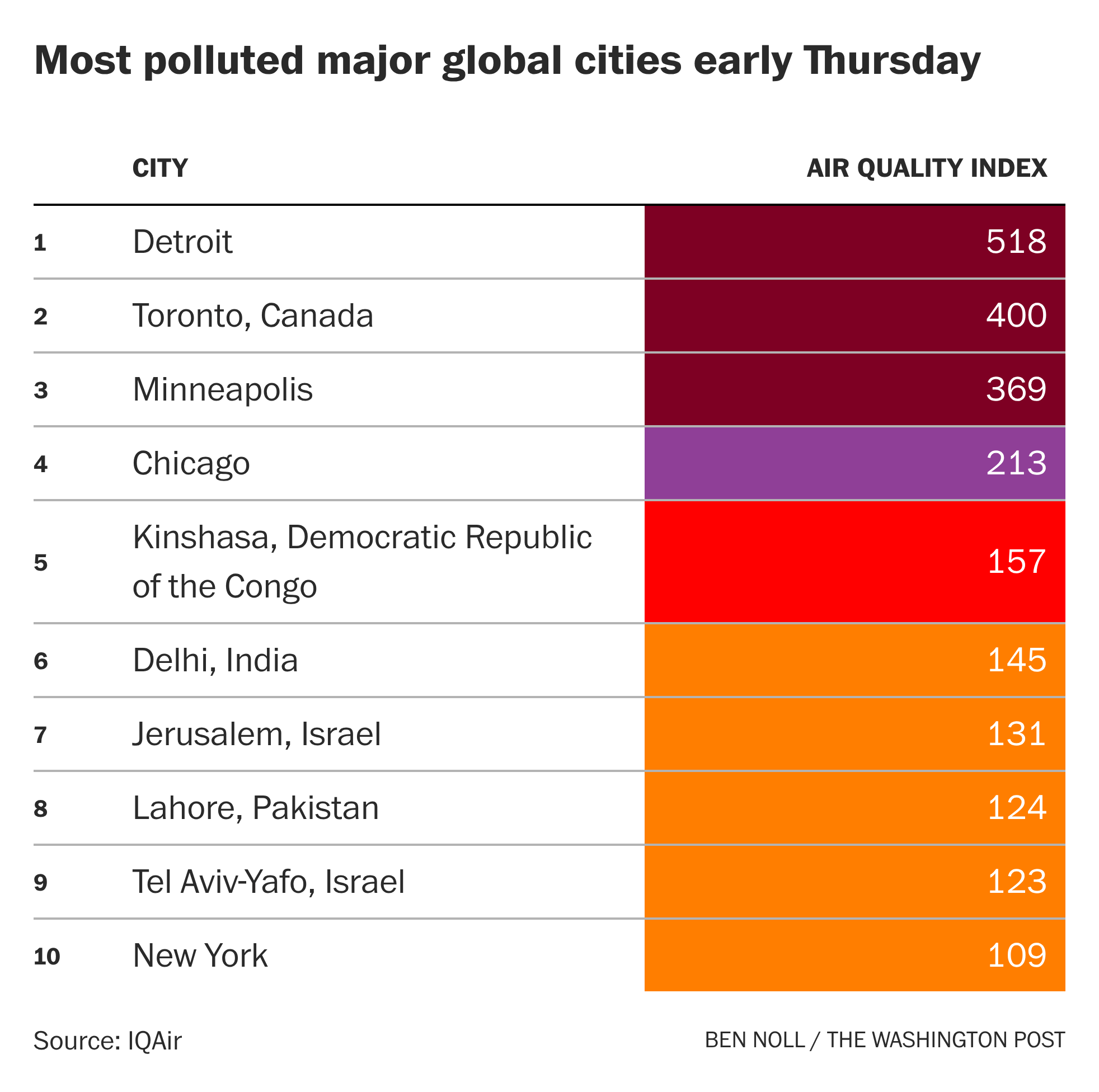
In the Hudson Valley, air quality was “moderate” early Thursday after a peak in the unhealthy range on Wednesday afternoon.
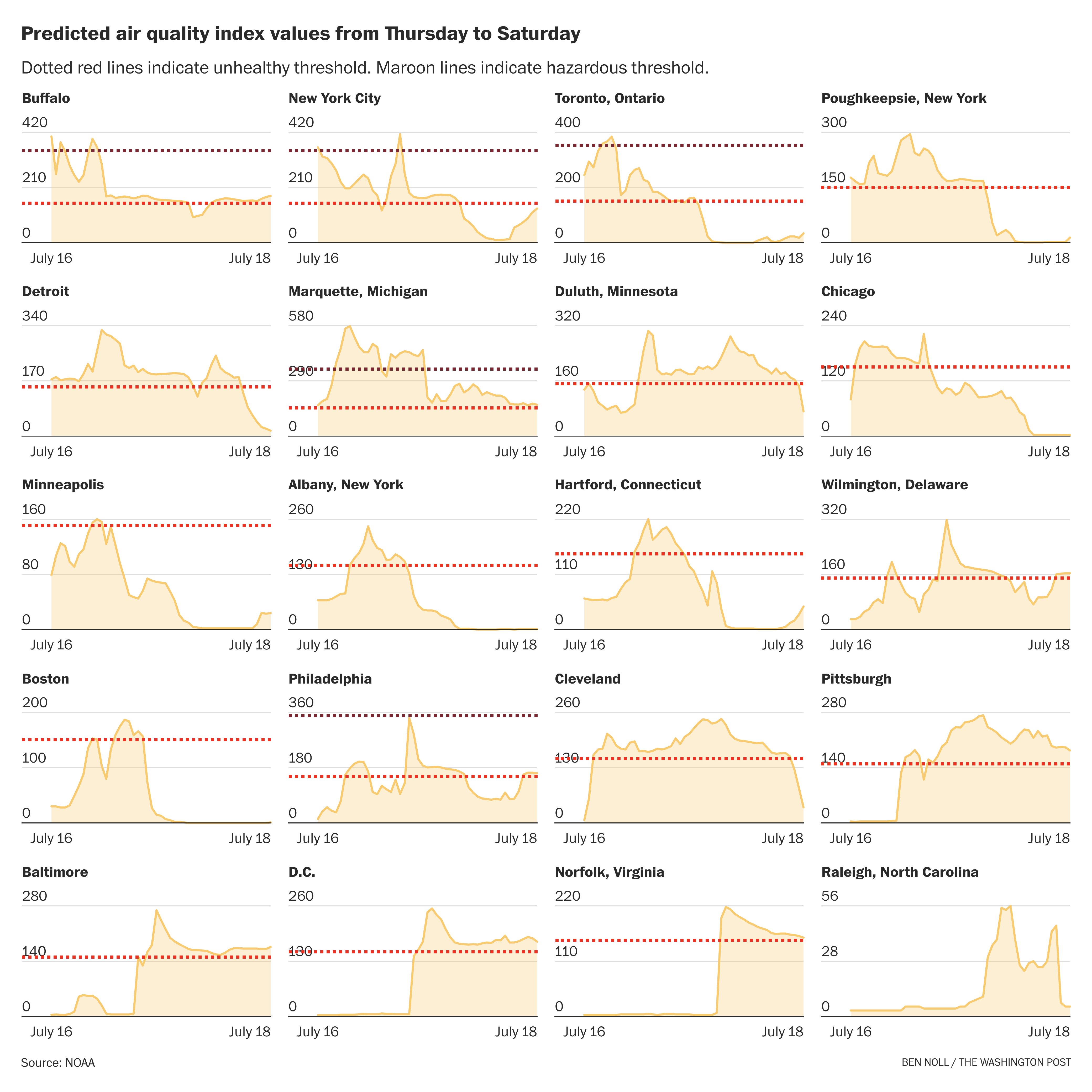
Unfortunately, another dense smoke plume is forecast to arrive Thursday afternoon and evening, probably causing air quality levels to worsen once again, with an unhealthy peak predicted around 3 p.m. or so. This smoke is expected to linger Thursday night.
But there is some good news.
On Friday, smoke is predicted to blow away, south of the region. While it engulfs the Mid-Atlantic, the Northeast and New England will probably get a break.
This break will be short-lived. Changing winds on Saturday will again blow the smoke north, with rain also helping to transfer some of it down toward the ground.
In other words, Saturday’s forecast is for rain with a side of smoke.
Farther north, some rain is expected across the Canadian wildfire areas on Friday and Monday, but it probably won’t be enough to put the fires out.
So I might be doing these smoke-casts for a while. If the smoke does indeed filter away from the Hudson Valley on Friday, I might not need to issue an update! 🤞
If you want to read more about what’s happening with the smoke, check out my story in Thursday’s Washington Post. Here’s a gift article.
And here’s a bonus chart for tracking smoke concentrations in different cities 🔎
Hey Ben, thank you for your coverage as always. I had a question about AQI. Across apps there is a wide variance in the rating. Do you have any insight as to why? When I compare IQ Air to Purple Air to Apple Weather to .gov resources the numbers are all over the place. Using Bard College as my closest point. Trying to understand which is reliable. Thank you!!
Good thing we still have some of those Covid-era masks….(cough cough)