

The good news? This will probably be the last really bad wildfire smoke day in the Northeast for a little while.
The bad news? It’s going to be a bad wildfire smoke and thunderstorm day, and rain could leave behind specks of soot and ash on cars, windows, and other outdoor surfaces.
Early Saturday, New York City was the third most polluted major city in the world — behind D.C. and Toronto — and that acrid air was on its way toward the Hudson Valley.
The highest smoke concentrations are expected between 10 a.m. and 6 p.m. in the region, when air quality index values could again surge into the unhealthy and very unhealthy ranges.
This will be coupled with the potential for gusty afternoon and evening thunderstorms, again bringing a risk for damaging winds to the Hudson Valley.
Beyond that already serious risk, the rain was also likely to bring down some soot and ash with it, which could appear as smudgy black marks on outdoor surfaces.
Not fun.
By Saturday night, the rain should have washed most of the smoke out of the sky with the wind blowing the rest of it away. While a little more smoke could waft through on Sunday, concentrations look low — good news for the World Cup final.
Rain is expected in the main wildfire areas in western Ontario from Monday into Tuesday, helping to tamp down the fires and reducing their smoke outputs.
That should also reduce the chances for another really big outbreak of smoke around here — for now.
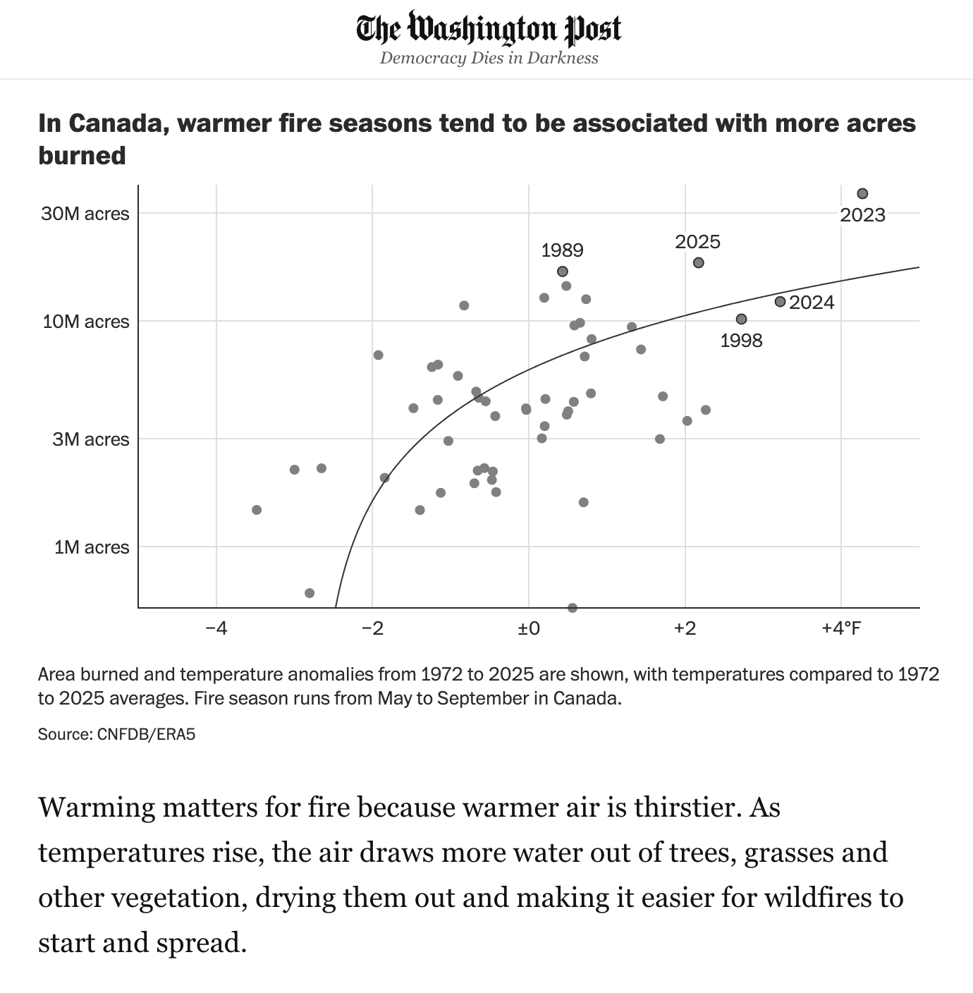
If you’re interested in reading more about why Canadian wildfire smoke has more frequently affected the U.S., I explored that complicated topic and much more in Saturday’s Washington Post. Here’s a gift article.
Here’s to clearer skies!