

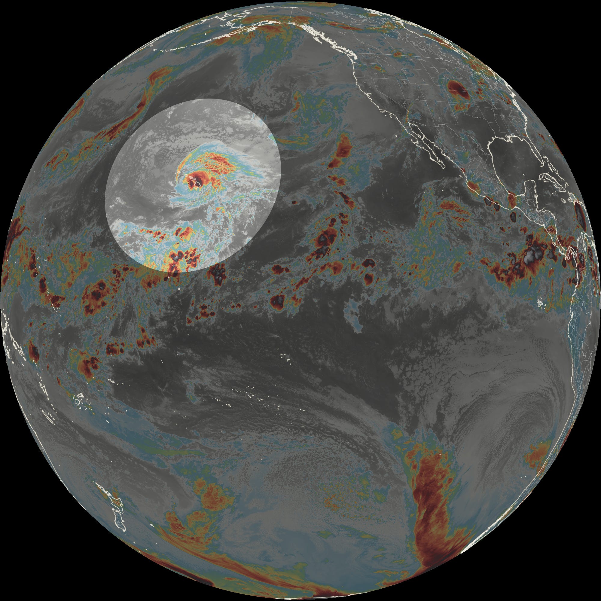
The southern United States is baking under the planet’s strongest heat dome. The West is bracing for another surge of hot air this week. A rare hurricane hit Hawaii. There’s still some wildfire smoke in the Northwest, albeit less than recent weeks. And the Midwest is reeling following a week of destructive storms and floods.
But the Northeast? Things aren’t too bad around here.
We can’t possibly be done with 90-degree heat for the summer, can we?
Back in September 2015, the last time there was a super El Niño, it reach at least 90 degrees on six out of the first nine days of that month.
If history is a useful guide, then there’s more high heat coming this summer!
But not really this week. It will be muggy on a couple of days, but a more comfortable air mass will probably arrive by Friday.
The week ahead
A stormy start and finish is possible in the Hudson Valley with some decent weather in the middle.
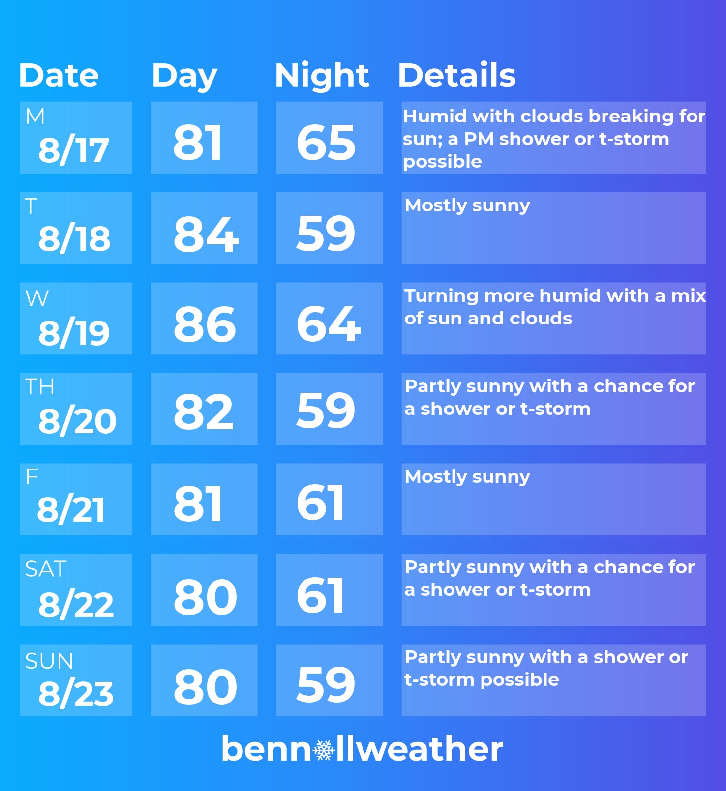
Monday: it’s going to be humid as morning clouds break for afternoon sun; there’s a chance for a PM shower or t-storm
Tuesday: warm with a good deal of sunshine
Wednesday: warmer yet and more humid, but probably remaining dry
Thursday: chance for a shower or t-storm as a front approaches
Friday: probably dry with lower humidity and sun
Saturday-Sunday: the weekend could come with rising chances for scattered showers and storms
Looking ahead to the week of August 24, it could be on the cooler and drier side for the time of year. Although the peak of hurricane season is just a few weeks away, the threat for storms continues to look lower than normal across the Atlantic.
That’s because extremely warm water associated with a record-breaking El Niño in the Pacific is focusing the storm action there — and harsh winds in the upper atmosphere that spread from the Pacific to the Atlantic are acting like a hedge trimmer for potential hurricanes.
Speaking of El Niño, I wrote a piece in the Washington Post this week that looked at what this extraordinary global event could mean for temperatures in 2027 — basically pushing them a decade ahead of the recent trend line, giving the world a preview of the late 2030s. Here’s a gift article if you want to check it out.
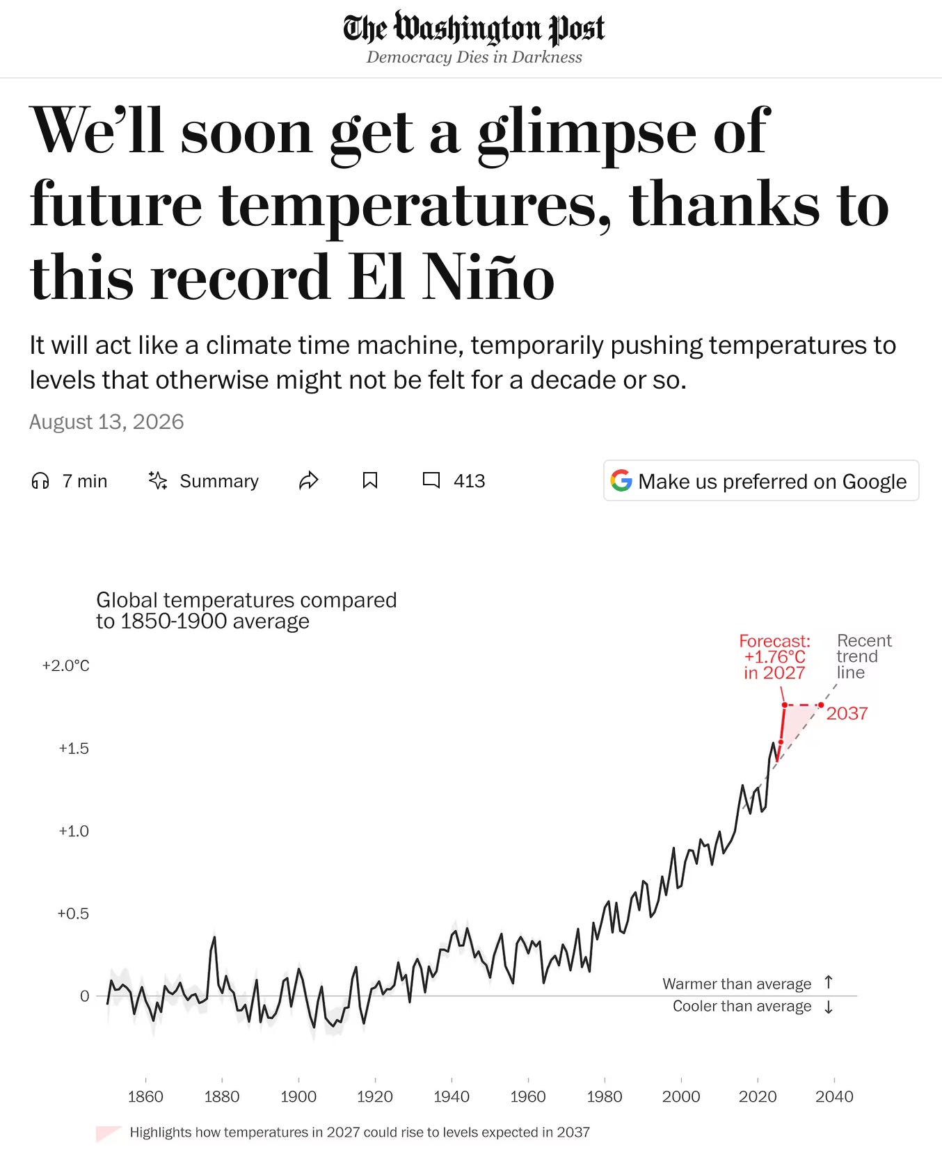
There is no modern precedent for an event of this scale and intensity and one of its many impacts will probably be frequent, strong storms near the U.S. East Coast starting in mid-to-late fall.
Time permitting, I’d like to provide some commentary on possible fall weather patterns in the Hudson Valley for premium subscribers at some point in the weeks ahead — so stay tuned!
I’m ready for snow and winter!!!!!