

A cooler, less humid air mass that spent the last few days traveling from Alaska is coming in for a landing on Monday! 🛬
And that means the Hudson Valley is in for some sterling weather to start the week.
Sun-filled afternoons are expected on Monday and Tuesday, with temperatures dipping into 40s on Monday night. The air will have that fall feeling — briefly.
But summer, which ends on September 22 this year, has one last trick up its sleeve, with humidity again building from Wednesday into Thursday.
If you’re wondering what the next few months have in store, check out my outlook released last week.
What El Niño will bring to the Hudson Valley this fall

With a stretch of mostly settled weather coming up for the Hudson Valley and some new climate model data fresh off the press, it feels like a good time to look farther ahead 🔮
The week ahead
It will be a pleasant start to the week before a front approaches on Thursday, bringing more humidity and a chance for some rain. Decent weather should return after that, lasting at least through Saturday.
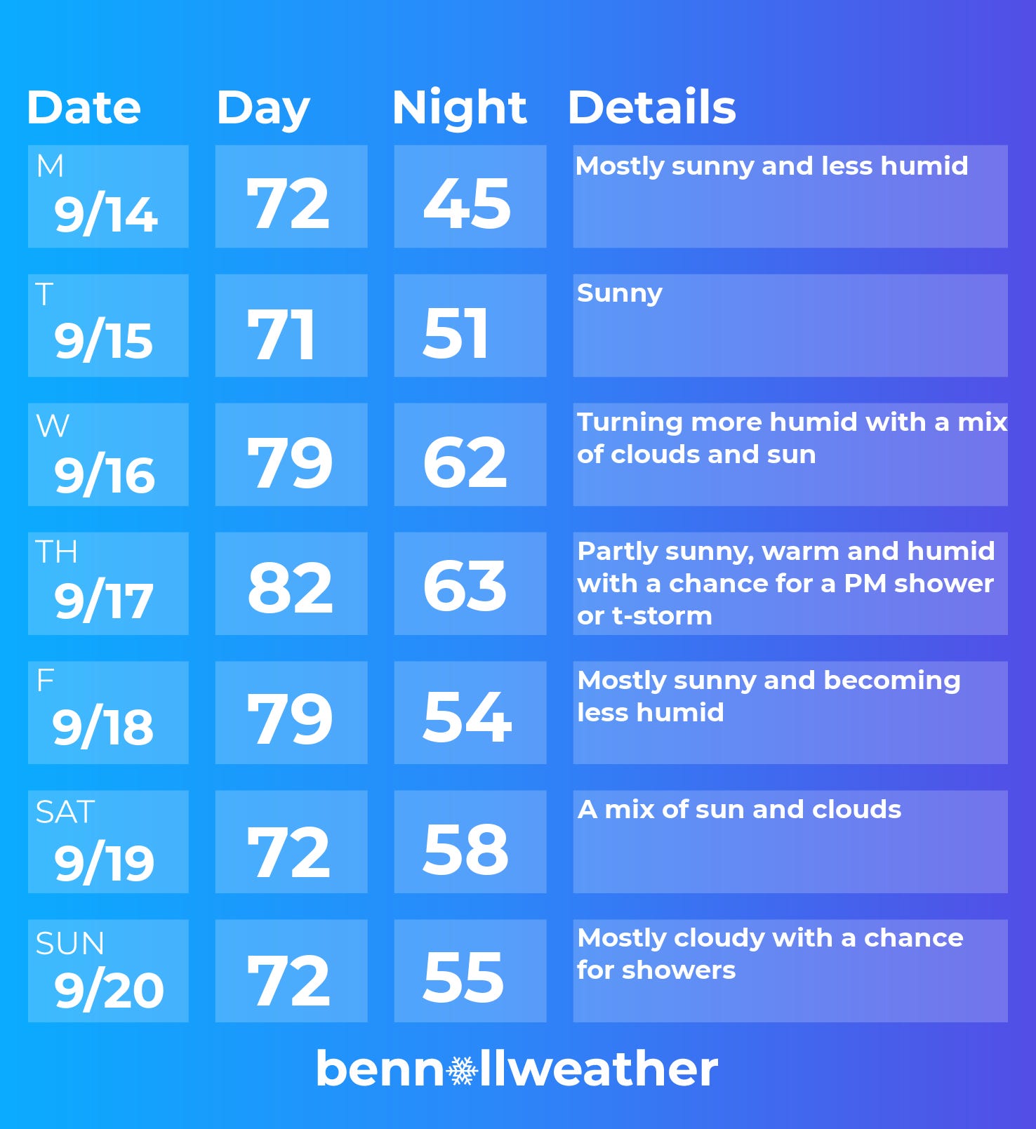
Monday: decreasing humidity and plenty of sun
Tuesday: a crisp morning with cloud-free skies
Wednesday: warmer with more clouds and humidity rolling in; slight chance for a sprinkle
Thursday: warm and muggy with a chance for a late-day or overnight shower or storm
Friday: humidity easing with clouds and sun
Saturday-Sunday: it’s looking like a dry start to the weekend for now, before rain chances increase on Sunday
Looking ahead to the week of September 21, and it could be rainy and humid to start.
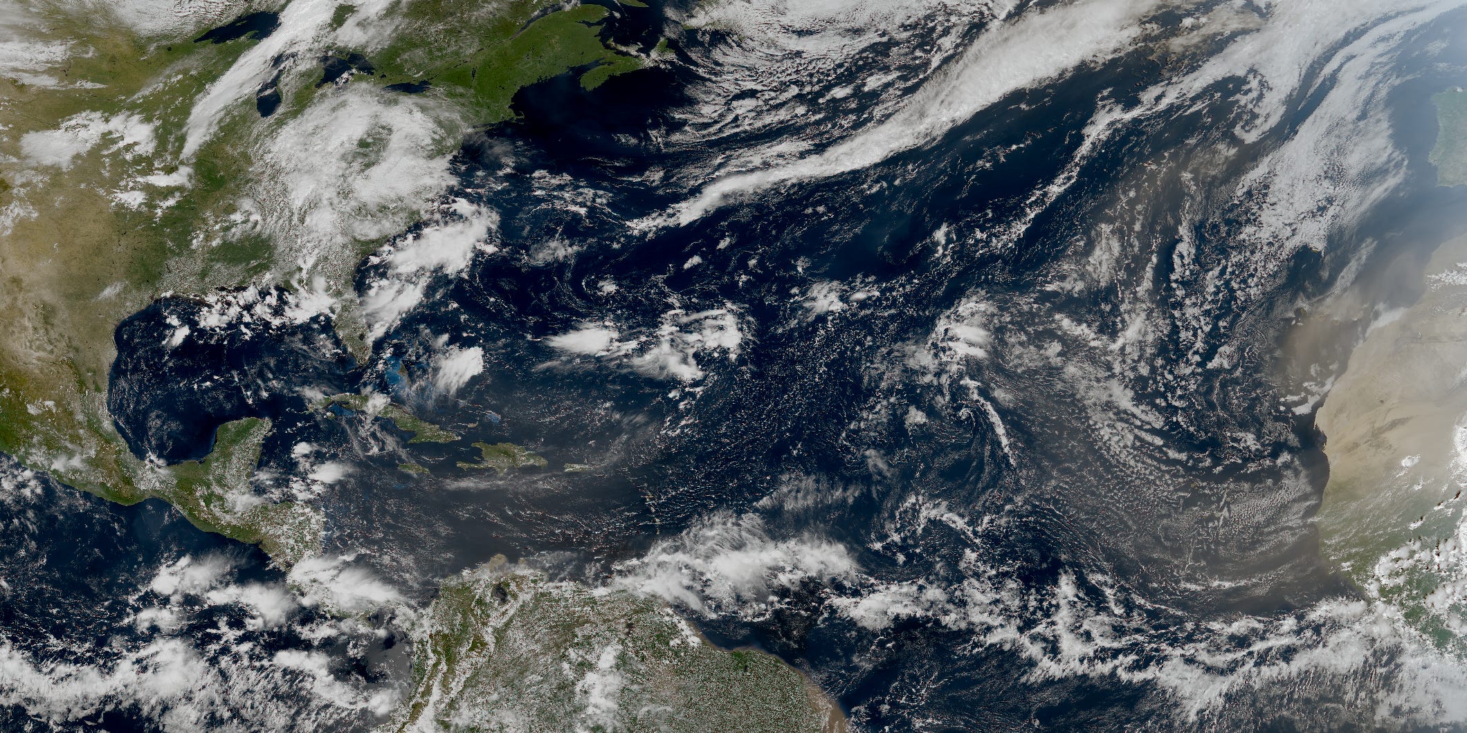
In the Atlantic Ocean, there still haven’t been any hurricanes so far this year.
Since records began in 1851, there have only been two years that featured zero hurricanes: 1907 and 1914. Hurricane season runs through November, so there’s still plenty of time, and it’s looking like patterns may become more conducive toward storm activity from late September into October.
While the Atlantic has been unusually calm, the Pacific has been very active, with Hawaii being hit by two hurricanes so far this season, a rare occurrence.
The soon-to-be most powerful El Niño event on record — and its record warm Pacific Ocean temperatures — is the main driving force behind these unusual storm patterns.
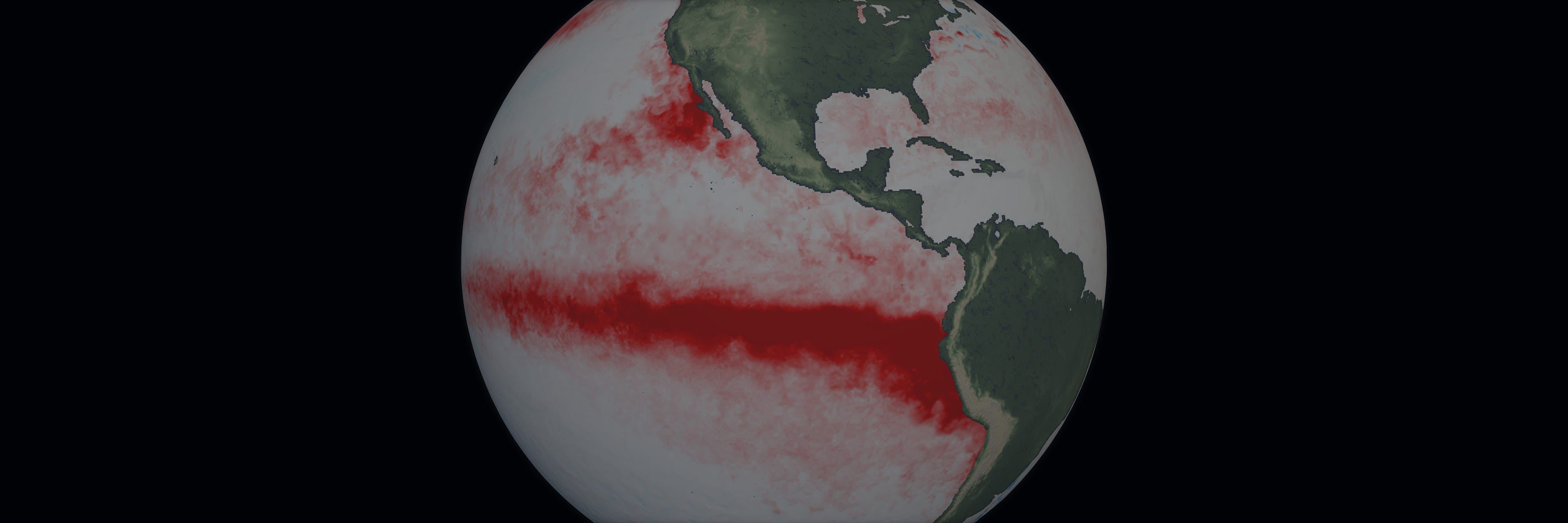
Another patch of record warm water near Southern California has been contributing to very unusual humidity levels there.
In this week’s Washington Post, I wrote about a unique type of ocean wave that will reach California’s shores in the weeks ahead, raising sea levels and elevating the risk for coastal flooding and damaging storms there this winter.
Here’s a gift link to read about that.