

Well, this week looks interesting in the Hudson Valley.
A very powerful area of high pressure will build over Quebec while a sizable storm — likely an early-season nor’easter — brews off the coast of North Carolina.
And the Hudson Valley will be stuck in the middle of that weather sandwich.
Will the rain miss us to the south and east, or will the storm’s backside bump into the region, bringing rain and wind?
Although the storm’s track is currently uncertain, it could make its closest approach from late Friday into the weekend. How close to the coast it tracks will determine whether or not the weekend is gloomy.
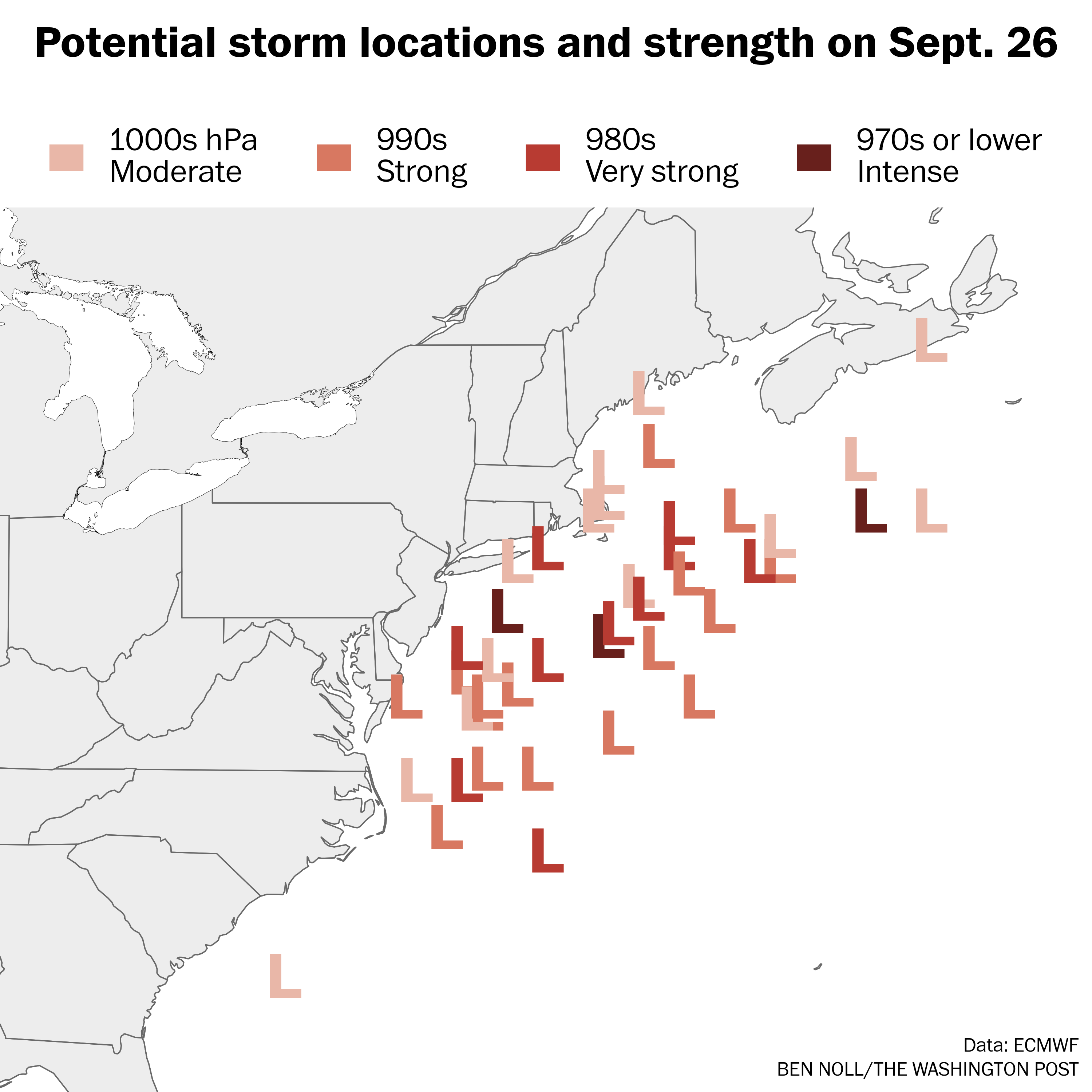
One certainty is that it won’t be warm. The fall equinox is on Tuesday and it will feel like fall this week. Factor in a stiff northeasterly breeze — blowing in from Newfoundland — and it will feel more like October!
The week ahead
It will be a rather cool and breezy one in the Hudson Valley as summer-like weather suddenly ends.
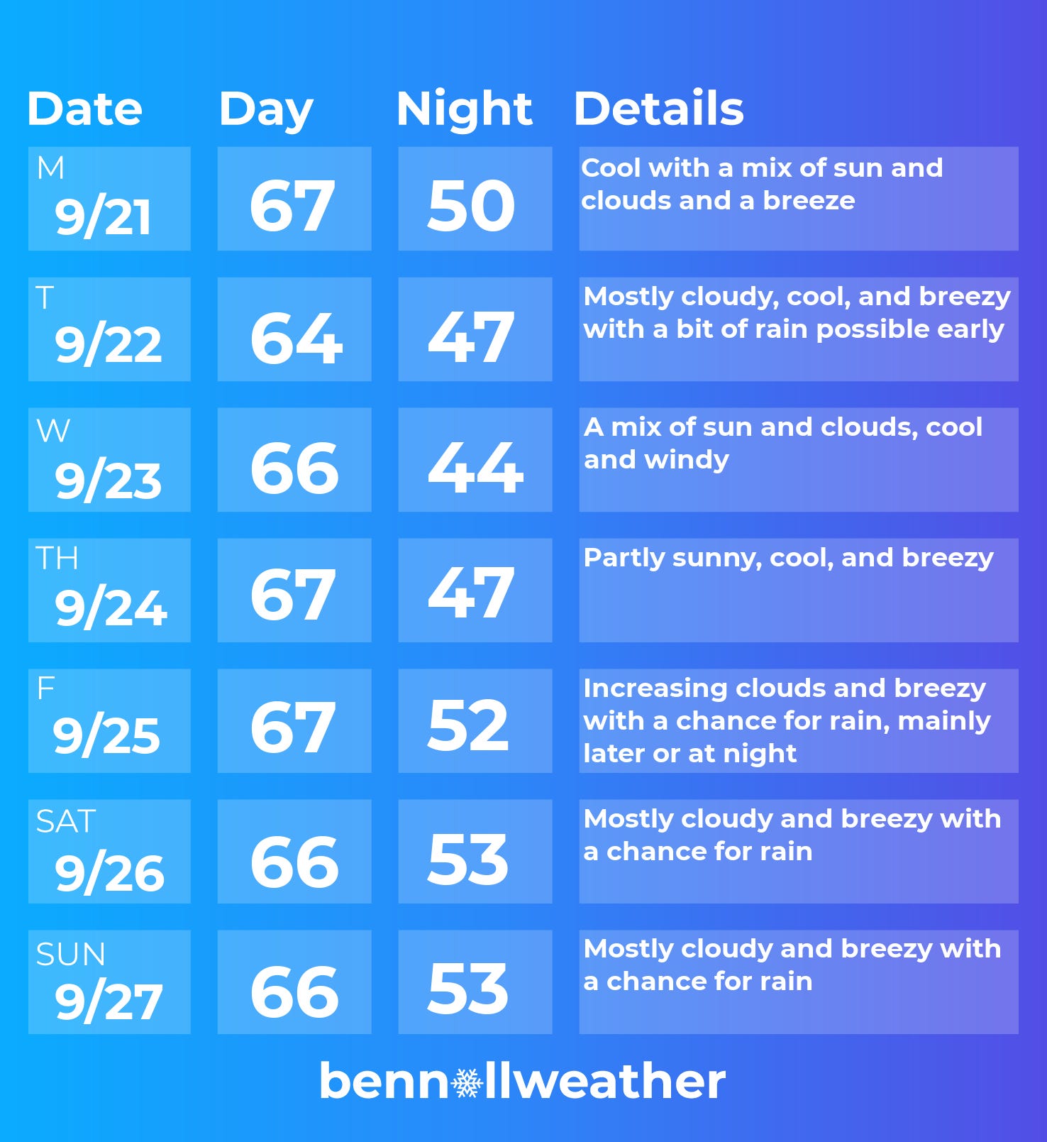
Monday: breezy with a mix of sun and clouds
Tuesday: mostly cloudy with a chance for a bit rain early; cool with a breeze
Wednesday: windy and cool with sun and clouds
Thursday: like Wednesday 🔁
Friday: more clouds, nor’easter nearing?
Saturday-Sunday: breezy with rain possible, but if the storm passes farther offshore, then the weather could turn out decent…
Looking ahead to the week of September 28, the nor’easter might still be nearby early, before departing. It probably won’t be as cool, either.
I searched for a photo that could roughly capture the tempestuous nature of this week’s weather and found this oldie-but-goodie of the Nugget Point Lighthouse in New Zealand’s South Island, with some ominous clouds in the background.

PS: I started drafting my Hudson Valley winter outlook! It will be released to premium subscribers in late October, tentatively on October 24th ❄️
Click the button below to receive it as soon as it’s published ⬇️