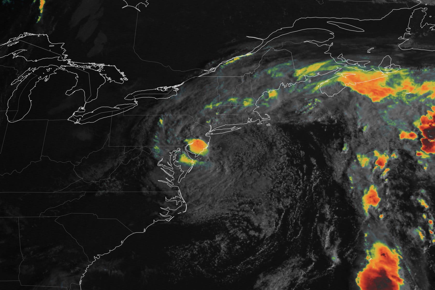
The Hudson Valley is in the thick of early-season nor’easter. On Saturday, it brought wind gusts of over 50 mph, downed fully-leafed trees, and caused scattered power outages.
Strong winds will continue in the region on Sunday morning as the storm pushes ashore in New Jersey, but ease back slightly during the afternoon.
It’s a goofy storm. Because it was captured by a separate atmospheric disturbance, it will sit and spin near New Jersey and Long Island for over 24 hours before finally spinning away on Monday.
You have to see it to believe it:
Campbell Hall resident Ronnie Truax sent this photo of trees scattered like popsicle sticks on his property, highlighting the storm’s danger, despite the Hudson Valley being around 100 miles from its center.

But the Hudson Valley also dodged the worst of this storm, which has been at the coast. That’s where huge waves have relentlessly battered the beaches, with feet of water inundating the shoreline, flooding homes, businesses, and vehicles.
If it’s any sign of things to come this winter (I think it is), then it could be a long winter.
Anyway, this storm will be a memory by Tuesday when the sky turns brighter. It will even feel summer-like for a time later in the week.
The warmth is being shoved across the country by a hurricane, named Polo, that will cross Mexico on Monday before its remnants push across Arizona, New Mexico, and Colorado from Tuesday into Wednesday, where bad flooding might unfold. Flooding and severe weather is also possible across Texas, Oklahoma, Kansas and Nebraska, so it looks like it will be another busy weather week — but not in the Northeast, at least once the nor’easter leaves.
The week ahead
After a wet start to the week, it will heat up, with a stretch of decent weather.
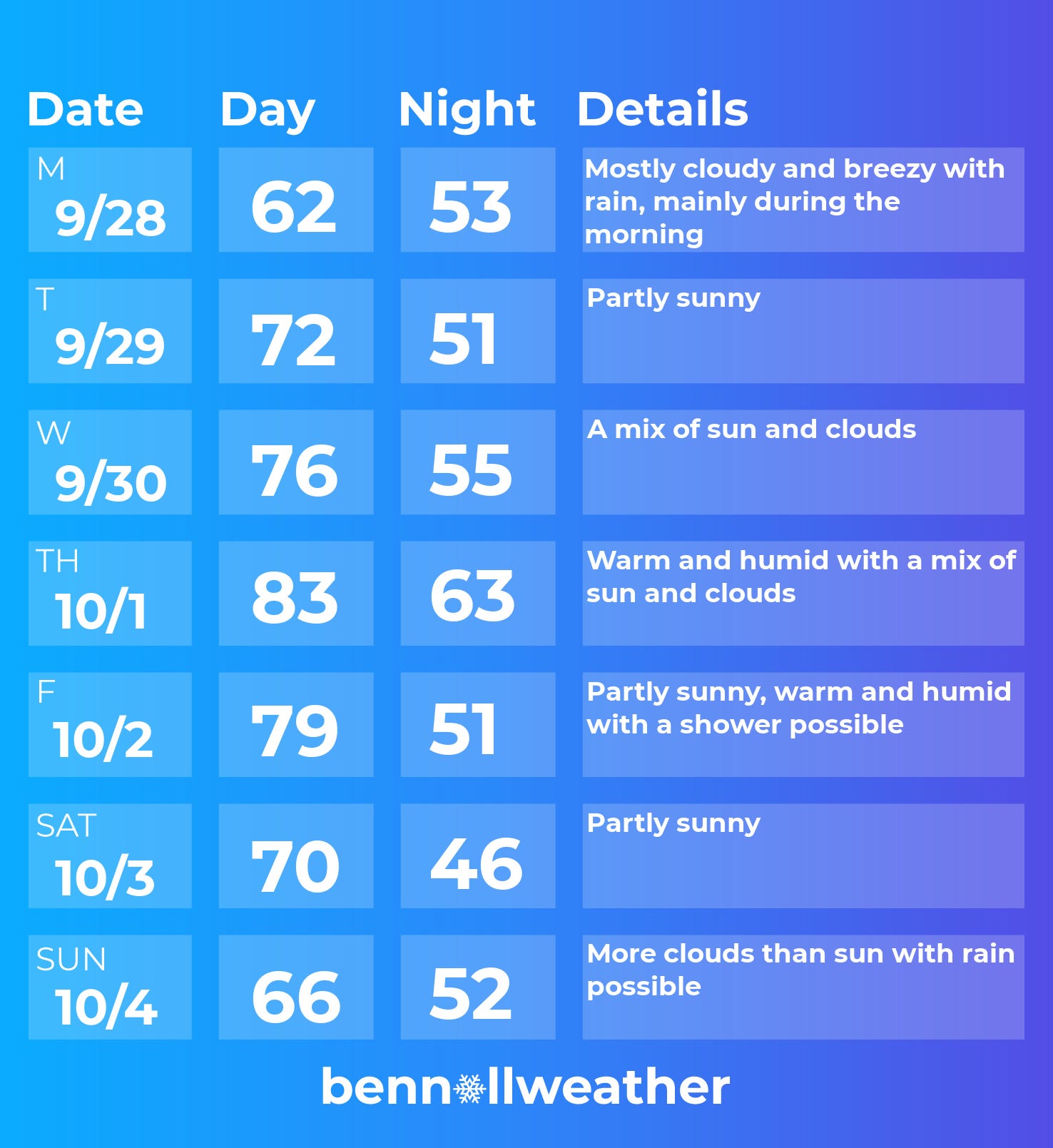
Monday: rain will probably continue, at least during the morning
Tuesday: warmer as the sun returns!
Wednesday: warming up more with clouds and sun
Thursday: warmest day of the week with humidity on the rise
Friday: probably remaining warm as a front approaches, chance for a shower
Saturday-Sunday: right now, the start to the weekend is looking dry, but another system, with moisture from Hurricane Polo’s remnants, could cross the region on Sunday or Sunday night — but confidence is currently low.
Looking ahead to the week of October 5, temperatures look to turn cooler. At some point during the week, there may be a transition to a drier-than-normal pattern that lasts into mid-October.
As for my winter outlook, which will cover things like the prospect for numerous nor’easters this winter, I aim to release it to premium subscribers on Saturday, October 24. Click the button below to receive it.
Enjoy the sun when it returns this week! ✌️