The rainy remnants of Hurricane Isaias are on the Hudson Valley’s doorstep.
But once they clear on Monday, a rather warm stretch of mid-October weather will follow.
This warmth is connected to the remnants of another tropical storm, named Rachel, racing through the deserts of Southern California and Nevada. As the Hudson Valley gets rain on Sunday, so will the country’s driest place: Death Valley, California. There could be considerable flooding in parts of the West.
This large, slow-moving western disturbance will help to blow warm air into the East to start the week.
But by Saturday, the Hudson Valley may feel its first true Arctic air mass of the season, and there could even be some flurries near the Great Lakes.
In other words, hold on for the ride!
You can watch this big temperature switcheroo play out in the animation below.
Is this impending cold blast a sign of things to come this winter? My Hudson Valley winter outlook is taking shape and will be released to premium subscribers on Saturday, October 24. Click the button below to receive it.
The week ahead
The weather this week won’t exactly be of the award-winning variety that defined last week, but it won’t be too bad either. A cool down late in the week could be a shock to the system.
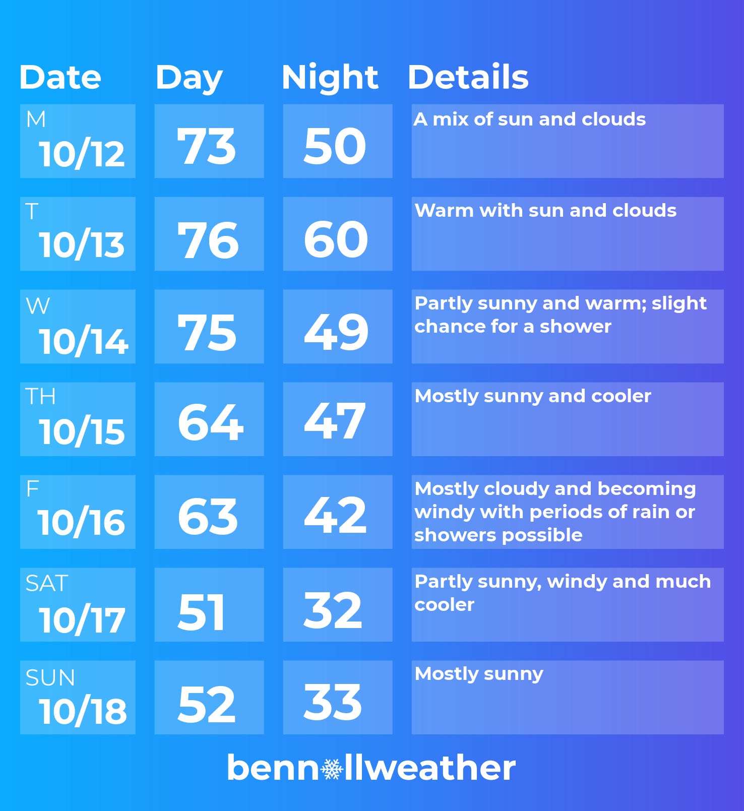
Monday: warmer with clouds giving way to sun
Tuesday: remaining toasty for the time of year; a warm night
Wednesday: warmer than average again; chance for a passing shower
Thursday: cooler, sunny
Friday: strong cold front approaches with rain and wind
Saturday-Sunday: much cooler and windy! November-like 📉
Looking ahead to the week of October 19, temperatures should rebound pretty quickly back into the 60s and perhaps 70s. It currently looks drier than normal.
Testing 1, 2, 3…
My Hudson Valley forecasts are and have always been hand-crafted. Every week, I synthesize huge amounts of data and deliver it as consumable morsels in this letter.
But by Wednesday or Thursday, the forecast that I sent on Sunday morning is at risk of becoming stale.
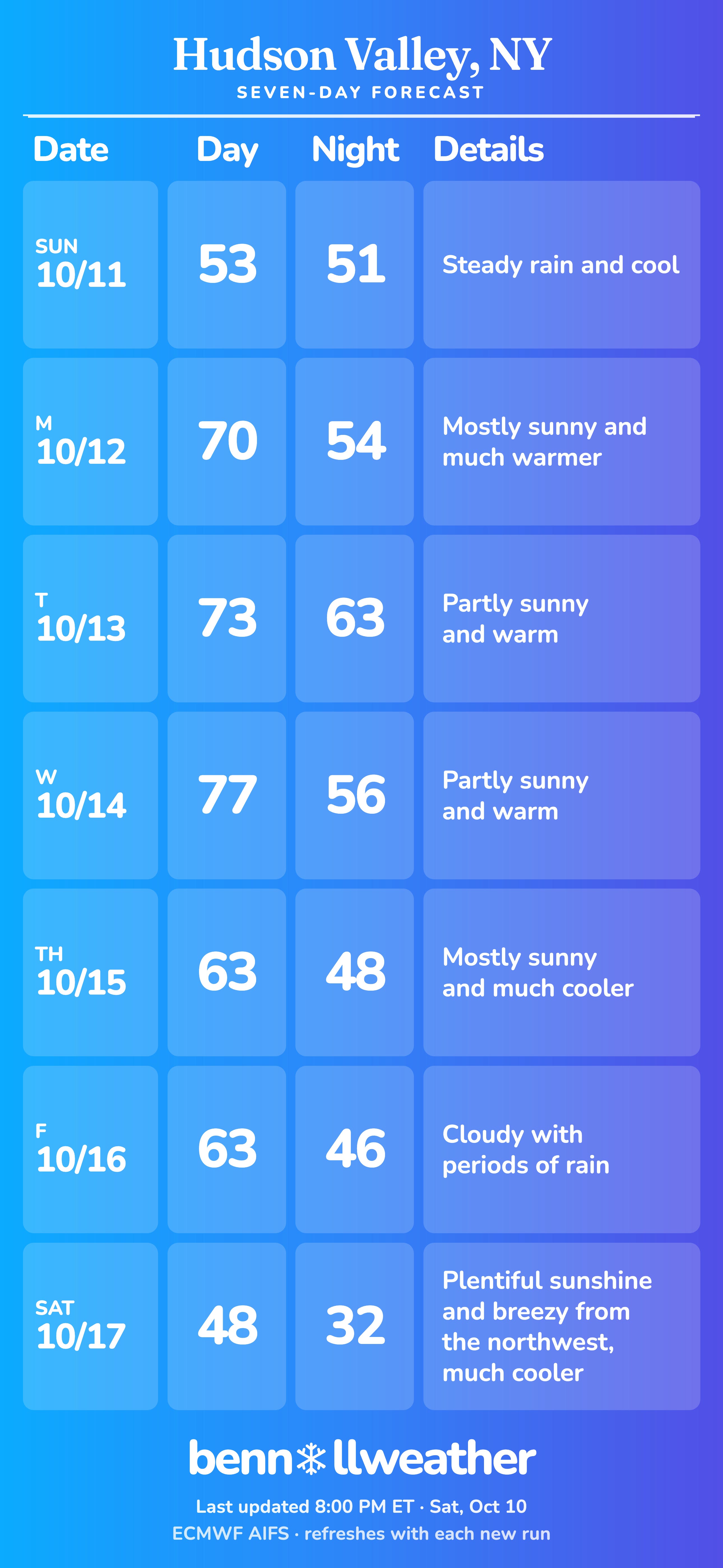
So I set up an automated seven day forecast for the Hudson Valley that updates every six hours! You can check it out here.
It uses data from the most accurate global weather model on the market now, called the Artificial Intelligence Forecasting System from ECMWF.
I consider this model when I make my forecasts and tend to weight it heavily, but now you can feel free to track it yourself throughout the week.