

It hasn’t rained in the Hudson Desert since October 16.
By the time this dry streak likely finally comes to an end on Thursday, it will have reached an exceptionally rare 19 consecutive days.
The season’s first El Niño-fueled disturbance is forecast to reach the region late in the week, bringing some rain, though the exact timing and duration is currently uncertain.
Enjoy the last few dry, sunny days before that pattern change. On Wednesday, high temperatures won’t be far from the daily record of 74 degrees.
This November isn’t exactly looking cold, and I wouldn’t expect any snow days to pop up in the immediate future.

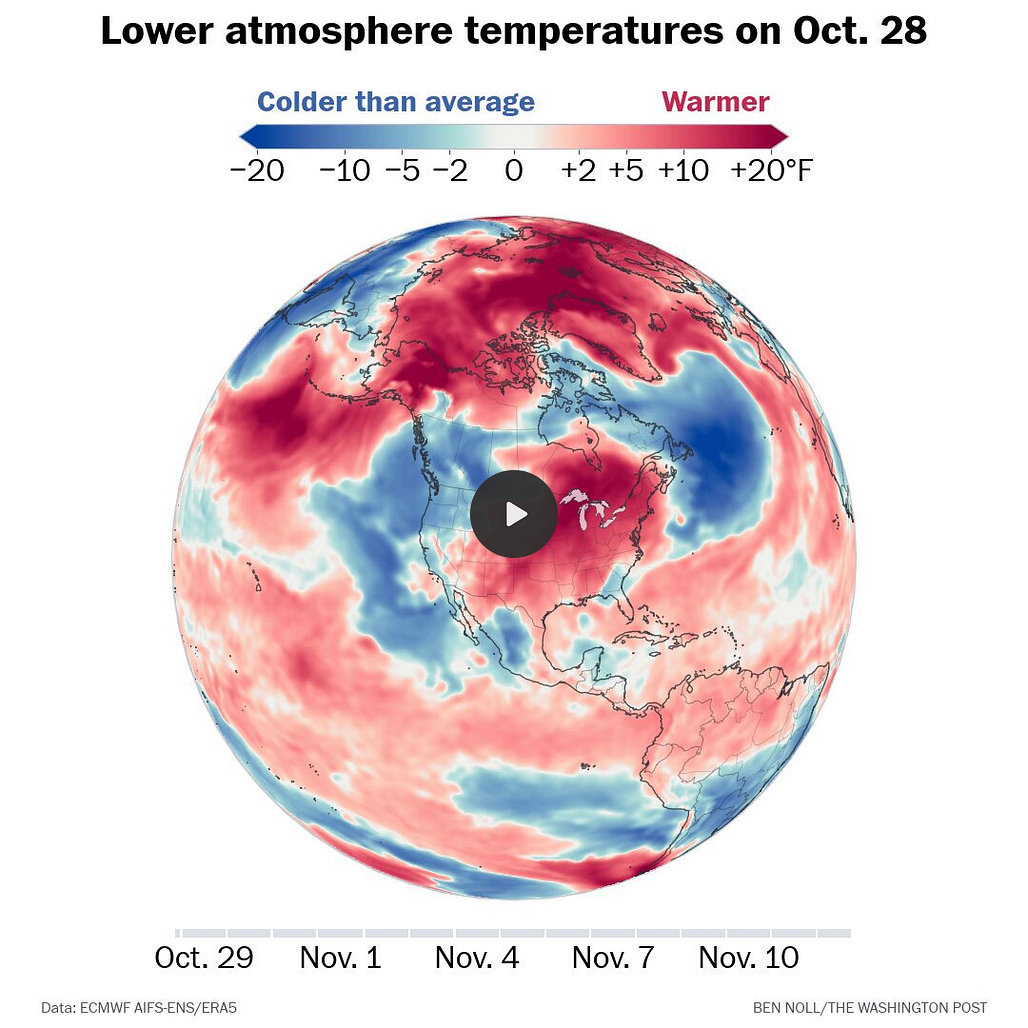
The week ahead
It should remain nice and dry until Thursday.
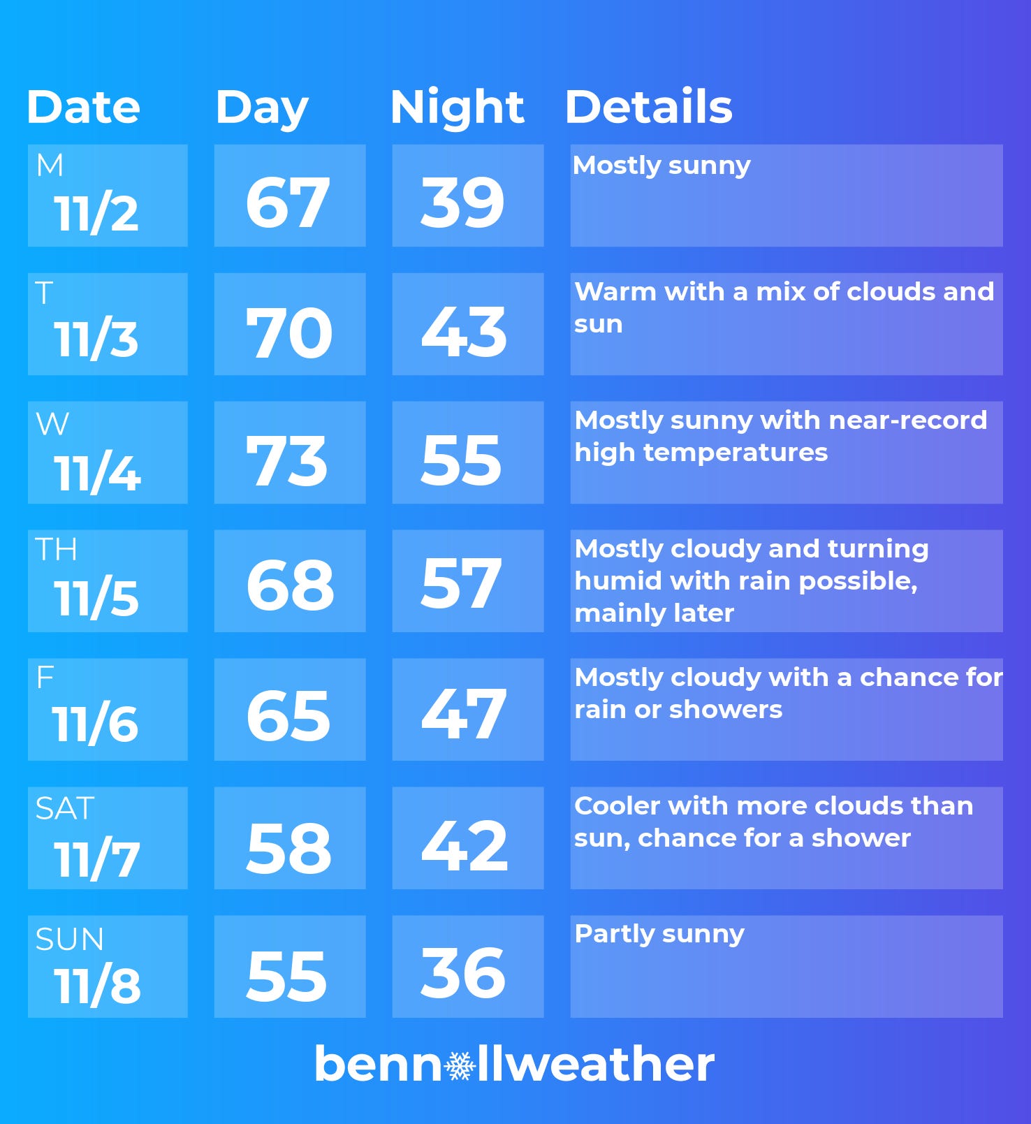
Monday: plenty of sun
Tuesday: warm for the time of year
Wednesday: near-record high temperatures 🚀
Thursday: clouds increasing, with rain possibly arriving
Friday: plenty of clouds, some rain lingering?
Saturday-Sunday: depending on how long the storm sticks around, Saturday may not be the best, but Sunday currently looks dry — turning cooler
Looking ahead to the week of November 9, there’s a chance for another El Niño-fueled storm early in the week. Temperatures don’t look cold, but they don’t look warm either. More clouds should hold high temperatures down but elevate overnight temperatures.
Speaking of El Niño, I recently surveyed nine meteorologists across the country for their thoughts on the winter ahead. You might want to check it out — especially if you plan on heading south this season! Here’s a gift link.
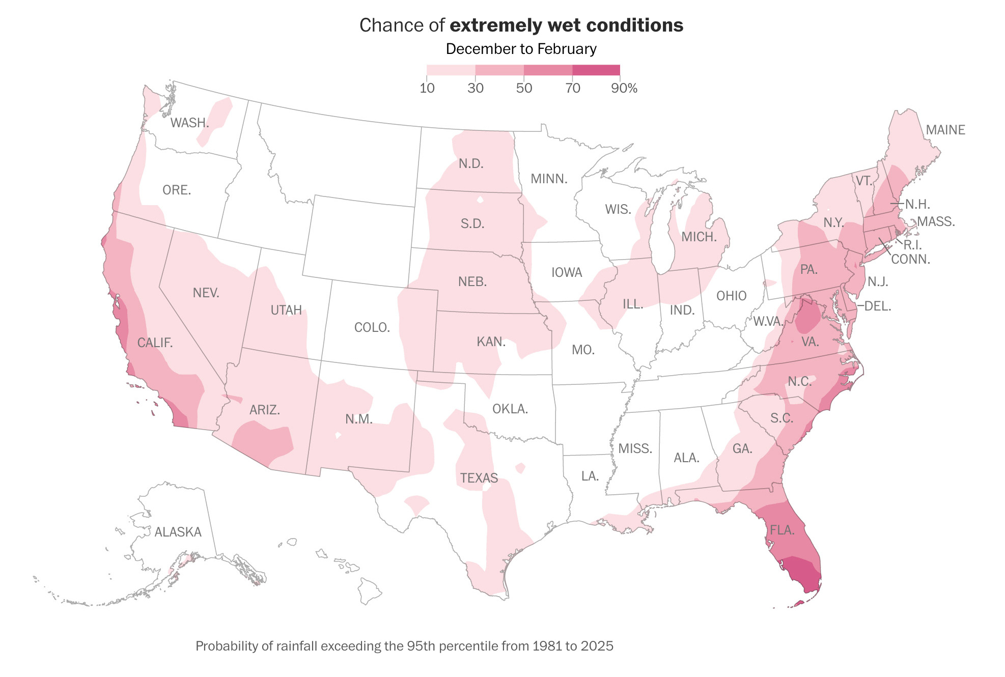
Basically, if you live in an area shaded pink on this map, your chances for a particularly stormy winter are notably higher than normal.
Before winter starts, premium subscribers will gain access to a brand new snow day tool. I think it will come in handy — especially in the new year.