It’s that time of the year. The air is turning crisper. The days are short. And some buzz is brewing about a certain four letter word.
It can snow in mid-November in the Hudson Valley. Remember the big blast of snow in mid-November 2018?
But several ingredients need to come together in just the right way, and I’m not quite sure it will be cold enough for a big event this time.
The atmospheric puzzle pieces that could eventually help form a coastal storm are still way out over the North Pacific Ocean and aren’t expect to converge until late Wednesday. This contributes to forecast uncertainty.
Usually, it’s inland, elevated, and mountainous areas that can score big on snow this time of the year, while areas closer to the coast remain too warm.
That said, current guidance shows a 1-in-5 (20 percent chance) of an inch of snow in the mid-Hudson Valley on Friday. So, we watch!
The week ahead
One thing that’s more certain is that this week will be cooler than recent weeks, especially from Friday through next weekend when a cold air mass dives down from Canada. Blustery winds will add to the chill.
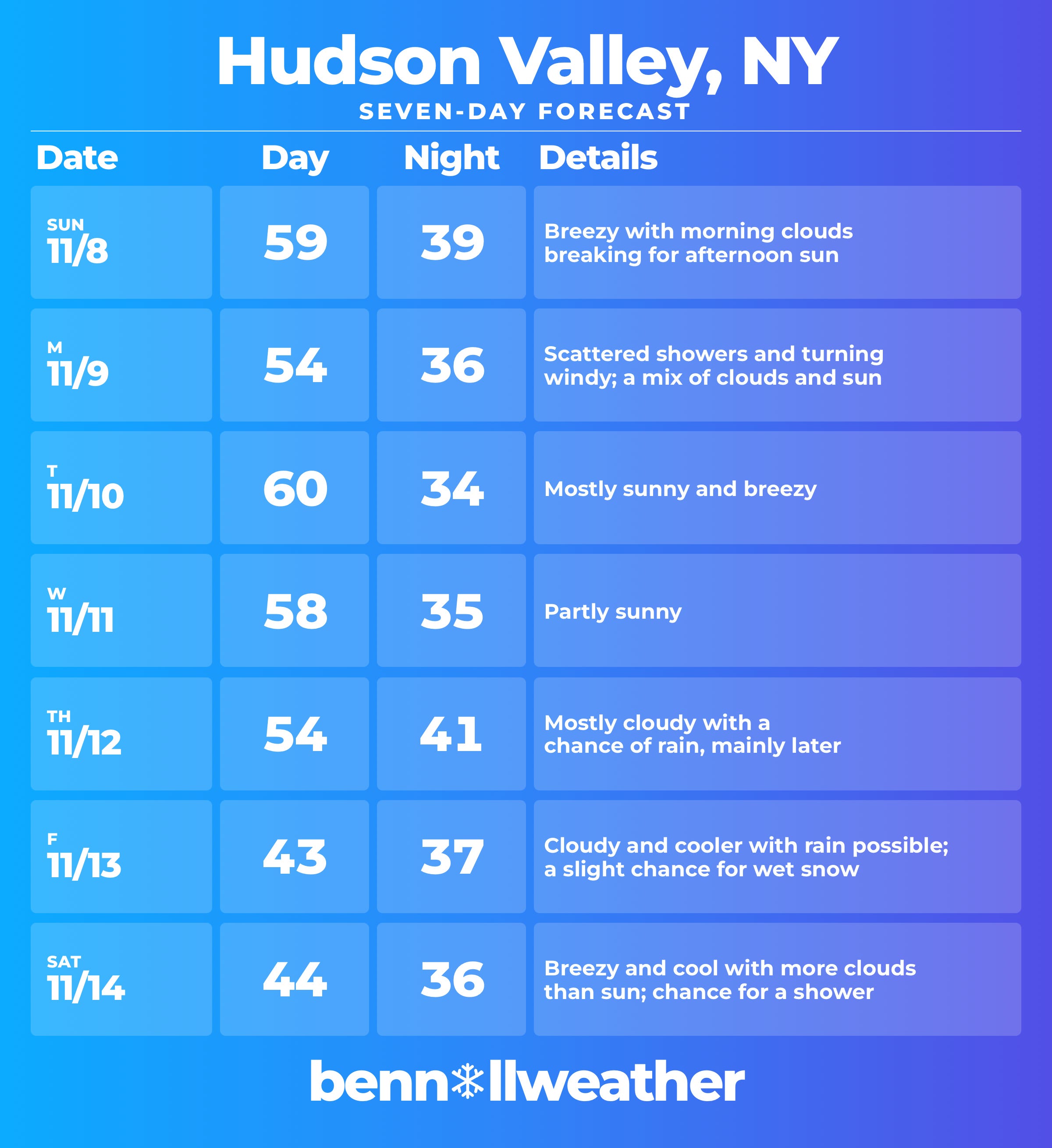
Monday: scattered showers, especially during the morning; turning windy with a mix of clouds and sun
Tuesday: mostly sunny and milder; breezy
Wednesday: partly sunny and comfortable
Thursday: mostly cloudy with a chance for rain later or overnight
Friday: cooler with rain possible and a slight chance for wet snow
Saturday-Sunday: the weekend will probably feature decreasing amounts of clouds, some wind, and cool conditions as any potential storm departs
Looking ahead to the week of November 16, a trend toward milder, drier conditions is expected. In other words, the chill looks unlikely to stick around!
Stormy conditions are possible late in the month.
I’ll keep you in the loop as the forecast crystallizes this week — and provide an update if needed.