


Watching next week 🔎 ❄️
Premium update #15

At long last, there’s the potential for some wintry weather: next week.
The first possible event is from late Sunday into Monday. There’s another chance from Wednesday-Friday.
As I wrote about last weekend, the Northern Hemisphere is going through a major pattern change that involves more high pressure near Greenland and northern Canada.
In turn, the U.S. is turning stormier.
Meteorologists look at transition periods into a new pattern as “windows of opportunity” for storms. The same goes when the pattern or phase is ending.
It appears that our first window of opportunity is from late Sunday into Monday as a disturbance in the upper part of the atmosphere swirls across the Great Lakes and into the Northeast.
Believe it or not, this feature is currently in the Bering Sea west of Alaska! It has a long way to go before it gets to our neck of the woods.
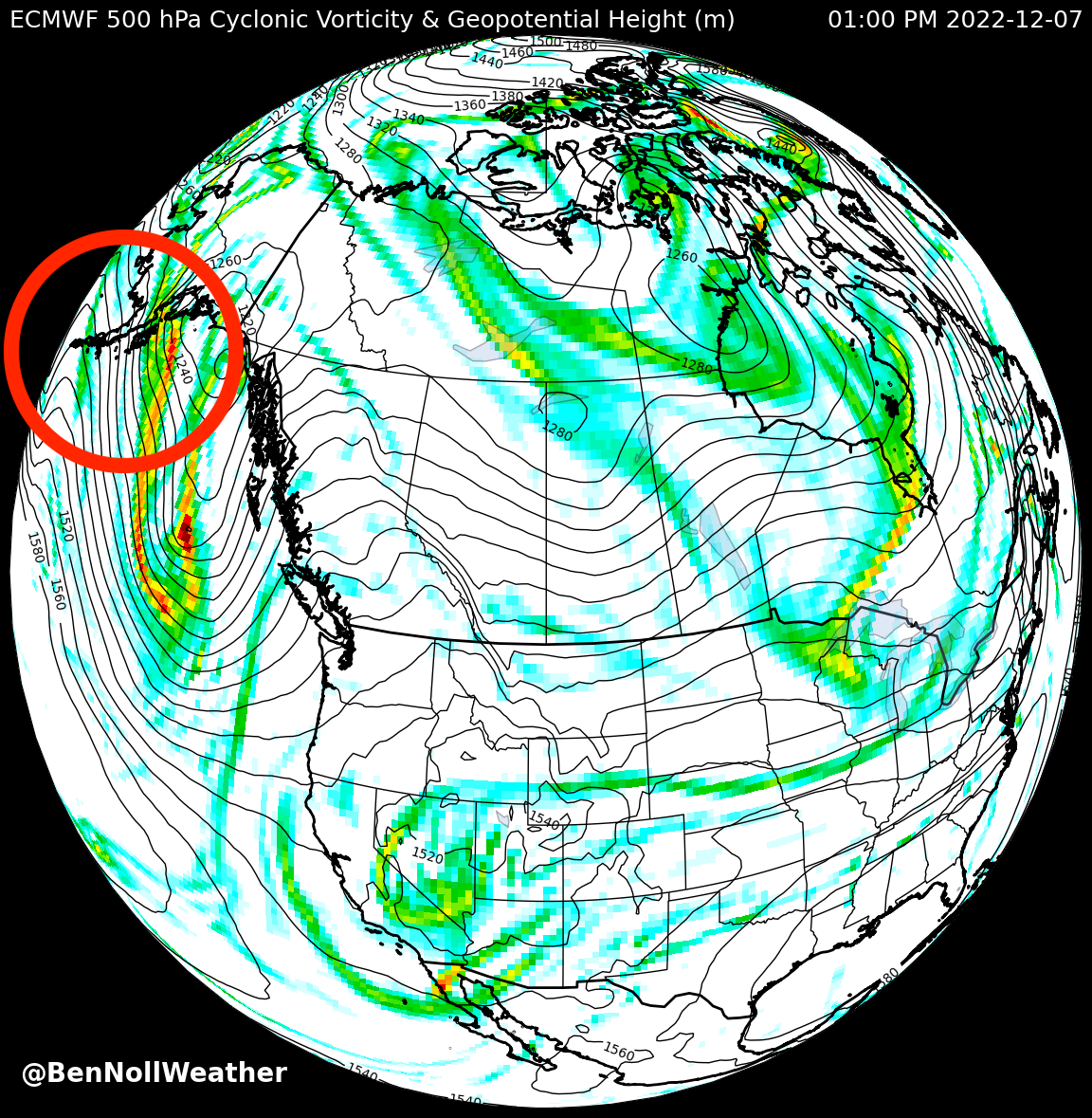
Because of its currently remote location, it isn’t being sampled by weather stations and balloons like it would if it was over land — such information is critical to building an accurate picture of the current state of the atmosphere.
A reasonably accurate prediction of the future starts with getting now right!
Until the disturbance moves ashore in the Pacific Northwest on Friday, you might expect to see some changeable forecasts in your favorite weather app.

So, what can we say right now?
There’s a chance for some snow between Sunday afternoon and Monday
Temperatures don’t look particularly cold (low to mid 30s), but if snow falls at night, it could stick
We’ll know more on Friday
Meteorologists have another tool on their belt for dealing with uncertainty, called an ensemble model.
Instead of running a computer model once, it’s run 30 or more times. Each iteration of the model is tweaked slightly differently in an attempt to capture the range of possible atmospheric behavior.
When many ensemble members agree (disagree) on the forecast, confidence is higher (lower).
The U.S. agency NOAA makes its weather model, called the Global Forecast System (GFS), and its ensemble, called the Global Ensemble Forecast System (GEFS), freely available online.
I regularly slice and dice this data to make maps, plots, and charts that are relevant to the Hudson Valley 🗺️
In the plot below, I’ve taken the 30 different ensemble members and plotted how much snow each member predicts will be on the ground by Monday afternoon.
🔎 You may have to zoom in, but about 10 of the 30 members (33%) are going for at least an inch (yellow shading 🟡). Three or four members suggest the possibility for more than three inches (orange shading 🟠).

As the event draws closer, we can expect more agreement across the ensemble members.
Later next week, another disturbance will spin in from the west. There’s a wide range of possibilities, but the high pressure zone to our north could help to funnel cold air into the Northeast.
This could set us up for an icy mix ⛸️
Alternatively, if the storm tracks too far west and north, warm air could be dredged up from the Gulf of Mexico, resulting in plain rain.
While next week’s forecast is far from etched in stone, Mother Nature has her hammer and chisel out!
Stay tuned to find out what she carves up ☺️