Some snow Tuesday, Arctic chill Friday
Update #431
Hello everyone! I hope you are having a good weekend. I’ve got the scoop on the weather for the next week.
After a rather mild, tranquil January so far, the final week of the month will bring a little more excitement: there will be some snow followed by plenty of cold as a larger mid-week storm likely passes off to the south.
Today’s cold will give way to a noticeably milder day on Monday with high pressure overhead. Make the most of it, because…
Tuesday
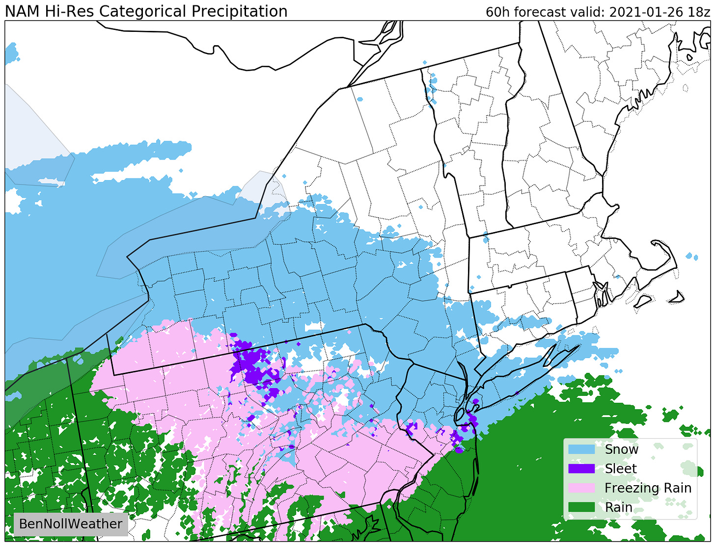
High pressure will give way to an advancing shield of moisture on Tuesday, which will result in some snow for the Hudson Valley.
There will be lots of dry air in the lower atmosphere, which is expected to limit the intensity of the snow and slow its arrival time.
What? Periods of light snow.
When? Starting from west to east from the mid-morning into the early afternoon, continuing Tuesday night.
How much? 1-3 inches in total by Wednesday morning.
Impact? With temperatures in the 20s, snow should have no trouble sticking to surfaces. The afternoon commute could have slippery roads — remember, it doesn’t take much snow to cause tricky travel. There is a low chance for school closures and a low-to-medium chance for early dismissals. There is also a chance for delays on Wednesday morning, depending how persistent the snow is overnight.
Rest of the week
There could be a lingering flurry on Wednesday morning. Otherwise, expect clouds and some sunshine.
On Thursday, a more formidable coastal low is expected to form off the Mid-Atlantic coast with a swath of accumulating snow possible for Maryland, Virginia, Delaware, and maybe North Carolina. Meanwhile, the Hudson Valley will likely be north of the action, experiencing a stiff northerly breeze with dry weather.

A strong, Arctic cold front is forecast to cruise through the region on Friday as a long-awaited lobe of the polar vortex makes its presence felt. A pocket of air currently over Nunavut might just meander through Canada before finding its way into the Northeast.
The deep chill and biting breeze is expected to last through Saturday.
On Sunday or Monday, a low pressure system might approach, which could cause some wintry precipitation as the polar chill gradually departs.
Looking ahead to the first week of February, the weather is looking busy. A warmup is possible later in the week. Big temperature swings are typically associated with storm systems.
Follow along on Twitter for the very latest information and I’ll be in touch again soon!
If you are finding these updates helpful, consider grabbing some merch or giving a small donation.


