Based on the skating rink that developed Monday night, you’d be hard-pressed to believe that today (Tuesday) would have a chance to be the warmest day in the Hudson Valley since December 🤷♂️
The roller coaster that you didn’t buy a ticket for is in full effect this week, ricocheting from from near 50 degrees in some places today to yet more snow and ice later Thursday into Friday.
It wasn’t just freezing rain that fell overnight in the Hudson Valley. I received reports of people and dogs falling too as they attempted to take on the impromptu skating rink. Accidents have also been reported. Be careful out there!
Temperatures in northern and western Orange, Ulster, Sullivan, and northern and western Dutchess County remained at or below the freezing mark as of 4:30 am. The rest of the region had risen just above freezing.
By 9:00 or 10:00 am, even the coldest locations will have jumped above freezing with improving conditions expected through the morning.
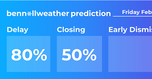
I’m expecting widespread school delays with isolated closures possible in the iciest locations. Fortunately, power outages were limited across the region due to light winds.

After a settled day Wednesday, attention will quickly turn to the second round of this week’s one-two weather punch.
The arrival time of the snow has been pushed out a bit as high pressure to the north keeps the system at bay. This also means that the impact of the storm will linger somewhat longer into Friday.
Thursday-Friday
What? Snow, changing to ice in parts of the region on Thursday night.
When? Starting later Thursday morning or afternoon from south to north. Ending Friday morning.
How much? A high chance for more than 3 inches. A medium chance for more than 6 inches.
Impact? Early dismissals are possible on Thursday. School delays or closures are possible on Friday. Treacherous travel conditions could affect the Thursday evening and Friday morning commute.
Have a great day!


