A+ start the week 💯
Update #441
Hello there! The phrase “April showers bring May flowers” won’t apply this week, at least to start.
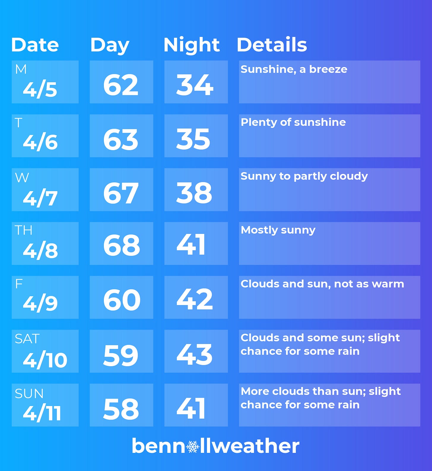
Monday-Thursday will feature slightly warmer temperatures with each successive day and plenty of sunshine. Aside from a breeze on Monday, winds look light.
A great time to be outside! ⚾
This weather will help progress the spring “leaf out”, which is ahead of schedule according to the National Phenology Network.
Green shading indicates an earlier than normal leaf out while brown shows a later than normal bloom.
Looking ahead to Friday, low pressure will begin to push eastward from the Great Lakes. At the same time, a skinny ridge of high pressure will hold over the Northeast.
Being over 5 days away, it’s a bit too early to know whether the high will hold its ground or if some rain will sneak in from the west. At the very least, it looks like there will be more clouds and somewhat cooler temperatures from Friday-Sunday.
If you have plans next weekend, keep an eye on the forecast over the coming days.
Warm weather is unlikely to be locked in for the week of the 12th. Instead, variability, typical for the time year, is expected.
Meanwhile, in New Zealand, these remarkable clouds lined the sky on Friday.
Called lenticular clouds (Latin for lentil-shaped), they form when strong, moist winds blow perpendicular to a mountain barrier in multiple levels of the atmosphere. They are commonly mistaken for UFOs 🛸
New Zealand’s vast north-south mountain ranges, close proximity to the ocean, and frequent strong westerly winds make it a lenticular hot spot.
They are quite uncommon, but not unheard of, in the Hudson Valley.
Early this year I saw these clouds first hand, one of my favorite photos…
Enjoy!


