Henri: flooding a serious concern
Update #461
There will be some dry and sunny weather this week, but first we have to get through Hurricane Henri. This post contains the latest on the storm as of early Sunday morning.
Radar imagery reveals the eye of the storm some 170 miles away from the Hudson Valley as of early Sunday morning.
The storm will hook left today, with its western flank reaching the Hudson Valley this afternoon and evening. The left side of Henri is its wet side, the right its windy side.
We’ll escape the worst of the winds but may end up amid some of the storm’s heaviest rains later today through tonight with flooding a serious concern.
There was already significant flooding across New York City and New Jersey on Saturday night.
Henri’s forward progress will slow considerably on Sunday night as it gets blocked by a ridge of high pressure to the north and east. This will cause it to dump intense rain over the same general region for a period of about 12 hours, including eastern New York and the Hudson Valley.

Key information:
🌧️ Rain — will get underway later in the morning or early in the afternoon. The heaviest will occur from late afternoon through Sunday night, when it will fall torrentially at times. Widespread amounts of 2-5 inches are expected with localized amounts of 6+ inches, especially over elevated terrain. If you live in a flood prone area, prepare for flooding. Never drive through floodwaters as you never know how deep it is. If you find yourself in a flash flood, get to higher ground immediately. Here are some tips on what to do during a flood.
🌬️ Wind — will be strongest well to the east of the Hudson Valley, fortunately. Gusts of 20-30 mph will be possible later Sunday and Sunday night with sporadic power outages possible.
💥 Impact — expect delays and cancellations across most regional airports on Sunday, building as the day goes along. Flooding may result in road closures. Widespread power outages are likely across eastern Long Island, eastern Connecticut, and Rhode Island. Charge your devices to be on the safe side 🔋
There will still be some areas of heavy rain come Monday morning before conditions gradually clear. To add insult to injury, there is a chance for thunderstorms in the Hudson Valley during the afternoon.
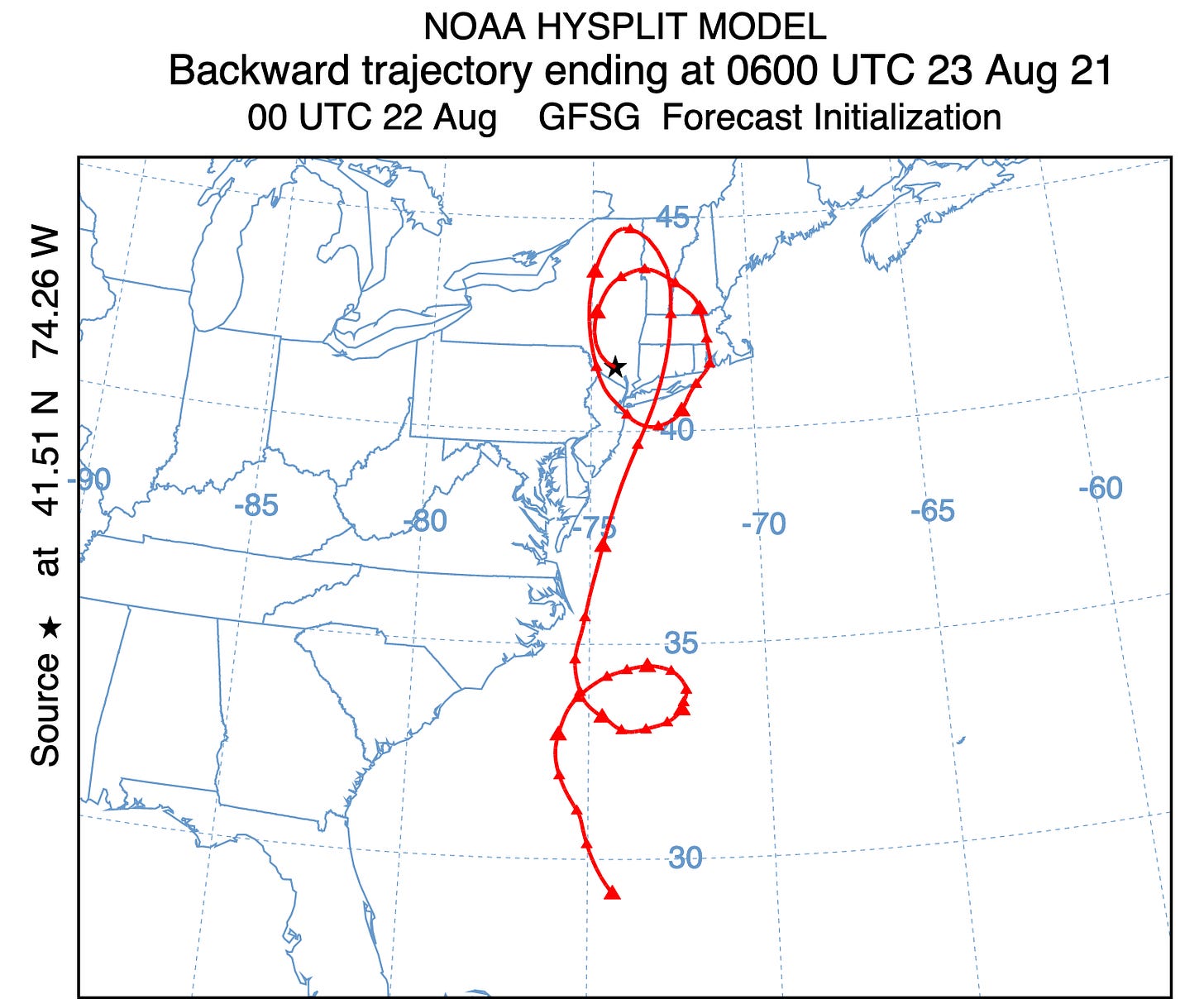
As you might expect, Henri will drag lots of humidity northward from the tropics. The air in the Hudson Valley on Monday would have been in the middle of the Bermuda Triangle 10 days prior 🙃
Despite the heat and humidity, Tuesday and Wednesday look dry. The next chance for rain will come in the form of scattered thunderstorms on Thursday afternoon as a front approaches from the north.
The front looks to pass through the region by Friday, ushering some refreshingly cooler air that will last through Saturday.
The comfortable weather will likely be short-lived, with a return to above average warmth early in the week of August 30th. Some cooler weather is possible in early September.
For the latest, you can follow me on Twitter. Please be safe out there! 🙏


