First flakes possible! ❄️
Update #523
Hello everyone! Big changes are on the horizon. After an exceedingly warm start to November, the party is over.
📉 Temperatures are in the process of taking a nosedive with a cold week ahead.
And as the title says, we’ll indeed be watching for the first snow of the season on Tuesday night and early Wednesday morning 😱 ❄️
As snow day season swings in, consider upgrading your subscription to premium by clicking the button below. For $5/month or $50/year, you can stay an extra step ahead of Mother Nature with me. Premium subscribers get access to extra posts, especially ahead of winter storms, as well as a subscriber chat!
Before you get too concerned, I don’t think the snow is going to be a big deal if it happens, with temperatures hovering just above freezing and relatively warmer grounds preventing much in the way of accumulation. But it does represent a “winter is coming” moment! 🥶
It’s not just New York: areas in blue on map below will experience sub-freezing temperatures at some point in the next 10 days. No state is spared, although Florida is looking pretty good away from the panhandle 😎

The main weather system this week will occur from Tuesday night into Wednesday, bookended by dry but chilly conditions.
Monday and Tuesday will both feature highs in the 40s and sub-freezing morning temperatures. Low 20s on Tuesday morning — get ready to scrape some frost!
On Tuesday afternoon, clouds will start to increase ahead of the system that will arrive on Tuesday night and bring a mix of rain, snow, and possibly sleet 🌨️
➡️ With temperatures hovering near or just above freezing, precipitation may start as wet snow and/or sleet across the region on Tuesday night between 9:00 pm-1:00 am, from southwest to northeast.
During the predawn hours on Wednesday morning, any wintry precipitation will likely mix with and change to rain as warmer air moves in. The higher elevations of Orange, Ulster, Sullivan, Dutchess, and Putnam County stand the best chance of seeing some snow, mainly near and north of I-84. Rockland and Westchester will probably be a bit too warm for snow.
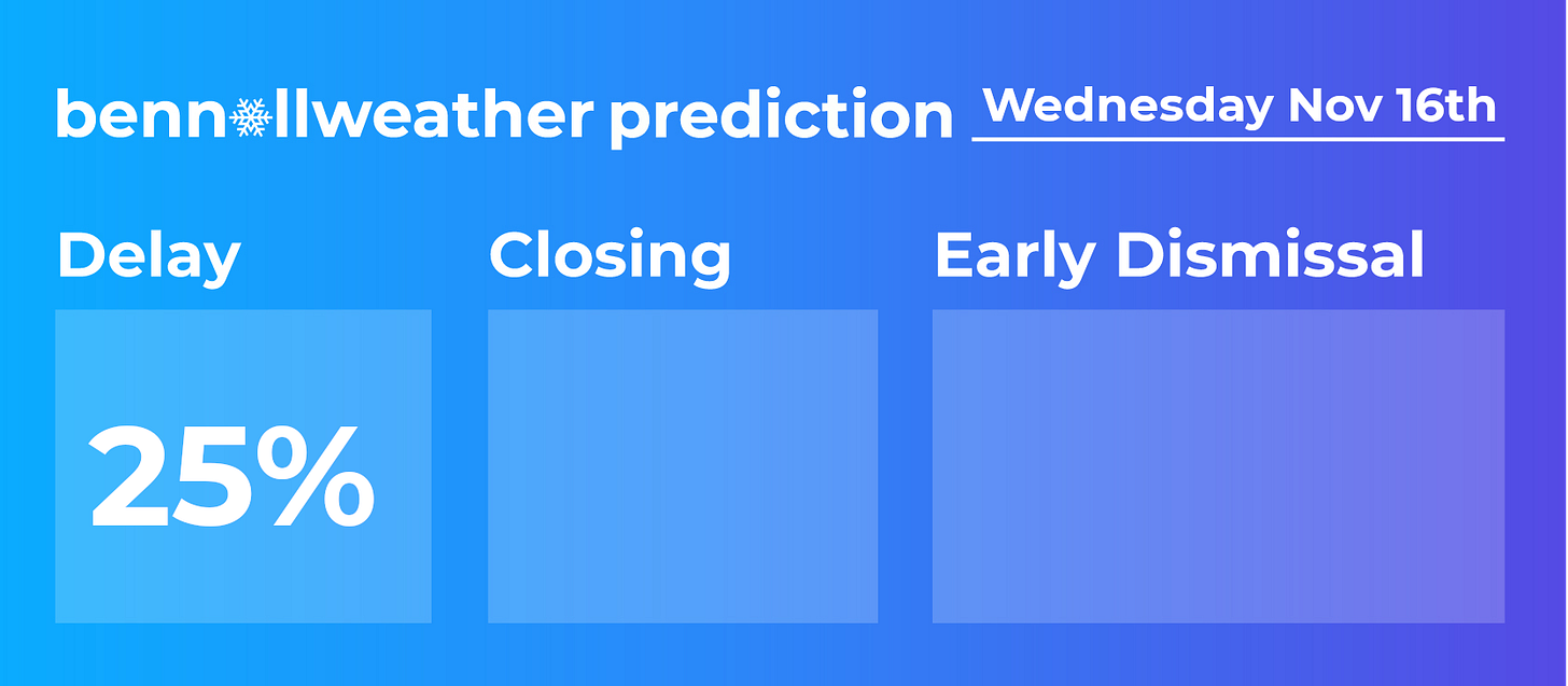
In terms of impacts, it’s mainly the collective groan of those who are not fans of snow that may emanate across the Hudson Valley early on Wednesday morning 🙃 — I’d put it at a 1-in-4 chance (25%) that it evolves into something heavy enough to cause delays. And if that’s the case, you’ll hear from me again.
For the Catskills and my followers from the likes of Sullivan West, Monticello, Liberty, and elevated parts of Ulster County, the situation bears closer watching as wet snow and sleet could fall steadily for several hours on Tuesday night and early Wednesday morning with temperatures near freezing. I’d say a full day is still more likely than not, but a two hour delay wouldn’t shock me!
A cold rain will continue on Wednesday morning, most likely ending during the early afternoon. A cold, northwesterly wind from Canada will stream in behind the storm, potentially causing scattered snow showers on Thursday 🌬️
🥶 A reinforcing shot of cold air is expected on Friday, lasting through the weekend — note the overnight temperatures in the teens!
From Sunday into Monday, yet another area of impressively cold air could swing toward the East Coast. I’ll be watching this period for possible formation of a coastal low pressure system, but if it were to form, a southerly track would be favored.

🦃 The early indication for Thanksgiving week is for drier than normal conditions despite the chill. The perfect type of weather to enjoy a cup of hot apple cider and slice of pumpkin pie after the turkey, stuffing, and mashed potatoes 🤤
As an American living overseas, I really miss Thanksgiving!
Reporting from the sugarcane capital of the Philippines
The “where in the world is Ben Noll” series continues this week from a place called Bacolod.
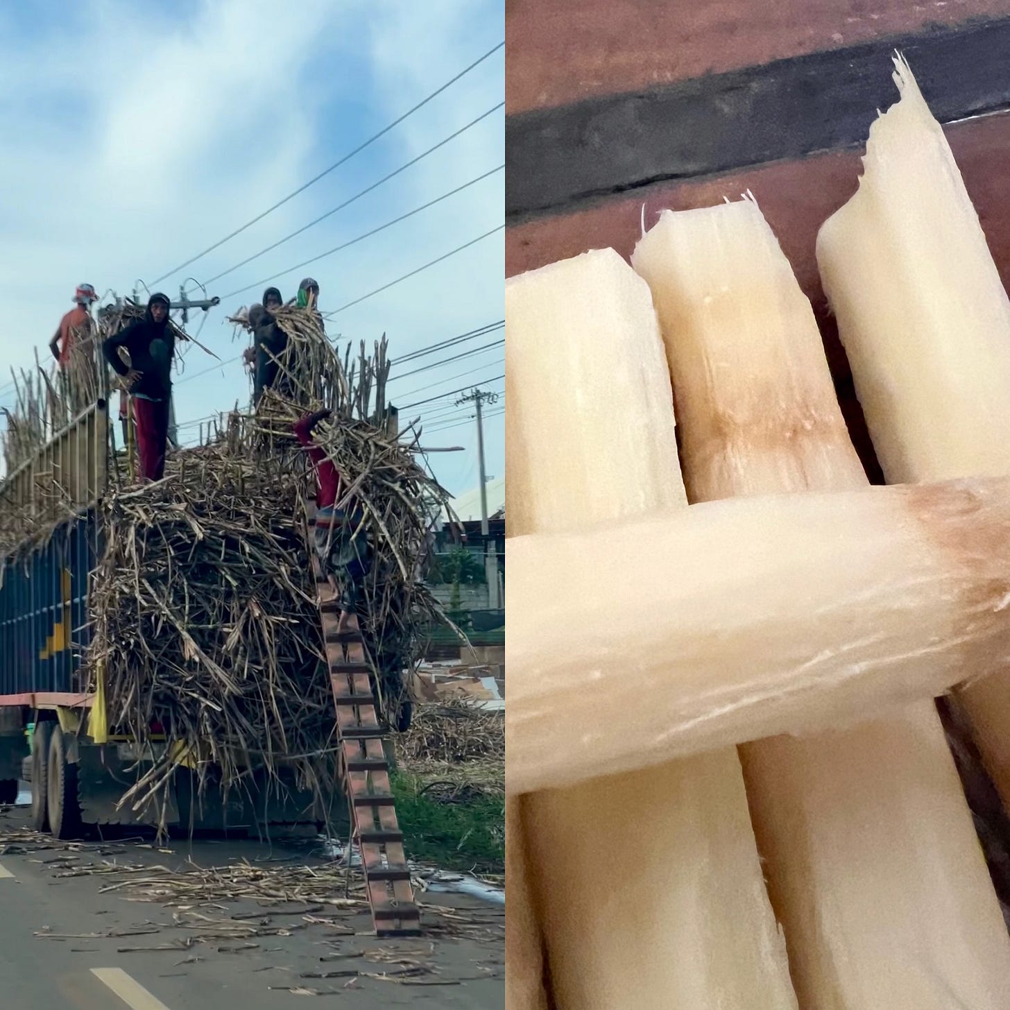
Located at 10˚N latitude deep in the tropical western Pacific, it’s a sultry place that has the nickname “sugar bowl of the Philippines”. This is because it is the sugarcane capital of the country, one of the country’s most important crops. I certainly didn’t expect to be chewing on raw sugarcane by the end of my day there, but that’s what traveling is about — seeing and trying new things.
As for the weather, temperatures range from 88-93 by day and 73-77 by night with stifling humidity.
Locals seek refuge from the heat in the mountains, which are home to an active volcano named Mount Canloan. While the mountain peak was shrouded by cloud on the day of our trip, a typical effect of the unstable, hot, and humid air, there were several other notable sights.
Sugarcane stalks are very tough but edible! When you chew on it, it releases a sweet juice that’s a perfect afternoon pick-me-up. Raw sugarcane is not just consumed by locals for a burst of energy but for health benefits as well.
My afternoon ritual has been standing out on the balcony of my 10th floor accommodation, admiring the tropical cumulus clouds, and chewing on sugarcane 😅
🌴 Sending warm vibes. Have a sweet week!


🧙🏻♀️will keep 👀’s open ❄️❄️
Thank you Ben