
Frigid week ahead as storms swirl nearby
Update #635

Hello! The weather will be very cold and windy this week 🥶
On Monday, the Hudson Valley will find itself near the northern fringe of a storm. There’s a chance for a coating of snow, mainly south of I-84, from the late morning into the afternoon.
No extended holidays and weekends this time — sorry!
From near Philadelphia southward, the impact will be much greater. The map below shows the winter storm severity index, which highlights the wide extent of the storm’s snow, ice, and wind impacts from the Plains to the Mid-Atlantic.
On Sunday, the storm will bring blizzard conditions to Kansas and western Missouri and Washington D.C. is expecting 6 to 10 inches of snow on Monday.

After the storm passes offshore on Monday night, the weather will be cold and windy for the rest of the working week.
Next weekend, there will be another storm to watch. More on that later.
The week ahead
After a storm swirls to the south of the Hudson Valley on Monday, cold, dry, and windy conditions will dominate.
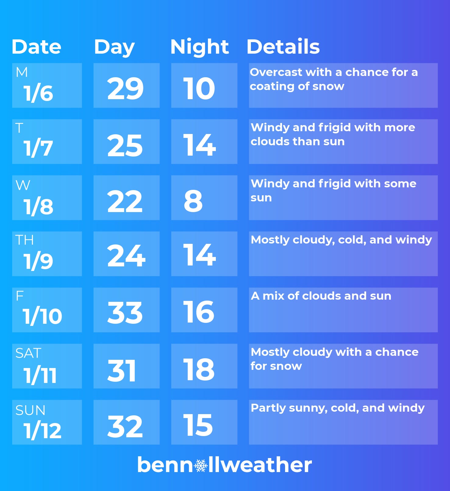
Monday: a chance for a coating of snow; otherwise, cloudy and cold
Tuesday: windy and frigid 🥶🥶
Wednesday: like Tuesday, but colder 🥶🥶🥶
Thursday: the biting cold and wind continues 🥶🥶
Friday: not quite as cold nor windy
Saturday-Sunday: watching snow potential for Saturday, probably dry and windy on Sunday
The freezing weather will continue during the week of January 13th.
Photos to warm you up 📸
Enjoy a few photos from my recent trip to Rotorua, New Zealand’s geothermal capital!


🔥 Stay warm this week! I’ll be in touch if the Saturday storm swirls toward the region.
Long-range winter storm potential
Will the Hudson Valley have a big storm anytime soon?
